August 9, 2018
Support the Critical Grasslands of Twin River HRNA!
Dear Wilderness Defender, The provincial government is seeking public input on the proposed expansion and…


As one of six large blocks of grasslands left on the glaciated plains of North America, the Milk River Ridge is a stronghold for Alberta’s native grasslands. The area houses many rare and endangered fish, amphibians, birds and plants.
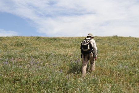
Photo © C. Olson
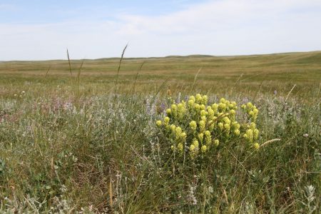
Photo © C. Olson
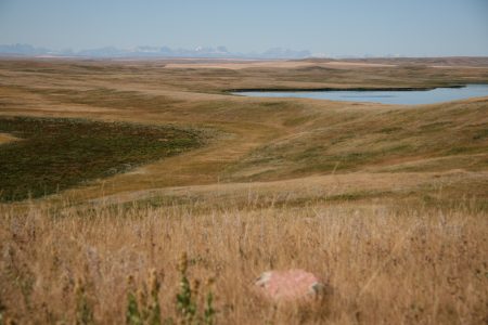
Photo © C. Saunders
AWA’s vision for the Milk River Ridge is that its critical grasslands receive strong, long-lasting protection, including halting any future oil and gas development within the area’s sensitive native grasslands.
 |
 |
|
The rolling grasslands, articulated ridges and deep ravines of the Milk River Ridge give it an unmistakeable charm unique to southern Alberta. Photo © H. Unger
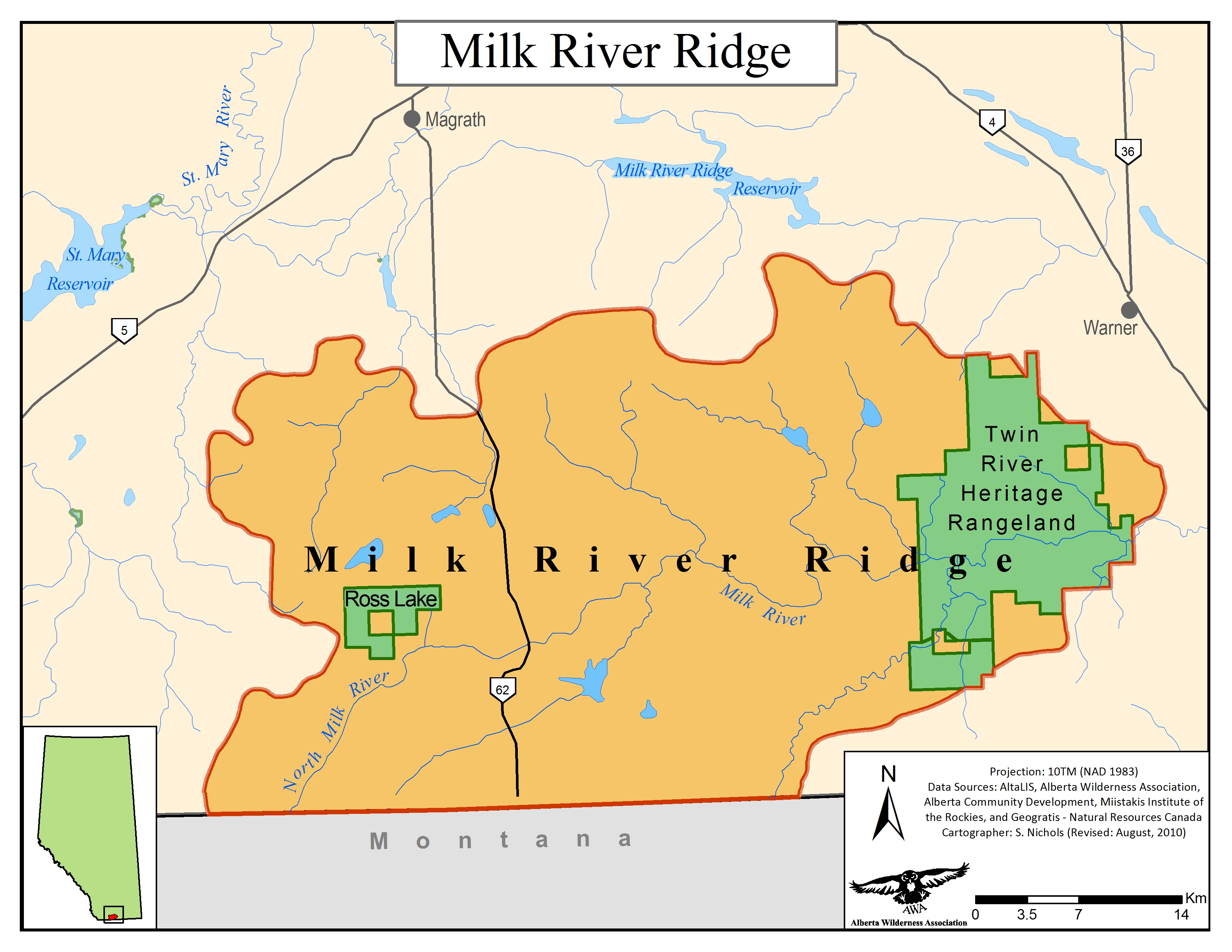
AWA’s Milk River Ridge Area of Concern is a 1,663 km2 area in southern Alberta along the Canada – United States border. The area is comprised of extensive foothills fescue, wetlands, glacial spillways, and deeply incised ravines with intervening ridges.
The Milk River Ridge is an internationally significant grassland, home to several species of rare or endangered fish, amphibians, birds, and plants, an provides important habitat for deer and pronghorn, nesting areas for several birds of prey, including the peregrine falcon, as well as the sharp-tailed grouse. It is one of six large blocks of grasslands left on the glaciated plains of North America.
AWA’s Milk River Ridge Area of Concern includes two protected areas:
Protected Areas
The protected areas of the Milk River Ridge, Ross Lake Natural Area and Twin River Heritage Rangeland Natural Area, are managed under the Wilderness Areas, Ecological Reserves, Natural Areas and Heritage Rangelands Act (WAERNAHR).
Public Lands
The remaining lands within the Milk River Ridge are managed under the provincial acts and policies pertaining to the White Area, which is managed primarily for agriculture and settlement. Relevant acts and policies include: the Public Lands Act, the South Saskatchewan Regional Plan and the historical Integrated Resource Plans.
Many of the grazing allotments and grazing leases within the Milk River Ridge have been sustainably managed over time by ranchers. These acts of stewardship have helped to maintain the natural grasslands of the Milk River Ridge.
AWA’s vision for the Milk River Ridge is that its critical grasslands receive strong, long-lasting protection, including halting any future oil and gas development within the area’s sensitive native grasslands.
The Milk River Ridge is a 1,663 km2 area in southern Alberta along the Canada – United States border. The area is comprised of extensive foothills fescue, wetlands, glacial spillways, and deeply incised ravines with intervening ridges. Milk River Ridge can be located along Highway 62, south of the Town of Magrath.
 AWA’s Milk River Ridge Area of Concern. MAP © AWA: JPG | PDF
The Milk River Ridge is found within the Milk River and St. Mary drainage basins.
Milk River
The Milk River rises in Western Montana, meanders through Alberta for 160 km, and loops back to the United States. Eventually, the waters reach the Missouri River and then the Gulf of Mexico – it is the only Canadian river to do so. The Milk River relies heavily on spring runoff for its natural flow. The Milk River’s low flow has been a source of contention for Southern Alberta’s agricultural producers, as many have advocated for damming or diversion to increase the Milk River’s flow. Damming could result in negative environmental impacts to the riparian habitat surrounding the Milk River.
The flow of the Milk River is shared by Canada and the United States under a 1909 International Boundary Water Treaty. Under the treaty, these rivers are considered as one waterway and their flows divided equally between the two countries. Under an agreement in 1921, natural flow is divided equally between the United States and Canada in the winter. But during irrigation season (April 1 – Oct. 30) the U.S. receives up to three-quarters of the natural flow of the Milk River and Canada three-quarters of the St. Mary River. In times of higher flow levels, the water is equally shared. Flow in the Milk River in late summer and fall often relies on diversion from the St. Mary.
St. Mary River
The St. Mary River arises in the high alpine area of Glacier national Park and is partly fed by glaciers. It flows north into Alberta and into the St. Mary reservoir. It becomes part of the South Saskatchewan River Basin whose water flows into Hudson Bay.
The Milk River Ridge has a distinctive sandstone formation, known as Milk River sandstone, interbedded with layers of shale. The sandstone is visually apparent from the exposed sandstone pillars and cliffs that protrude from the shores of the Milk River, known as “castellated sandstone”. These pillars are protected by a top layer of ironstone. The Milk River is deeply incised, as water from melting glacial ice has cut a series of wide channels through the ridge including Whisky Gap, Lonely Valley and Verdigris coulee.
As with many of the rocks underlying southern Alberta’s plains, the Milk River sandstone comes from the Cretaceous age within the Eagle formation. Below the Milk River sandstone is the Colorado formation , and above are the Pakowki, Foremost, Oldman and Bearpaw formations.
Information gathered from Geology and Groundwater Resources of the Milk River Sandstone in Southern Alberta by P. Meyboom (1960).
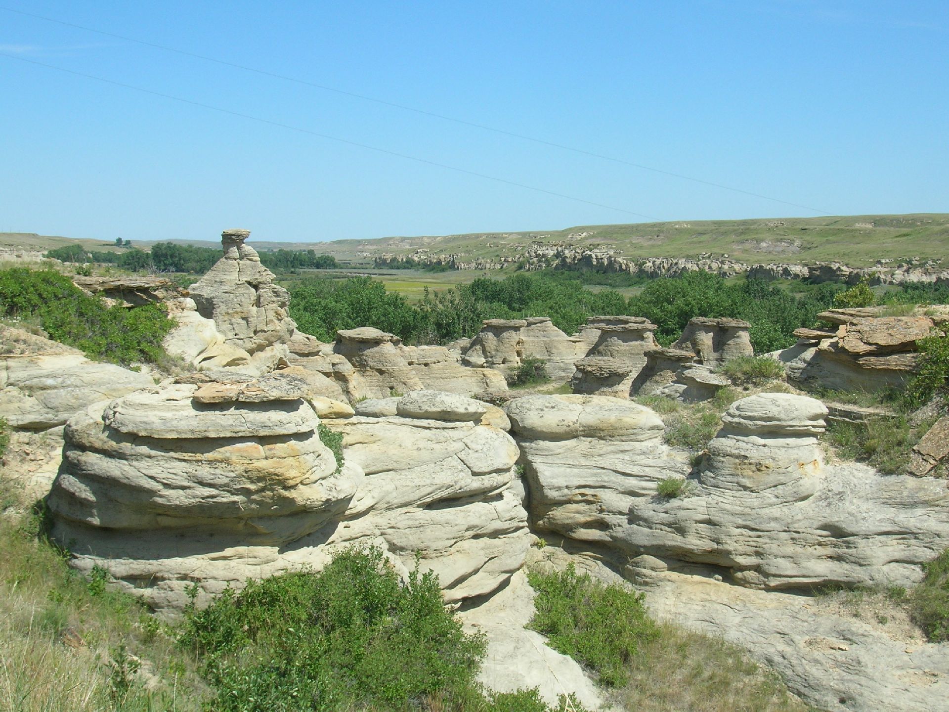
Sandstone pillars along the Milk River. Photo © H. Unger
Approximately 50 percent of the Milk River Ridge has been designated Nationally Significant. This National significance comes from being one of three unglaciated areas on the plains of Canada, significant habitat for Sharp-tailed Grouse and goose breeding, and the extensive foothills grasslands and numerous rare plant species found along the Milk River Ridge. The areas being proposed for expansion provide important nesting areas for pintail ducks and a host of waterfowl. It is not unusual to see elk drinking at the larger ponds and the ranchers who steward this area have reported a grizzly bear sow with three cubs frequenting the area.
 Milk River Ridge ESAs. Map © AWA FILES: JPG | PDF
AWA’s Milk River Ridge Area of Concern is located within the Grasslands Natural Region of Alberta. The low arch of the Milk River Ridge rises 300 m above the plain, straddling the Mixed-grass and Foothills Fescue Natural Subregions.
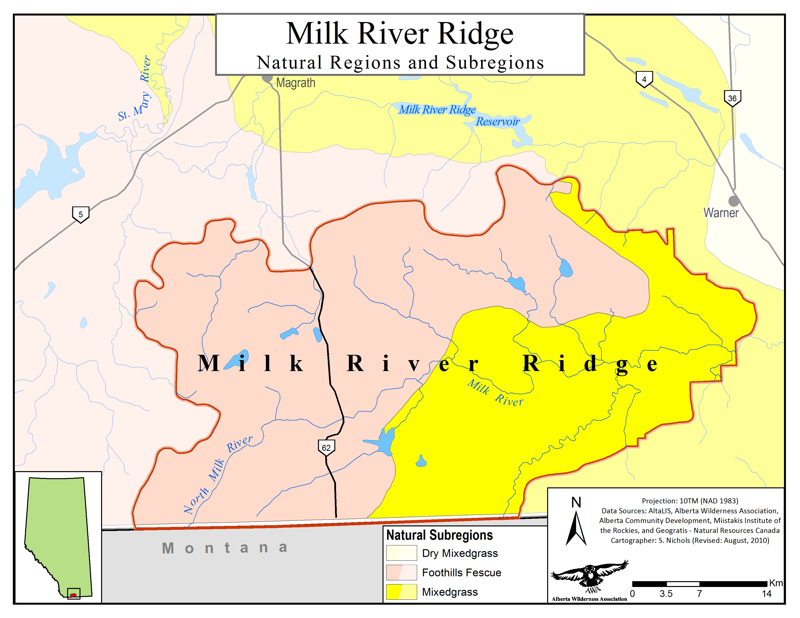 Milk River Ridge Natural Subregions. Map © AWA FILES: JPG | PDF
Numerous priority plant species, including hare-footed locoweed, intermediate hawk’s-beard, Raymond’s sedge, few-flowered rush, western blue flag, and Cusick’s paintbrush, can be found in Milk River Ridge. Rare plants found in the Twin River Heritage Rangeland Natural Area include prickly milk vetch, tufted hymenopappus, and Carolina whitlowgrass.
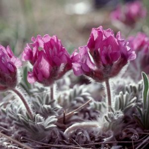
Harefooted locoweed. Photo © C. Wallis
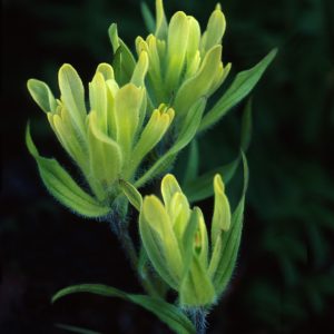
Yellow paintbrush. Photo © R. Rasmussen
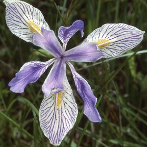
Western blue flag. Photo © C. Wallis
River valley habitats like those found in this the Milk River Ridge Area of Concern are extremely important for wildlife on the Great Plains; they provide water and shelter in habitat with relative scarcity of both elements.
Birds: Milk River Ridge contains dense nesting bird-of prey populations including ferruginous hawks (COSEWIC Threatened), golden eagles and prairie falcons. The area also houses populations of pintail duck, Baird’s sparrow, Brewer’s sparrow and Sharp-tailed Grouse dancing grounds
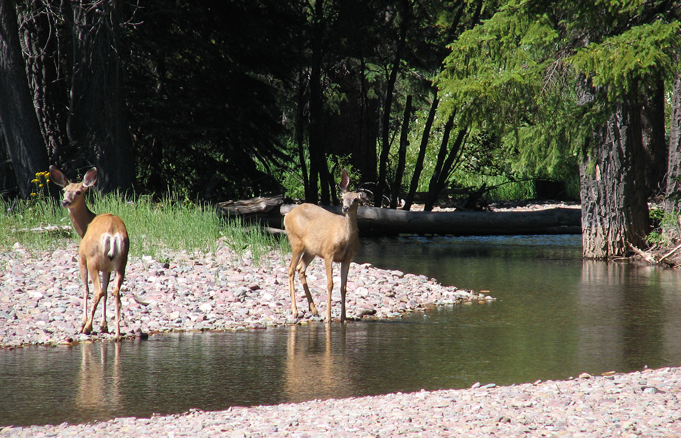
Mammals: Large mammals prevalent in Milk River Ridge include pronghorn, white-tailed deer, and mule deer. Small mammals include the yellow bellied marmot
Amphibians: Northern leopard frog
Fish: Shorthead (St. Mary) sculpin, Silvery minnow, stonecat, brassy minnow, sauger
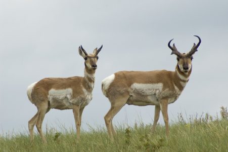
Pronghorn antelope. Photo © A. Teucher
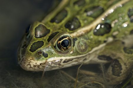
Northern leopard frog. Photo © A. Teucher
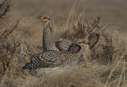
Sharp-tailed grouse. Photo © C. Wallis
The Milk River holds particular cultural significance to the Peoples of the Blackfoot Confederacy (Siksikaitsitapi), which historically consisted of the Kainai, Siksika and Amskapi Piikani. The Piikani used the plains surrounding the Milk River to hunt.
Down the Milk River, to the east of the Milk River Ridge Area of Concern, is Writing-on-Stone Provincial Park. This Provincial Park encompasses a spiritually significant site for the Blackfoot Peoples, as it contains thousands of petroglyphs, hundreds of pictographs, and is known to be a spiritual meeting place.
The Ross Lake Natural Area and Twin River Heritage Rangeland Natural Area both allow hunting within their boundaries. However, as both sites contain grazing leases, they have some hunting access restrictions and additional care must be taken to recreate alongside cattle herds. Permission from grazing lease holders for access to the leased area is required.
Oil and gas
Oil and gas poses a number of threats to the critical grasslands of AWA’s Milk River Ridge Area of Concern. Given the scarcity of native grasslands that remain in Alberta and their limited protective status, oil and gas exploration threatens to convert what grasslands remain. In addition to surface disturbance, oil and gas development introduces invasive species into the area through roads and other forms of linear disturbance; invasive species will outcompete native grassland species, further reducing native vegetation in Alberta’s Grasslands Natural Region.
Granite Oil Corp. (formerly DeeThree Oil) has held subsurface leases within the Milk River Ridge area proposed for expansion of the Twin River Heritage Rangeland. As of December 2018, Granite dropped an application for surface access and drilling . The leases expired in December 2018. The proposed Heritage Rangeland designation will prohibit Alberta Energy from selling any additional leases within the site. Proposals by Granite Oil Corp. (DeeThree) have been met by years of objection by AWA and others, and numerous calls for the leases to be cancelled and compensated.
In September, AWA included a hiking tour of the area as part of its Adventures for Wilderness program. It was a successful day, with beautiful weather and an opportunity to meet with the lease holder who helped the group understand grazing practices and the family’s philosophy of stewarding these native grasslands.
In December, Granite Oil Corp withdraws their application for surface access in the Twin River Heritage Rangeland Natural Area.
In October, Alberta Energy Regulator announces there will be a hearing to determine whether or not Granite Oil Corp.’s application for surface access will be approved within the Twin River Heritage Rangeland Natural Area. AWA is vehemently opposed to surface access and disturbance and will participate in any way possible if a hearing is called.
In June, Alberta Energy Regulator renews Granite Oil Corp.’s subsurface leases in the Twin River Heritage Rangeland Natural Area, which is accompanied by a dispute over surface access in the protected area’s native grasslands.
The Government of Alberta proposes to expand the Twin River Heritage Rangeland Natural Area by 3,173 hectares and redesignate the area from a ‘Natural Area’ to a ‘Heritage Rangeland’. This proposal is followed by a consultation period, originally conducted during the month of August, but extended to the end of September in response to public scrutiny of the proposal. AWA sends a letter to the Government of Alberta in support of the proposal, and releases an Action Alert calling Wilderness Defenders to participate in the public consultation. AWA receives reports that the large majority of responses to the proposal are favourable. Despite public support, the expansion and re-designation never reaches cabinet.
AWA engages repeatedly with government departments and the Alberta Energy Regulator to seek restrictions on industrial development and advance formal protected area status. Our meetings with the Minister of Energy and her staff have not seen the department move to protect the area. Despite many attempts to introduce the issue and explain the concerns and solutions, awareness of the problem was found to be practically non-existent. AWA continues to investigate all options for securing protection of this area.
AWA leads a day hike to the area with members and supporters from the Lethbridge region this summer. For many, it is their first time experiencing the spectacular natural ecosystem on the Milk River Ridge. Many write letters and or postcards to the premier in an attempt to increase awareness and response to the need for protection of this area.
An expansion of Twin River and Onefour Heritage Rangelands has still not been designated. With local ranchers on board and industry possibly willing to engage in compensation with the Crown, protecting these areas is a clear win-win. However, the process remains stalled and underscores an example of how conservation is a low priority.
AWA engages repeatedly with government departments and the Alberta Energy Regulator to seek restrictions on industrial development and advance formal protected area status.
In November, Minister Kyle Fawcett responds to AWA’s concern about the expansion of Twin River and Onefour Heritage Rangeland, writing, “while it is encouraging to have support from the grazing leaseholder and the Alberta Wilderness Association to extend Milk River Ridge as a conservation area, our government must test these ideas with a broader community of local Albertans.”
The World Wildlife Fund (WWF) writes a letter in support of moving forward on conservation objectives for the Twin River and Onefour Heritage Rangeland under the SSRP.
DeeThree Oil is now operating as Granite Oil.
In October, the South Saskatchewan Regional Plan proposes an addition to the Twin River Heritage Rangeland Natural Area. Petroleum exploration and development by DeeThree threatens to undermine this addition. AWA asks for DeeThree’s lease to be surrendered to the Crown and paid compensation.
The Draft South Saskatchewan Regional Plan is officially unveiled. The draft does not address conservation in native grasslands in any specific way; no legislated protection is proposed for grassland areas despite the large number of species at risk in southeast Alberta. AWA argues that Milk River Ridge, Wild Horse Plains and key stretches of wild rivers in the south should be legislatively designated as Heritage Rangelands.
In September, AWA learns that sensitive rough fescue and mixed grasslands on the Milk River Ridge are being opened up to exploration activity in the Alberta Bakken oil play. At the same time, efforts to secure legal designation for these lands are being delayed until the Government of Alberta releases its South Saskatchewan Region Plan (SSRP). This comes despite the fact that, in February 2011, the South Saskatchewan Regional Advisory Council (RAC) recommended the Milk River Ridge, west of the town of Milk River, adjacent to the Twin River Heritage Rangeland, as a “Candidate Conservation Management Area”. AWA urges the Alberta government to place a moratorium on new surface development in the Milk River Ridge until the SSRP is released.
In February, Alberta Environment informs AWA that the International St. Mary and Milk Rivers Administrative Measures Task Force report had been shelved for approximately five years but would be released to the public within the next few months.
In April, The International St. Mary and Milk Rivers Administrative Measures Task Force releases its final draft report. The International Joint Commission (IJC) task force was established in 2004 to determine whether water from the two rivers was being apportioned equitably and what administrative improvements could be made to help each country optimize the use of their apportioned waters. The task force found that based on 55 years of records, the U.S. has historically received four percent less than the combined flows to which it is entitled, and Canada has received four percent more. The task force found that improvements to the St. Mary storage and conveyance facilities in Montana and additional storage on the Milk River in Alberta may allow diversion of full entitlement by both countries; however, environmental impacts and instream flow needs would have to be considered.
In December, a new international task force was set up to examine the 1921 agreement and will make recommendations to improve it.
In July, the International Joint Commission (IJC), which includes three Canadians and three Americans, holds four public meetings in Montana, Alberta and Saskatchewan to seek public comment on the 1921 agreement. At the meeting in Lethbridge, attended by 300, people were against revising the agreement.
In letters to the IJC both the Southern Alberta Environmental Group and AWA note that the aquatic and riparian environments of the two rivers are stressed and degraded by current water management. SAEG writes: “Healthy rivers reflect healthy societies. IJC is responsible for making decisions regarding the use and quality of boundary waters. If the test of common good is to be met, decisions by IJC need to consider instream flows to protect and restore the health of the aquatic environments in these shared rivers.”
In April, Montana Governor Judy Martz asks the International Joint Commission (IJC) to re-open the 1921 agreement arguing that Montana has been prevented from receiving its full 50% share of water under the treaty. In dry years, it calculated that Montana receives around 40%. Alberta argues that the agreement is fair, that it takes only the amount of water it is entitled to, and it needs all the water it currently uses to maintain the irrigation economy of the area.
It is likely that the 2002 meeting between Alberta’s Milk River Water Management Committee with members of the international group regarding the Milk River Water Study was the catalyst for the Montana challenge.
In February, the Minister of Environment studies the feasibility study for dams and diversions on the Milk River.
In January, AWA is informed that former Environment Minister, Lorne Taylor, has locked the Milk River Feasibility Study in a cabinet until the International Joint Commission (IJC) finishes its deliberations on Montana’s challenge of the international agreement regarding sharing of water of the St. Mary and Milk Rivers. AWA writes to the new environment minister, Guy Boutillier, to ask about the status of this report and for a copy.
A water moratorium is imposed on new applications for water allocations from rivers in the Oldman Basin. “That we have reached an environmental limit with respect to water withdrawals is a hard truth that all residents of the Oldman River basin must finally face…,” writes Cheryl Bradley in response to an article in the Lethbridge Herald. “If the old cry of “more storage” sounds again, it will indicate we have not yet come to terms with living in a dry land with limited water resources.”
In December, the feasibility study for dams and diversions on the Milk River is completed.
In January, Environment Minister quietly launches feasibility study for Milk River Ridge Dam in provincially protected area, the Twin River Heritage Rangeland.
In December, the Milk River Water Management Committee meets with members of the international group regarding the Milk River Water Study.
In November, Ryan Davison of the Prairie Farm Rehabilitation Administration (PFRA) speaks at a Warner County Council meeting on the Milk River aquifer study, designed to measure the quantity and quality of the water in the aquifer. The Milk River Water Management Committee is to meet with Minister Lorne Taylor and the Lieutenant Governor of Montana to discuss mutual interests.
In October, the Milk River Water Management Committee is working with Alberta Environment and their U.S. counterparts in promoting the need for the Milk River project, emphasizing the need for a safe water supply. The Milk River Water Management Committee attends the Premier’s Dinner, making numerous contacts with Ministers and MLAs.
In August, the Prairie Farm Rehabilitation Administration (PFRA) announces a National Water Supply Expansion Program, a cost share program to help fund certain water supply projects in drought affected areas in Alberta and Saskatchewan.
In July, Warner County Council moves to forward a letter to Alberta Environment asking them to investigate the possible rebuilding of the Monson Dam in the S 1/2 of 3-6-19-4 to ensure that any possible future flooding and irrigation issues can be mitigated.
In June, Communities of Coutts, Milk River and Warner hold tri-council meetings and continue their efforts to have the province consider a water storage project on the Milk River which will allow the municipalities a better water source.
On May 7, The Milk River Basin Water Management Committee continues to keep in communicate with key contacts in Alberta Environment, Prairie Farm Rehabilitation Administration (PFRA) and Environment Minister, Lorne Taylor.
The St. Mary, Chin, Milk River Ridge, 40 Mile Coulee and Waterton reservoirs are almost empty in March, and the Oldman reservoir is much below normal. A severe drought has affected southern Alberta for two to three years. The Milk River Water Management Committee, concerned about uneven supply of water, wishes to explore options to even out the levels.
The Twin River Heritage Rangeland is protected as part of Special Places. It encompasses the confluence of the north and south Milk Rivers. This site “marks a milestone in conserving Alberta’s wilderness and natural heritage…,” says Environment Minister Gary Mar. “[This site contains] important plant and wildlife habitat that bring greater diversity and ecological integrity to our growing network of protected areas.”
Ron Hierath, MLA for Cardston Taber-Warner says, “The new Twin River protected area is a win-win situation for all Albertans. Ranchers who have used the area for years will maintain their livelihood, while responsible grazing and land-use practices will preserve the grasslands for generations to come.”
The Order in Council for the Heritage Rangeland was approved without the removal of a Water Resources reservation/notation on the Land Status Automated System (LSAS), the Public lands land registry system. Technically this reservation/notation, which would allow the building of a dam, should have been removed as LSAS designations do not apply to areas under Community Development’s legislation. The local committee, assuming the prospect of a dam was very unlikely, indicated to Environment Minister Ty Lund that the reservation/notation was not a major issue.
A South Country Protected Areas Report states that “the proposed Milk River Dam and reservoir, if constructed, would flood significant portions of riparian range in the valleys of the north and south forks.” The Milk River Basin Studies estimates that flooding would extend about 30 km upstream from the confluence of the north and south Milk Rivers.
The Milk River dam is postponed indefinitely because of a withdrawal of federal monetary support.
Drought-affected communities hope for an early announcement of the dam. It is noted that the Milk River almost runs dry during the fall, making it an unreliable source of water for municipalities.
The Prairie Farm Rehabilitation Administration (PFRA) conducts a feasibility study into dam sites on the Milk River.
An article in the Wild Lands Advocate considers other reasons not to build the dam, including increased erosion of topsoil, inefficient use of water in a dry and windy area (about 30 per cent of total storage of small reservoirs is lost to evaporation and up to 50 per cent of water diverted could be lost in conveyance and on farms. Overall efficiency of existing irrigation systems in Alberta is only 20 to 40 percent), loss of valuable valley bottom lands, loss of wilderness canoeing opportunities, loss of valuable wildlife habitat.
1985
In December, a 129 acre conservation notation (CNT 860012) for a potential reservoir area is placed by Alberta Environment. “Part or all of the land may be required to the Milk River dam and reservoir.” However, the reservoir would far exceed the 129 acres.
The Alberta Government approves a 31 m high irrigation dam on the Milk River, about 16 km west of the town of Milk River, with construction to begin in 1987, at a conservative estimated cost of $30 million of taxpayer money to irrigate 8,100 ha of land owned by 40 farmers. There was no public input. Montana also approves the dam. Environmentalists react “with anger and disbelief.”
In June, still suffering from drought, farmers are cut off from using Milk River water for irrigation because Canada “has used up its share of water this year.” The Prairie Farm Rehabilitation Administration (PFRA) says that the project would require no ditches or auxiliary construction.
The Milk River dries up during the summer drought. Some Milk River seniors describe the drought as the worst one in memory.
The Milk River Basin Studies Socio-Economic Analysis of Water Supply Alternatives concludes that “all of the proposed projects have a benefit-cost ratio of less than unity, at least suggesting that none of the projects can be justified solely on the basis of the direct agricultural benefits they would generate.” Secondary benefits, which are expected to be large, possibly making the dam more economically viable, would include regional construction spinoffs, revenue generated from irrigation equipment sales, and savings to farmers who will be able to grow their own cattle feed.
The analyses are admitted to be inherently subjective with an element of uncertainty. University professor Terry Veeman says, “Economists remain leery about justifying any project on the basis of secondary benefits.” He adds that better soil and water management practices would be more cost-effective than dams.
The study on soil and geology says that the soils “are not generally economically productive because they form on unstable material that is easily eroded.”
The Milk River Basin Studies Environmental Overview Study concludes that “any future modification to the river’s regime would have to be assessed not only in terms of impacts upon the local area directly affected by inundation and the application of abstracted water, but also in terms of the whole basin. Thus potential benefits to land use practices generally and economic development as a whole at the west end of the basin must be assessed not only against local cost, but against benefits and cost accruing to the basin as a whole.
The matter is important because land uses elsewhere in the basin, particularly along the course of the river, may be affected; because the river supports a riparian habitat that is scarce in the basin; and because certain aesthetic attributes of the river, particularly in the eastern portion of the basin, may be affected. There may also be implications for land use practices in the United States.”
Natural river flow approaches zero on several occasions of the Milk River.
The Milk River Water Users Association, a group of ranchers and farmers, are concerned about the serious shortage of water for stock and irrigation uses. This group asks Alberta Environment to examine possible alternatives for ensuring adequate water supply, largely for irrigation, along the Milk River.
The Prairie Farm Rehabilitation Administration (PFRA) undertakes a study of potential water storage sites in the Milk River Basin. Any control of water supply would require a dam and reservoir, or off-stream storage in a tributary valley. Of the five potential reservoir sites identified, Milk River Site 2 would hold the most amount of water for the least cost.
A water development committee proposes that the gap near the Milk River Forks (the confluence of the North and South Milk Rivers) would be a good place for a dam. Pursuit of this option is not followed due to such reasons as hilly terrain, lack of local interest and potential international implications.
In February, Order in Council PC 682 of the Privy Council of Canada ruled in part: “So far as the interests of Canada are concerned, it appears that it would be preferable to have a reservoir on the St. Mary River at Spring Coulee Alberta instead of the recommended reservoir at St. Mary Lakes in Montana, and to have a reservoir at what is known as the Forks Site in Alberta on the Milk River instead of the recommended reservoir at Verdigris Coulee.”
Subsequent investigations by the Department of the Interior indicates that the Forks Site would be would be a much better site for protection than the Verdigris Coulee proposal. More detailed studies were undertaken to substantiate this claim.
In October, the International Joint Commission (IJC) recommends the following: “The Commission finds…that the quantities of land in this international region susceptible of development far exceed the capacity of the rivers in question even under the most exhaustive system of conservation…every effort should be made to obtain the maximum efficiency in irrigation from these waters…the Canadian Reclamation Service [should proceed] with the proposed Verdigris Coulee Reservoir in Alberta.”
The Milk River holds particular cultural significance to the Peoples of the Blackfoot Confederacy (Siksikaitsitapi), which historically consisted of the Kainai, Siksika and Amskapi Piikani. The Piikani used the plains surrounding the Milk River to hunt.
Down the Milk River, to the east of the Milk River Ridge Area of Concern, is Writing-on-Stone Provincial Park. This Provincial Park encompasses a spiritually significant site for the Blackfoot Peoples, as it contains thousands of petroglyphs, hundreds of pictographs, and is known to be a spiritual meeting place.
August 9, 2018
Dear Wilderness Defender, The provincial government is seeking public input on the proposed expansion and…
August 3, 2018
Yesterday, the Alberta government released a proposal to expand the Twin River Heritage Rangeland Natural…
August 1, 2018
Will the Government of Alberta allow industrial scale wind and solar farms on public lands?…
September 1, 2017
Wildlands Advocate article by Angela Waldie, PhD For three glorious weeks this spring, my days…
July 7, 2017
Grasslands Conservation Commitment Absent Alberta stalls on protection for Milk River Ridge In an important…
March 20, 2017
Dear Wilderness Defender, Grasslands are the most altered, most endangered, and least protected ecosystem in…
December 22, 2014
Today AWA submitted comments on the federal recovery strategy for the endangered greater short-horned lizard….
November 2, 2014
Dear Wilderness Defender, Sensitive Milk River Ridge Grasslands and Grizzlies on the Plains Need Your…
October 8, 2014
Letter sent by AWA to Premier Jim Prentice regarding the proposed establishment via the SSRP…
September 9, 2013
Alberta Wilderness Association (AWA) has learned that sensitive rough fescue and mixed grasslands on the…
September 9, 2013
AWA learned late last week that sensitive rough fescue and mixed grasslands on the Milk…
October 31, 2012
Wild Lands Advocate article, October 2012, by Sean Nichols. The new minister of Alberta Tourism,…