July 24, 2024
Final Terms of Reference for Snake Lake Reservoir Expansion
The final terms of reference for the Snake Lake Reservoir Expansion project have been published,…


As the smallest Natural Region in Alberta, the Canadian Shield is a landscape shaped by granite bedrock exposures, sparse vegetation, coarse glacial deposits and countless lakes
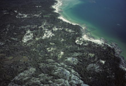
Photo credit: C.Wallis
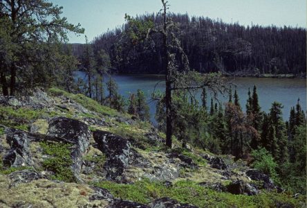
Photo credit: C.Wallis
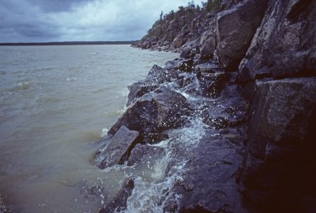
Photo credit: C.Wallis
The Canadian Shield Natural Region is a remote landscape within Alberta that has a relatively little disturbance. AWA believes that it should remain as pristine as possible to conserve its natural functioning and its distinctive value as a part of Alberta wilderness.
As the only part of Alberta belonging to physiographic region known as the Precambrian Shield, the Canadian Shield Natural Region is a small and yet distinctive segment of wilderness in the northeasternmost corner of Alberta. Spanning a total area of 9719 km2, the Canadian Shield has been subjected to a relatively low human footprint; the human footprint covers only approximately 7 km2 in total, and is primarily due to access being restricted to fly-ins or by boat with there being very few roads.
With an elevation ranging from 150 m to 400 m, the Canadian Shield is rough terrain, which can be attributed to the many rocky cliffs, outcrops, permafrost areas. There are also islands of vegetation in the form of trees and woodlands that are interspersed throughout the landscape.
A significant portion of this region is continuously covered by water; numerous fens and bogs cover nearly 20 percent of the region, with the sandy and muddy shores of lakes providing important habitat for migrating and breeding bird populations.
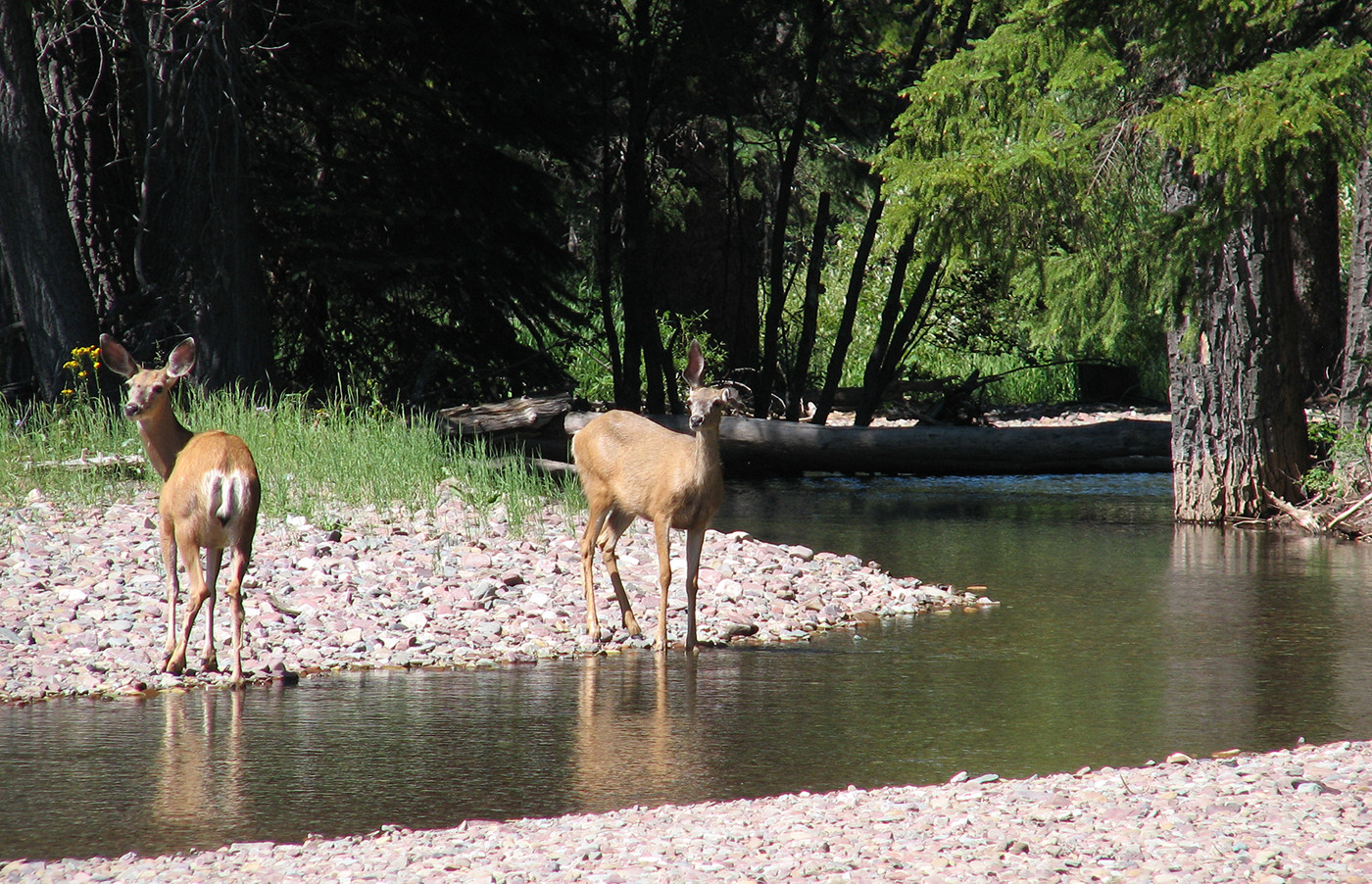
Furbearing mammals such as otters, minks and beavers are common wildlife species, with larger mammals being relatively excluded from this landscape with the exception of wolves, bears, and moose.
The whole of the Canadian Shield Natural Region of Alberta falls within the boundaries of the Wood Buffalo Regional Municipality, and encompasses the community of Fort Fitzgerald and hamlet of Fort Chipewyan, one of the oldest settlements in Alberta. This natural region’s western boundary is contoured by the Slave River, with it extending south until Lake Athabasca.
The Canadian Shield Natural Region is composed of a singular Natural Subregion in Alberta: the Kazan Uplands Natural Subregion.
AWA’s Areas of Concern that fall within the Canadian Shield Natural Region include:
Currently, 73.4 percent, or 7130km2, of Alberta’s Canadian Shield Natural Region is protected, with the majority of that area falling within the Kazan Wildland Provincial Park. The Kazan Wildland Provincial Park was identified through the Lower Athabasca Regional Plan (LARP), which was completed in 2012, however, the park was not formally designated as a protected area until May 2018. The remainder of this landscape falls within the Green Area of Alberta’s public lands, which are managed and administered under a multiple land use designation.
Land-use Framework
In 2008, the Government of Alberta promised to develop seven Land-use Framework regional plans that outline the integrated management of Alberta’s landscape and natural resources to attain sustainable economic, environmental and social objectives. The Canadian Shield Natural Region is found entirely within the Lower Athabasca Region. The single protected area within the Canadian Shield Natural Region, the Kazan Wildland Provincial Park, which is 5710km2 in size, and is managed under the legislation of the Provincial Parks Act.
AWA believes that this remote wilderness requires management strategies with an ecosystem based ethic that minimizes disturbance, and includes local First Nations interests and traditions.
The Canadian Shield Natural Region of Alberta is the province’s smallest Natural Region, comprising only 1.5 percent of Alberta’s landbase, which equates to approximately 9719 km2. This Natural Region occupies the far northeastern corner of the province and is completely surrounded by the Boreal Forest Natural Region. There are no major highways to access this wilderness, with fly-in access requiring authorization from Alberta Parks.
The Canadian Shield Natural Region is extensively covered with water, and falls within two major watersheds for Alberta: the Peace/Slave River Basin and the Athabasca River Basin. This natural region’s western boundary is contoured by Slave River which originates from the Peace-Athabasca Delta, and flows north into the Northwest Territories, and then subsequently into the Great Slave Lake. The Slave River is approximately 434 kilometers long, and has a cumulative drainage of 616,400 square kilometers. At the southern extent of this natural region is Lake Athabasca which begins right at the edge of the Precambrian Shield. Athabasca Lake receives water from the Athabasca and Peace River, and drains northward via the Slave River into Great Slave Lake. This lake is an integral part of the Peace-Athabasca Delta which is a highly productive wetland complex that provides important migration and nesting habitat for bird species such as whistling swan, whooping crane, in addition to other waterfowl species such as geese and ducks. La Butte Creek is a notable watercourse within this natural region as it is the largest Kazan Upland stream, and has a surrounding landscape that includes diverse sand plains, shield outcrops, and numerous wetlands rendering it ecologically significant.
There are many lakes of various sizes and depths that have historically supported First Nations, in addition to commercial fisheries since the late 1920’s, these include, but are not restricted to:
Exposed bedrock is a predominate feature within this Natural Region, which is defined as rockland or nonsoils. Pleistocene glaciers rendered this terrain a rugged and scoured surface creating rock basin lakes and low rounded hills. Near the southern part of Alexander Lake and Wylie Lake geographical units such as glaciofluvial sandy plains, drumlinoid masses, kames, kettles, crevasse fillings, and extensive outwash deposits can be found. Distribution, size, and the shape of lakes are primarily controlled by structural and lithological features of the bedrock. The major soil group is Brunisolic, a type of forest soil which is affected by permafrost. The area has peat and is water saturated, creating an ideal environment for organic or gleysolic soils.
The natural features of the Canadian Shield render this landscape provincially significant. In comparison to other Natural Regions within Alberta, the Canadian Shield has the highest percentage of environmentally significant areas, totaling 89 percent. In May 2018, the Kazan Wildland Provincial Park was formally established with a landbase that is estimated to contain 26 percent of what is considered ecologically significant aquatic habitat for the province of Alberta. The wildland park is characterized by numerous lakes, wetlands, and sand deposits amongst rocky outcrops of the Precambrian Shield. Sand and gravel outwash plains provide habitat for provincially rare plants and birds such as mew gulls and semipalmated plovers. The Kazan Wildland Provincial Park encompasses a significant portion of AWA’s Areas of Concern within the Canadian Shield which includes:
Wylie Lake
At one time was nominated to be formally designated as an ecological reserve, Wylie lake now resides within the Kazan Wildland Provincial Park. This lake and its surrounding landscape represents one of the many diverse and productive regions of the Canadian Shield that is well-known for its relatively large populations of walleye, lake trout, and northern pike that attract many anglers supporting local commercial fisheries.
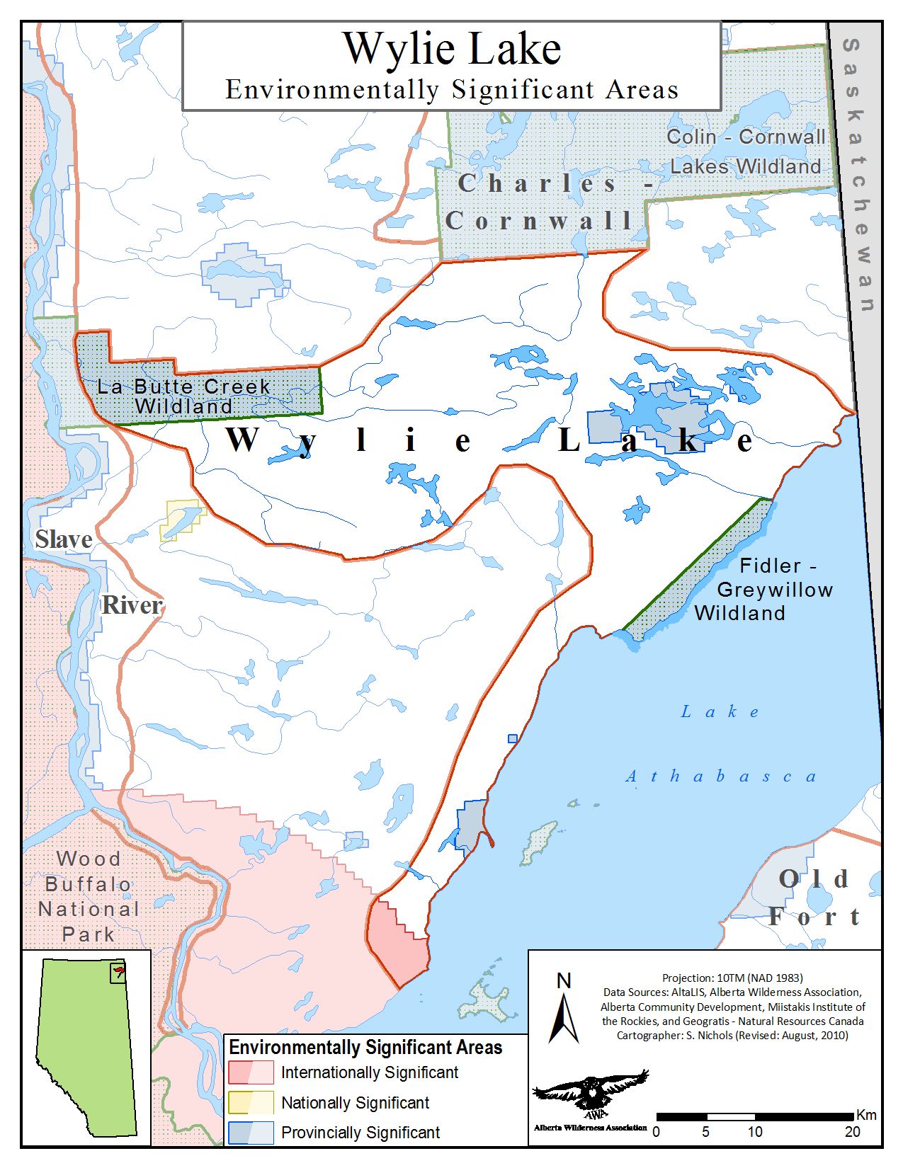
Environmentally significant areas of AWA’s Wylie Lake Area of Concern MAP © AWA: JPG | PDF
Charles-Cornwall
The shores of Cornwall Lake are sand plains and dunes with patches of bedrock outcrops and sporadic jack pine and aspen trees. Charles Lake has populations of lake trout, lake whitefish, northern pike, and yellow perch that has long been the traditional territory for local First Nation communities.
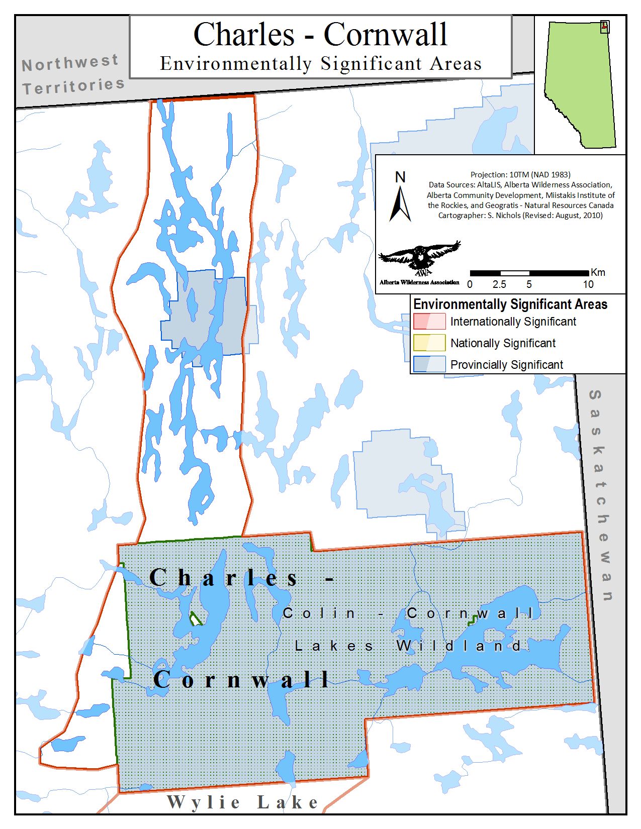
Environmentally significant areas of AWA’s Charles-Cornwall Area of Concern MAP © AWA: JPG | PDF
Slave River
Open falls, rapids and Precambrian rock exposures are all common natural features of the Slave River basin. Serving once as an important historical fur trade route, the Slave River continues to be a biologically rich area that provides vital habitat for many migratory birds and furbearing mammals, in addition to spawning habitat for fish. A large portion of the Slave River falls winds its way through Wood Buffalo National Park, and now borders parts of the newly established Kazan Wildland Provincial Park. Local communities located along the river include Fort Smith and Fort Fitzgerald.
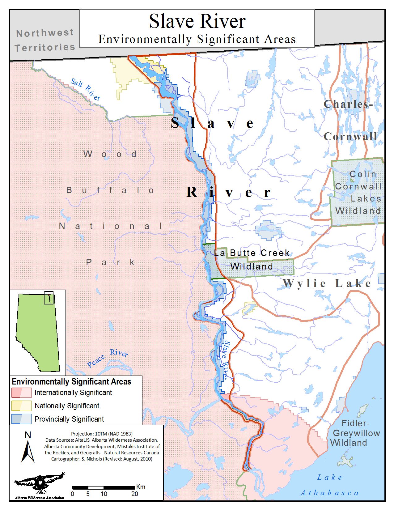
Environmentally significant areas of AWA’s Slave River Area of Concern MAP © AWA: JPG | PDF
Extensive granite bedrock exposure with minimal vegetation cover defines the Canadian Shield Natural Region of Alberta. The Shield consists of old and massive Precambrian crystalline rocks that intensely shape this wilderness into a rough topography. The land base has a significant amount of water cover by means of countless lakes, river, streams and various wetlands. The Canadian Shield represents a small segment of Alberta’s wilderness, only totaling 1.5 percent, and is completely surrounded by the Boreal Forest Natural Region. This Natural Region experiences a harsh climate; winters are generally quite long that are influenced by polar and arctic weather systems with 40 percent of the annual precipitation occurring in the form of snow. Summers in the Canadian Shield are short and have short growing seasons in comparison to natural regions with a mean temperature of 12°C.
The Canadian Shield Natural Region has only one Natural Subregion within Alberta:
Kazan Upland Natural Subregion
As the main area lying north of Lake Athabasca, almost 10 percent of this Subregion is composed of lakes, which includes Wylie, Colin and Charles Lake, in addition to various forms of wetlands covering approximately 20 percent of the Subregion. Where vegetation can grow, it normally occurs in pockets between rocky outcrops. Lichens and ferns are common ground cover growing over rocks and on deadfall, with some jack pine uplands in addition to aspen trees and black spruce bogs. Common understory species include Bearberry, Common Blueberry, Bog cranberry and Labrador Tea. This Subregion has many unique and disjunct ranges for invertebrate species and bird species such as the mew gull and the semipalmated plover that use the Woodman-Alexander Lakes area as a staging site.
Canadian buffaloberry (Shepherdia canadensis) PHOTO © AWA FILES
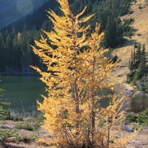
Tamarack (Larix laricina) PHOTO © AWA FILES
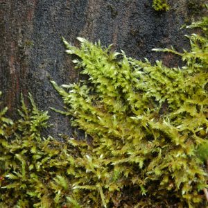
Feather moss PHOTO © AWA FILES
The Canadian Shield provides important breeding and staging habitat for many migratory bird species, in addition to habitat for large ungulates, furbearing mammals, and bird species. The watersheds are as equally diverse with many fish species.
Mammals
Birds
Amphibians
Fish
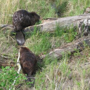
Beaver (Castor canadensis) PHOTO © AWA FILES
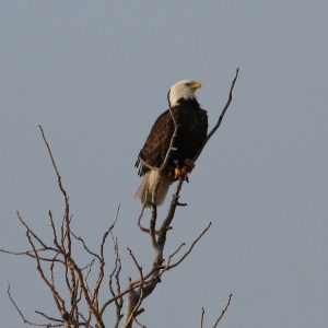
Bald eagle (Haliaeetus leucocephalus) PHOTO © AWA FILES
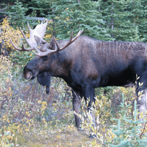
Moose (Alces alces) PHOTO © AWA FILES
The Canadian Shield Natural Region of Alberta is the traditional territory of the Athabasca Chipewyan First Nation and the Mikisew Cree First Nation. Many First Nation reserves are located throughout this natural region, which includes:
Given the remoteness of this landscape there are relatively few roads, with access being mostly restricted to fly-ins that require authorization of Alberta Parks. There are some fishing camps that provide anglers with an opportunity to explore the local lakes and rivers. Hunting and trapping is also a permitted land use near Fort Chipewyan.
Increasing human footprint
Given the remoteness of Canadian Shield Natural Region, and that a significant portion of this region is predominately covered with exposed granite bedrock, this landscape has historically undergone very little disturbance. However, over the past few decades, this Natural Region has seen an increase in human footprint. Despite this region only occupying a small percent of Alberta’s landscape, which equals approximately 1.5 percent, it is a sensitive landscape that cannot tolerate a significant amount of land disturbance or alterations.
The hummocky uplands, sand dunes, soft lichen and feathermoss ground cover, in addition to peatland bogs and fens are important for water retention, dispersal and filtration. These vegetative communities are delicate in nature and do not have the regenerative capacity because of restrictive climatic conditions.
An increase in surface disturbances can also compromise soil quality, fish habitat and water quality of drinking water for surrounding and downstream communities. Podzols soils, are the dominant soil type within the Canadian Shield, and generally support a very low vegetation productivity, approximately <1m3 . ha-1 .year-1 (Bickerstaff et al. 1981). Under cooler climatic conditions, these soils have a range of physical and chemical properties, such as being coarse-textured and nutrient deficient, that only allows for small increments of vegetative growth. It is estimated that between 1999 and 2016, total area of human footprint within the Canadian Shield increased by 2.97 percent , from 5.70 percent to 8.67, with most of these disturbances being attributed to linear features for an increase in transportation access, in addition to urban and industrial developments. Human activity can influence water, soils, and therein vegetation, on a local or regional scale, which has implications of varying intensity on the natural integrity for ecosystems (Maynard et al. 2014).
AWA believes that in order to conserve the natural functioning of the Canadian Shield, and neighboring ecosystems, this Natural Region should be managed with an ecosystem base ethic that prioritizes protecting local natural features such as soils, permafrost, water and vegetation cover from an increase in human disturbance, and protects the traditions and rights of local First Nations.
July 24, 2024
The final terms of reference for the Snake Lake Reservoir Expansion project have been published,…
July 18, 2024
The Alberta government wants public feedback on its new Plan for Parks, which will guide…
July 18, 2024
On July 18, 2024 AWA sent a letter to the ministers of Forestry and Parks…
July 10, 2024
As many of you know, Alberta’s decision to allow grizzly bears to be hunted again…
July 9, 2024
Alberta’s decision to allow grizzly bears to be hunted again despite being a threatened species…
July 5, 2024
It was controversial from the start, and a name change sought to hide it. Left:…
July 4, 2024
The Alberta government has reopened Crescent Falls recreation area after investing to improve it, yet…
June 22, 2024
Text by Devon Earl Photos by Devon Earl and Carolyn Fisher The group headed out…
June 20, 2024
There’s one thing that’s been missing from Alberta’s landscape for some time and is finally…
June 18, 2024
CPAWS Northern Alberta, Alberta Wilderness Association, Pembina Institute, and The Alberta Chapter of the Wildlife…
May 26, 2024
With Kevin Van Tighem Text and photos by Lindsey Wallis It was a sunny morning…
May 22, 2024
TORONTO | TRADITIONAL TERRITORY OF THE MISSISSAUGAS OF THE CREDIT, ANISHNABEG, CHIPPEWA, HAUDENSOAUNEE AND WENDAT…