November 28, 2023
CST Canada Coal Limited response to AWA statement of concern
On November 16, 2023, AWA received a letter from CST Canada Coal Limited in response…


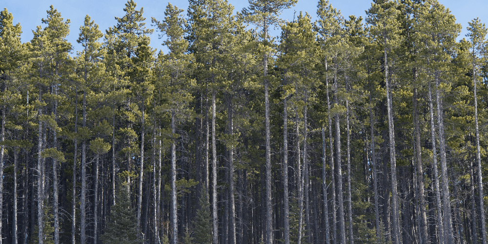
With landscapes extending across the continental divide, Kakwa has the most northerly glaciated peaks of the Rockies in Alberta that transition flawlessly into spectacular foothills.
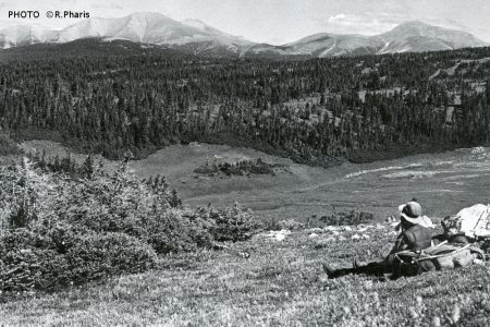
PHOTO ©R. Pharis
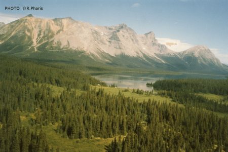
PHOTO ©R.Pharis
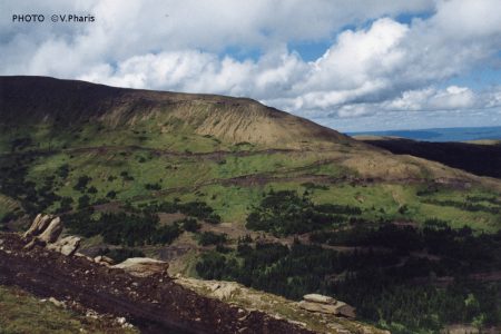
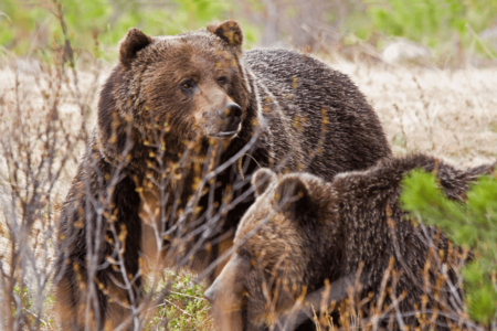
Caw Ridge in the Kakwa. PHOTO ©V. Pharis
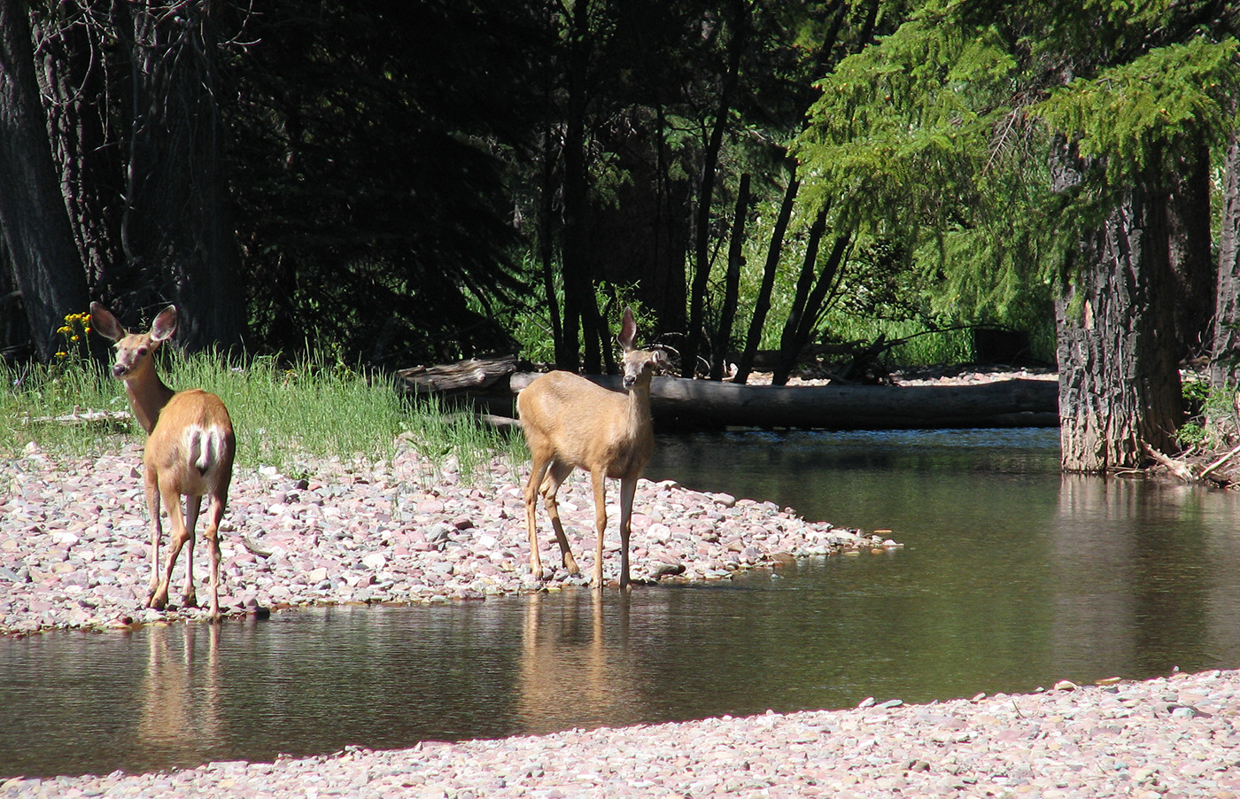
Kakwa’s diverse natural regions are the roaming ground for many of Alberta’s iconic species such as caribou, big horned sheep and grizzly bears. AWA believes Kakwa deserves increased protection and revived management to ensure its integrity from continuous industrial ventures.
 |
 |
Kakwa’s Rocky Mountain and Foothills Natural Regions offer a plethora of habitats for wildlife including mountain sheep, and threatened grizzly bear and Woodland caribou populations. Unfortunately, Kakwa’s vital landscapes are quickly disappearing due to minimal protection of public lands, and extensive industrialization.
Kakwa is located north of the Wilmore Wilderness , and extends east of the Alberta-British Colombia border. Notable features within Kakwa include Caw Ridge, Kakwa Falls, and Kakwa Wildlands Provincial Park.
The area supports the winter range for the Redrock/Prairie creek and the Narraway caribou herds, which have been designated as provincially and nationally threatened. Given the lack of protected areas within Kakwa, surging industrial activities continue to destroy critical caribou habitat, and jeopardizes the survival of these herds.
The Kakwa Wildland Provincial Park, designated in 1996, is the main protected area within Kakwa. The park is approximately 65,000 hectares (650 km2), and allows only low footprint recreation. In addition there is a small Provincial Park (Two Lakes PP) plus a handful of Provincial Recreation Areas, all of which total less than 30 km2 combined and are intended largely for non-motorized recreation. Most of Kakwa is unprotected public lands that require a science based management plan in order to facilitate the restoration of current and imminent linear disturbances.
Currently, most of Kakwa has been designated as a Multiple Use Zone, under the Eastern Slopes Policy which has the primary goal of utilizing the full range of resources available within the area with particular emphasis on maintaining the integrity of watersheds and environmental conditions. Access to this area is permitted to industry and the public, and is managed under the integrated resources plan of the peace region, in particular the Kakwa-Wapiti subregional plan. Kakwa will belong to the Upper Peace Regional Plan (UPRP) for Alberta’s Land use Framework once developed.
Some action towards reducing the collective industrial footprint within Kakwa has been initiated. Under the Integrated Land Management (ILM) approach, collaborating industrial companies developed the Kakwa-Copton Access Corridor Plan(2006), which established a network of all season access roads to be shared among industries with the objective to reduce linear disturbances.
The sole significant protected area of Kakwa, the Kakwa Wildland Provincial Park, is managed based on its legislative status. Under the Provincial Parks Act, the park is managed with the intent to: “preserve natural heritage of provincial significance or higher, while supporting outdoor recreation, heritage tourism and natural heritage appreciation activities that depend upon and are compatible with environmental protection” (Alberta Parks 2001).
AWA believes that in order to preserve the integrity of Kakwa, we must:
Bordering on the province of British Columbia, the Kakwa forms the most northerly portions of the Rockies in Alberta with AWA’s area of concern being approximately 5,967 km2. The area can be accessed from Highway 40 south of Grande Prairie, and north of the Wilmore Wilderness.
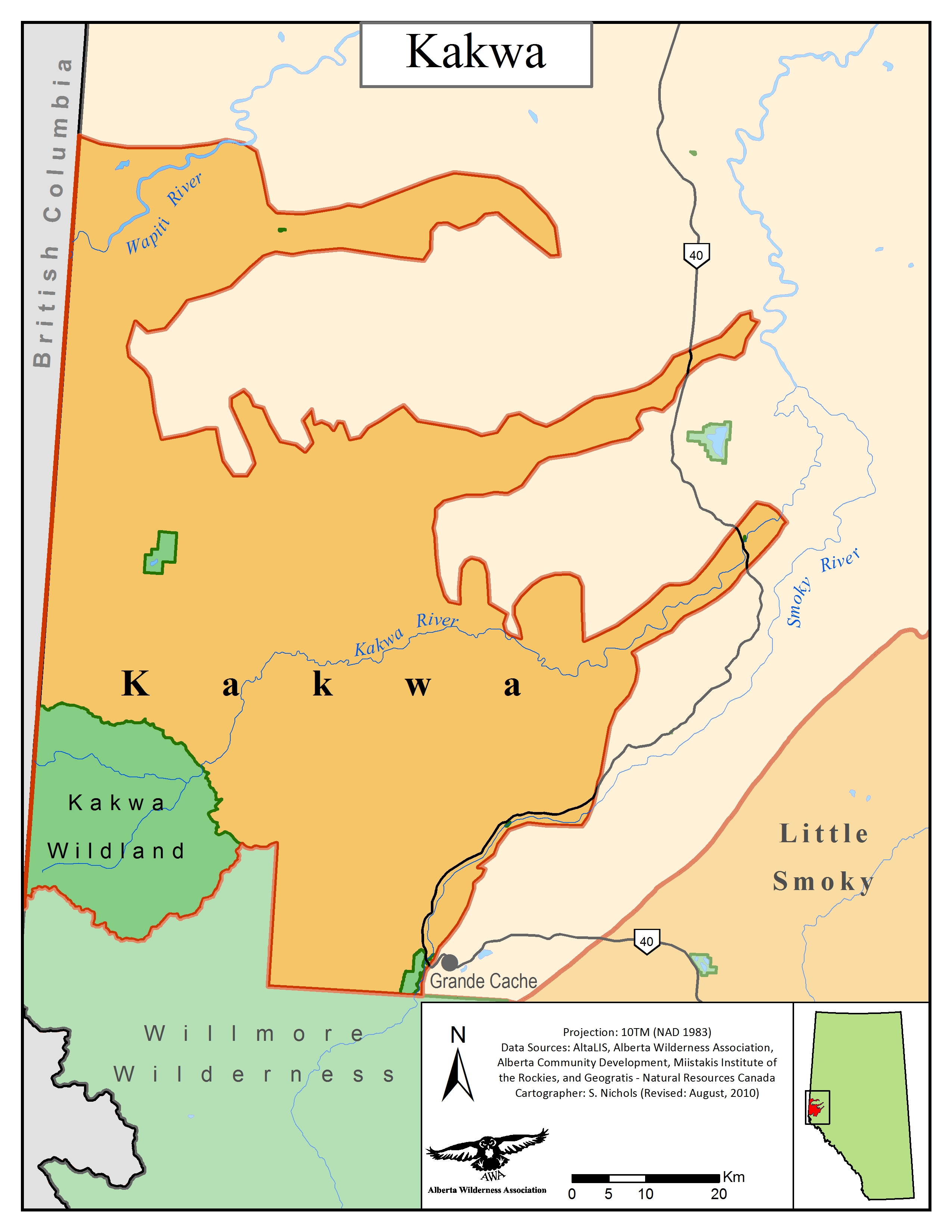
AWA’s Kakwa Area of Concern JPG | PDF MAP © AWA FILES
Kakwa’s watershed belongs to the Peace River Watershed, and more specifically, under Smoky/Wapiti River SubBasin. The Kakwa River originates in British Columbia, and enters Alberta northwest of Grande Cache. The river flows east from the mountains until confluence with the Little Smoky River. The surrounding area tributaries that support Kakwa River are Copton Creek, Redrock Creek, Prairie Ceek, and Francis Peak Creek. Kakwa is also home to the spectacular Kakwa Falls, which is a 30 metre drop.
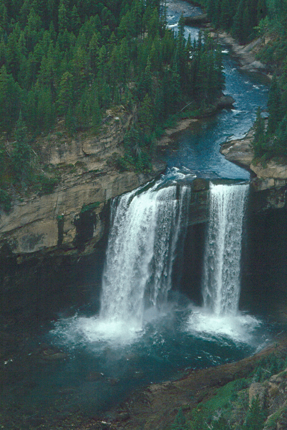
Kakwa Falls PHOTO: © AWA FILES
Kakwa lies within the Foreland tectonostratigraphic division of the Canadian Cordillera, and is underlain by a sequence of carbonate and clastic sedimentary rocks ranging from Late Precambian (> 600 Million Years) to Early Creataceous (< 135 million years) in age (Government of British Colombia 1991). Folds southwest-dipping, and northeasterly directed thrust faults are dominant structures in the area, with major thrust sheets containing strata that decrease in age towards the northeast.
Environmentally Significant Areas
Kakwa landscapes support a high level of biodiversity, providing essential habitat for caribou, big horned sheep, grizzly bears, wolves, and Arctic grayling. Kakwa Wildland Provincial Park is the only large legislative protected area within Kakwa.
Kakwa Wildland Provincial Park
Other Protected Areas
Caw Ridge
Caw Ridge, an alpine Subregion of Kakwa, is an unprotected ecological hotspot of particular concern. Approximately 21 km2 in size, Caw Ridge hosts a wide variety of wildlife including mountain goats, grizzly bears, and is also the winter range for the Redrock–Prairie Creek and the Narraway caribou herds. This area has been inundated by industrial developments and rigorous off highway vehicle recreational activities, and as such, has been one of AWA’s long standing Areas of Concern. AWA is seeking legislated protection and management similar to that of Willmore Wilderness Park, which does not allow use of motorized vehicles or new industrial activity.
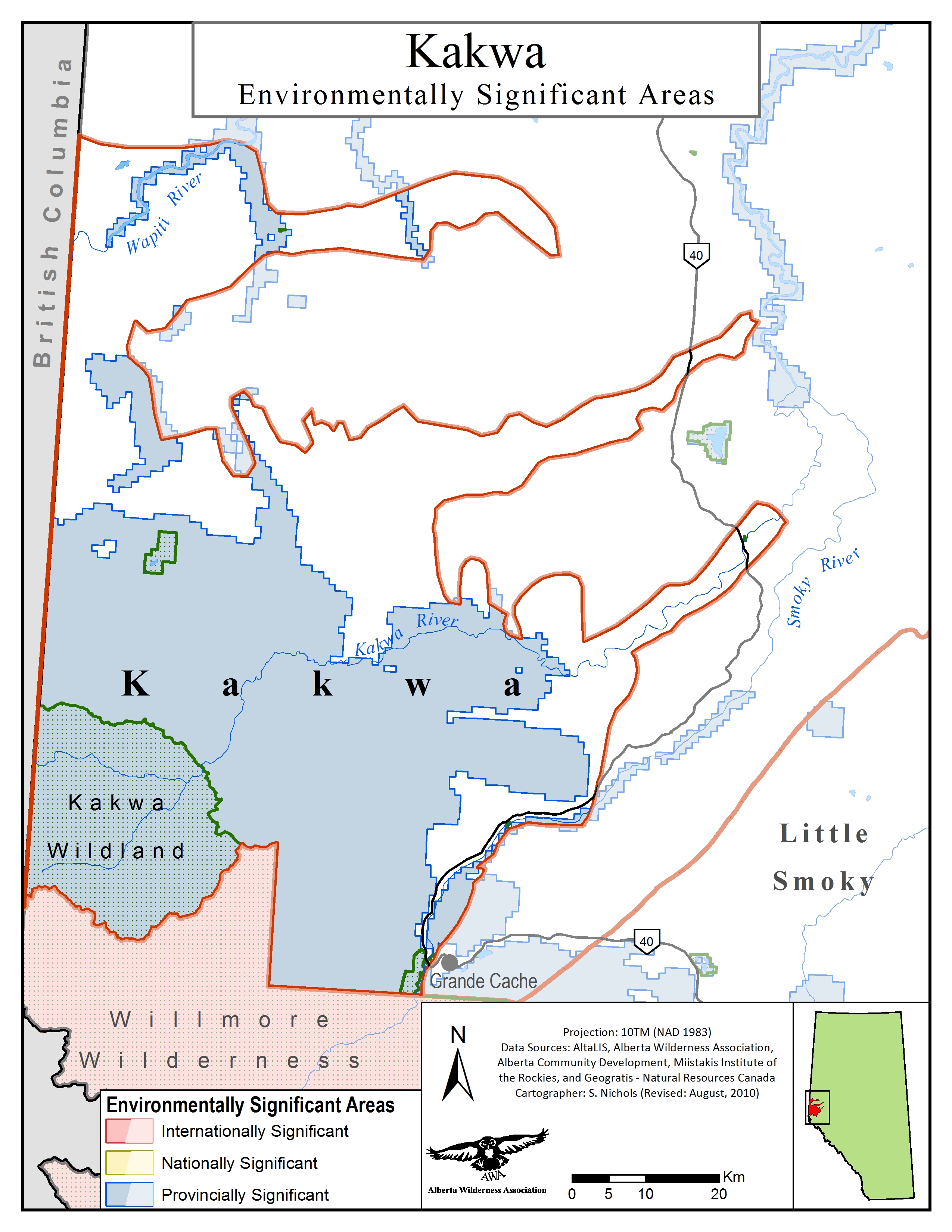
Environmentally Significant Areas: PNG | PDF MAP: © AWA
Kakwa is representative of the Rocky Mountain and Foothills Natural regions of Alberta. These landscapes transition from mountainous terrain, to subapline meadows which devolve into rolling foothills covered with extensive forests.

Natural Subregions map of Kakwa: JPG | PDF MAP: © AWA
Vegetation information source: Alberta Parks 2015
Foothills
Lower Foothills: is characterized by plateaus that are covered in mixed stands of aspen, lodgepole pine, white spruce and balsam poplar.
Upper Foothills: As the terrain becomes increasingly steep, this area is defined by coniferous stands of white spruce, and lodgepole pine with an under story of black spruce.
Rocky Mountains
Subalpine: is dominated by lodgepole pine, but some higher southern valleys are home to Engelmann spruce that are considered to be over 300 years old.
A number of plant species are at the northernmost extent of their range in Kakwa. Herbaceous communities differ throughout Kakwa depending on the Subregion and precipitation, but commonly found species include:
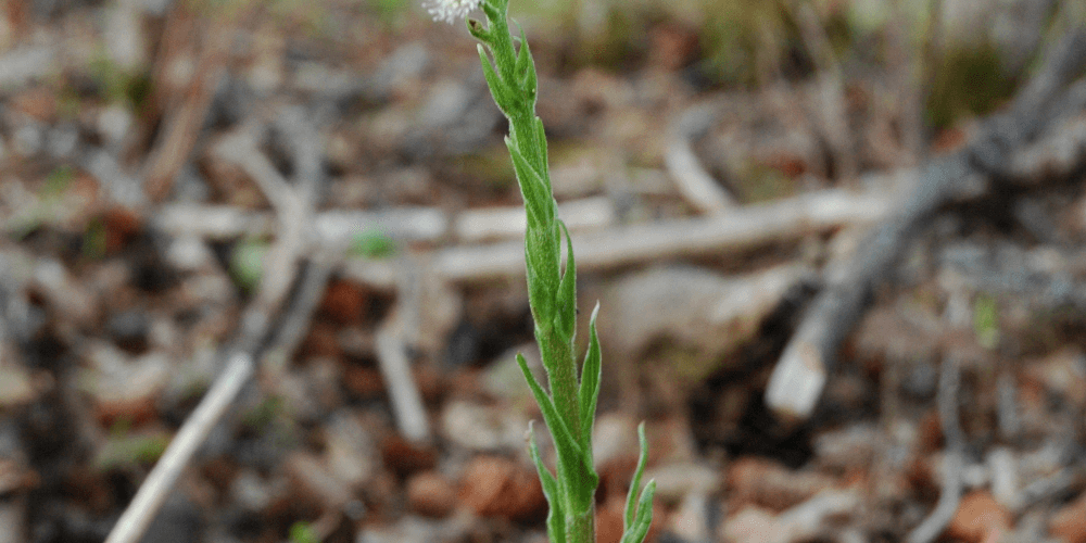
Sweet coltsfoot (Petasites frigidus) PHOTO © AWA FILES
Lodgepole pine (Pinus contorta) PHOTO © AWA FILES
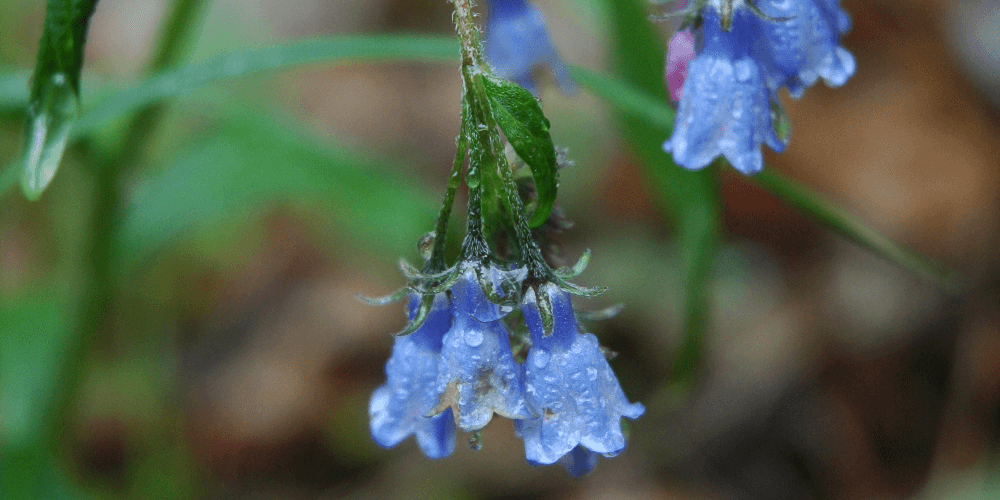
Tall mertensia (Mertensia paniculata) PHOTO © AWA FILES
Kakwa provides important habitat, and necessary migration corridors for a variety of animal species. Species common to Kakwa include:
Kakwa’s wildspaces are provincially significant given that they host many species and their ranges. Caw Ridge has long been recognized by wildlife professionals as an unparalleled area for biodiversity within Kakwa. It serves as a meeting area for flora and fauna typically found in the northern and southern Canadian Rockies.
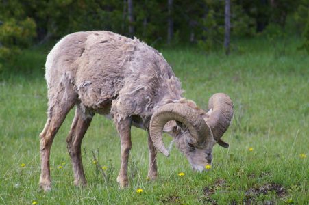
Bighorn Sheep (Ovis canadensis) PHOTO © AWA FILES
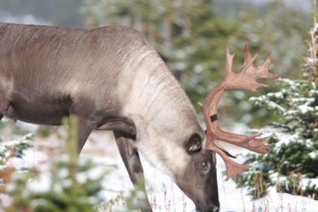
Boreal woodland caribou (Rangifer tarandus caribou) PHOTO © AWA FILES
Grizzly bear. PHOTO © AWA FILES
Grizzly Bears
Most of Kakwa landscapes are located within the “Recovery Zone” for threatened grizzly bear populations, which is habitat that is intended to support the recovery of this threatened species, placing limits on linear disturbances (Government of Alberta 2016).
Mountain Goats
This complex of rolling hills with short cliff faces and rockslides is home to the largest mountain goat population in Alberta. The resident population has undergone the most academic studies and documentation due to their relative isolation from surrounding mountain goat populations, and accessibility. With an approximate herd size of 90-100 individuals, the Caw Ridge herd has proven to be of exceptional value to science as the majority of the goats on Caw Ridge have been radio collared or ear tagged, and have demonstrated to be a species indicator for the anthropogenic effects on the local ecosystem.
Caribou
Caw Ridge is also the primary migration corridor for the Redrock/Prairie Creek and the Narraway caribou herds. These herds migrate between the mountainous areas of Alberta and British Columbia in the summer months to the foothills forests in the winter months. The migratory patterns of these herds are continually jeopardized, and loss of essential habitat is rapid due to industrial activities within Kakwa.
Redrock-Prairie Creek caribou herd:
Narraway caribou herd:
Kakwa’s watersheds demonstrate an equally species rich environment, and are critical spawning habitat for:
Wolves
Recreation throughout Kakwa includes observing fauna and flora, hiking, canoeing, fishing, camping, and motorized recreation.
In late 1960, there was a sharp decline in coal mining with almost no exploration in west-central Alberta but a resurgence of coal exploration and development occurred due to the opening of the Japanese market for metallurgical coal. Coal development switched from largely underground operations to predominantly surface mining (open pit and strip mining). This shift was met by increased public concern over the environmental impacts and lack of transparency in industry approval procedures. In 1972, the Environment Minister requested the Alberta Environmental Conservation Authority (AECA) be charged with investigating the conservation and environmental concerns of coal mining. The AECA conducted an investigation, held public hearings and prepared a report on The Impact on the Environment of Surface Mining in Alberta.”Despite initial failures to properly address potential environmental impacts, in 1976, the AECA did an inquiry on coal exploration policies, with site visits to sites including Caw Ridge, where coal exploration had been active. The results of this report concluded that coal extraction had significant environmental, social and land use conflicts associated with development.
Proper management of the coal industry took precedence, until 1996 when the Alberta Government began deregulating coal exploration, and it became a self regulating industry. Under the Alberta Government’s new code of conduct, road building and other exploratory applications were permitted without input from the government or the public, and government intervention was required only after the mine activity was completed to ensure damage is reclaimed.
In June 2020, the Government of Alberta rescinded the Coal Policy, only to re-instate in 8 months later, in February 2021, following widespread outcry from concerned Albertans of all walks of life. During the 8 months when the Policy was not in effect, several companies launched coal exploration projects with an eye to developing further mining enterprises, however none of these occurred in the Kakwa area. In February 2021, the Energy Minister also issued a directive to the Alberta Energy Regulator indicating that no mountaintop removal was to be permitted and all of the restrictions under the 1976 coal categories were to apply, including all restrictions on surface mining in Category 2 lands. (Approximately 34% of the Kakwa falls under Category 2 lands, with another 44% under Category 3, and 9% under Category 1 – fully protected. The remaining 13% is Category 4 – no protection – which is where the Grande Cache coal mine is located.)

Coal Development Policy Land Categories in Kakwa JPG | PDF MAP © AWA FILES
Kakwa has endured and continues to experience rampant industrial developments including, coal mining, industrial scale clearcut logging, and oil and gas extraction. The extensive anthropogenic disturbances have resulted in Kakwa habitats being degraded and highly fragmented, leaving most native species in a vulnerable state.
Despite being designated as provincially and nationally threatened, the Redrock-Prairie creek and Narraway caribou herds have no protected areas within their Kakwa ranges. Forestry, and oil and gas tenures cover most of the caribou ranges, with less than half of the remaining habitat being undisturbed. Without proper science based management plans in place, the remaining undisturbed caribou habitat within Kakwa will be engulfed by industrial development, and both caribou herds face extirpation.
While coal deposits underlie much of Alberta’s Foothills, there are complex geological problems that make accessing the coal-bearing strata difficult. Coal mining projects within Kakwa, particularly strip mining adjacent to Caw Ridge, pose significant threats to the surrounding habitat and the resident wildlife due to their invasive methodology. Many species within the Kakwa have lost vital habitat and are subjected to disruptive activities such as blasting or ripping; these industrial activities have influenced the population declines seen within Mountain goat and Redrock/Prairie Creek caribou. Caribou are frequently displaced by industrial activity into unfamiliar and exposed terrain where they suffer from inadequate food resources and are rendered more vulnerable to predators.
McIntyre Mines Ltd. began mining on Caw Ridge in 1969, and was purchased by Smoky River Coal Limited (SRCL) in 1987. SRCL was a privately owned Alberta with existing mining facility outside of Grande Cache. SRCL exported coal globally for steel production, had mined close to 50 million tonnes over a 13 year operation, and was recognized internationally for reclamation and was among the first of Canadian Coal Producers to receive and ISO 9001 designation for quality management. In 2000, Grande Cache Coal acquired 2 SRCL leases covering 1,100 ha for an underground coal mine. Grande Cache Coal Corporation was a private Alberta company, formed solely for reactivating coal mining in the Grande Cache area. In 2018 the Grande Cache mine was again sold, to CST Canada Coal Ltd. CST operated the mine until 2020 when it shut down due to the Covid-19 pandemic triggering a decline in demand that sent global coal prices plunging. As of 2021 operations remain suspended.
AWA would like to see the phase out of coal mining activities on and adjacent to Caw Ridge in order to protect wildlife populations and habitat, particularly the Redrock/Prairie creek and Narraway caribou herds and the mountain goat populations. New leases should not be granted, and existing industrial leases and permits should be amended on or adjacent to Caw Ridge. There must be no new road building or resource extraction activities. If further leases are granted, we recommend that a full Environmental Impact Assessment and public review be undertaken before allowing further resource extraction adjacent to Caw Ridge.

Caw Ridge, a sample of the damage incurred on the landscape by open pit mining. PHOTO: © AWA FILES
Kakwa has some of the highest off road recreational use in Alberta, resulting in significant damage to the landscapes. Recreationists use OHVs to access many of Kakwas ecologically rich areas, in particular Caw Ridge. Although many trials are defined within the area, there is no formal designation or enforcement, which results in the landscape becoming dissected by trails. While all recreation activities have an impact on the environment, OHVs have considerable negative consequences on soils and vegetation. Trails frequented by recreationists become increasingly compact, and suffer vegetation loss which increases surface runoff and erosion (Farr et al 2017). OHVs recreation also has the capacity to disturb wildlife with consequences such has habitat avoidance and degradation being the result. AWA believes that Kakwa requires an access management plan to control and restrict harmful recreational activities that have negative ecological responses. Intensive recreational activities overload an environment that is already saturated with disturbances.
A single FMA constitutes Kakwa is held solely by Weyerhaeuser Company Ltd, and increasing forestry associated industry infrastructure within Kakwa has resulted in habitat fragmentation and loss for many species. Industrial scale clearcut logging has reduced the amount of contiguous old growth stands, which are critical habitat for Woodland caribou. The Redrock/Prairie Creek and Narraway caribou herds utilize the foothills of Kakwa as their winter range with tendency to rotate between stands primarily grazing on terrestrial lichens. Continuous forestry development within Kakwa has significantly reduced the amount of suitable habitat for the herd, which ultimately affects their viability. AWA desires an ecological forest management plan for Kakwa to increase protected areas from forestry developments, and to ensure habitat protection for caribou and other native Kakwa species. This area also requires a restoration effort to mitigate habitat loss within Kakwa while simultaneously having a positive economic benefit for the forestry industry.
Petroleum and natural gas exploration is predominant throughout Kakwa, with tenure agreements being held by several companies. Current environmental consequences of oil and gas include:
Kakwa’s oil and gas exploration activities have rippling consequences in terms of its land and water footprints. Similarly to many of Kakwa’s ingenious species, the Redrock/Prairie creek and Narraway caribou herds have been directly influenced by the oil and gas developments. Industrial activities have reduced the herds winter ranges within Kakwa, restricting them to higher elevation habitats. Literature has demonstrated that caribou herds will limit and adjust their spatial distribution as to not overlap with areas that have been disturbed by industrial activities. The use of alternative higher alpine habitats has resulted in the Redrock/Prairie creek caribou herd being challenged by lower food quality and scarcity. By means of poor body condition, inferior habitat quality has dramatically affected the population dynamics of caribou by reducing herd viability and birth rates( Webster 1997). Kakwa deserves more profound management in order to moderate and combat the negative environmental impacts that accompanies the oil and gas industry.
AWA believes solutions are within reach to promote the preservation and protection of vital caribou habitat while supporting economic development that respects sensitive wildlife. Tenures within caribou ranges should be restricted because of the necessity of protecting critical habitat in order for caribou populations to survive. Additionally, companies that hold tenures throughout Kakwa should adhere to sharing infrastructure in order to limit new disturbances .
AWA participates in the Upper Smoky caribou sub–regional Task Force to complete a recommendation report.
AWA believes collaborative efforts are key to ensuring threatened Redrock Prairie Creek and Narraway caribou populations survive and recover, and to ensuring communities in these regions can also thrive. AWA seeks an enforceable land–use plan that achieves and maintains habitat conditions for naturally self–sustaining caribou. For areas outside caribou range, we seek effective management of cumulative land–use impacts to uphold Alberta’s commitment under the 1995 Canadian Biodiversity Strategy to maintain ecosystem, species and genetic diversity. We also support significant Indigenous leadership and participation in the region’s wildlife and habitat conservation.
In June, AWA begins direct engagements with Seven Generations Energy around biodiversity concerns and opportunities in their Kakwa region lease holdings.
In May, CST Canada halts operations at the Grande Cache coal mine due to the Covid-19 pandemic triggering a decline in demand that sends global coal prices plunging. There is speculation that although initially intended as a temporary shutdown as months pass it is more likely to become a permanent shutdown.
Also in May, AWA learns of a coal exploration program slated for the area in and around Caw Ridge by Horn Ridge Resources Ltd, and subsequently submits a Statement of Concern to the Alberta Energy Regulator against the application. AWA cites wildlife disturbance and displacement from exploratory activities, particularly focusing on the potential impacts from helicopter trips for field crews and gear, in addition to emphasizing the impacts of exploratory work on sensitive alpine vegetation and the construction of new access roads and trails. The application is refused by the AER, however the company may re-file their application. AWA commends the AER for rejecting this application.
In March, the Government of Alberta approves Weyerhaeuser’s Forest Management Plan (FMP) submitted in 2019, details of which can now be made public. The Government explicitly states that its FMP approval is preliminary and that the FMP will be subject to an approved Upper Smoky subregional plan.
In November, the Government of Alberta launches the Upper Smoky Caribou Sub-regional Task Force, a planning committee tasked with considering regional economic, access, and habitat scenarios to advise government on land-use planning at a local scale, including caribou recovery actions. As a task force member, AWA will seek a caribou range land-use plan that ensures meaningful indigenous leadership and participation, and that protects and manages caribou critical habitat within disturbance limits that are compatible with self-sustaining caribou. For areas of the Upper Smoky sub-region that are outside caribou ranges, we seek a land-use plan consistent with Alberta’s commitment under the 1995 Canadian Biodiversity Strategy to maintain ecosystem, species and genetic diversity. The ‘Upper Smoky’ sub-region as defined by the government overlaps with and extends beyond AWA’s Kakwa Area of Concern.
In fall, Weyerhaeuser releases their final “once per decade” Forest Management Plan (FMP) submission to the Government of Alberta, which includes detailed analyses of its preferred harvest scenario. However, despite Weyerhaeuser including AWA in its June 2019 slide presentation to stakeholders of a caribou-related multi-decade forestry harvest scenario that it was considering for the FMP, the submission itself remains inaccessible to public stakeholders until it is approved by the Government of Alberta.
In June, AWA meets with Weyerhaeuser to discuss their caribou-related harvest proposals. In spring 2019, AWA had requested that Weyerhaeuser reduce, rather than increase, its clearcut area in caribou critical habitat, in light of the April 2018 findings from the federal Minister of Environment and Climate Change of the threats to caribou habitat and recovery.
On July 26, the sale of Grande Cache Coal to CST Canada Coal Ltd. is completed for $US 430M. CST takes over operations of the No.8 Mine surface operation as owner and permit holder, with first coal shipments from CST anticipated in September 2018.
On April 30, the Minister of Environment and Climate Change Canada releases the first ever section 63 report under the Species at Risk Act, (SARA), where the Minister finds that outside of protected areas, provinces and territories have failed to protect almost all of boreal caribou critical habitat. The report highlights that the Southern Mountain Caribou populations, including the Redrock-Prairie Creek and Narraway herds, face an “imminent threat to recovery.”
On March 19, Alberta’s Environment Minister requests federal funding and more time to complete range plans. The Minister also states that Alberta is “suspending” consideration of potential Northwest protected areas until socio-economic impacts can be determined.
AWA meets with representatives of CST and GCC, and voices concerns about No. 12 Mine North, due to its location adjacent to Caw Ridge, an important wildlife area that AWA believes must be protected.
In February, Grande Cache Coal (GCC) declares bankruptcy. Following receivership, CST Canada Coal Company purchases the mine, along with all permits, licences, leases and approvals being transferred.
On January 12, AWA comments on Alberta’s draft provincial range plan, and states that it does more to increase the risk of caribou extinction for the foreseeable future by allowing more critical habitat in caribou home ranges to be destroyed than it does to work towards recovering thriving caribou populations.
On December 19, the government of Alberta releases draft for provincial woodland caribou range plan for public comment. The draft released allows unspecified new industrial disturbance in caribou critical habitat, and marks further delays in range-specific plans and actions. While advancing some positive principles, the government continues to delay necessary actions to achieve caribou home ranges
On November 28, a letter is delivered to all Alberta MLAs noting the dire situation of caribou and requesting their support to recover this iconic species. Supporters of Alberta’s endangered caribou delivers hundreds of postcards to the steps of the Alberta Legislature today, asking the Premier of Alberta to protect the habitat that these iconic wildlife need. The “Quarters for Caribou” event, organized by the AWA, comes after Alberta misses its 5-year deadline, in October 2017, for producing caribou range plans that protect least 65% undisturbed habitat, the absolute minimum required for caribou to sustain themselves.
On October 31, the federal government reports that the quality of caribou habitat continues to decline across Canada.
In a separate release, the David Suzuki Foundation, Ontario Nature and Alberta Wilderness Association identify critical habitat destruction “hot spots” in the ranges of threatened caribou in Alberta, Ontario and Quebec. The groups call on the three provincial governments to convene Indigenous and stakeholder groups to develop range plans that protect critical caribou habitat. No province or territory has fully met the timeline established in the Recovery Strategy for the development of range plans, due on October 5, 2017.
On November 23, Alberta’s department of Energy has extended its “use it or lose it” deadlines for drilling requirements for oil sands, oil, gas and mineral operators within every Alberta caribou range until March 2019. Alberta Wilderness Association welcomes this step to support caribou recovery, and requests that stringent limits on new surface disturbance in caribou ranges also be adopted soon.
On September 30, Alberta Energy announces an interim restriction has been placed on the sale of mineral rights within all caribou ranges in Alberta. The restriction applies to petroleum and natural gas, oil sands, coal and metallic and industrial mineral rights. The AWA is pleased to learn of this action with hope that it reflects the petroleum industry’s commitment to restoring Alberta’s Woodland caribou populations.
On August 4, AWA has found that no new energy rights within Alberta caribou ranges are scheduled for future sales. Two in-range licenses covering 24 km2, which had been posted for the August 19 rights auction, have since been withdrawn by Alberta Energy. AWA recognizes the importance of these lease sale withdrawals and urges the Alberta government to defer all new energy leasing within caribou ranges, until strong habitat-recovery range plans are in place to ensure survival of Alberta’s endangered caribou.
On April 28, the Alberta government plans another major auction of new oil and gas leases on 35,600 hectares (356 km2) of endangered mountain and boreal woodland caribou habitat, without rules to reduce surface disturbance below current excessive levels. The AWA asks all Alberta’s political party leaders to commit to defer energy lease sales in endangered caribou ranges until effective rules to protect the herds are in place. Since September 2014, the Alberta government has auctioned over 1600 km2 of Alberta caribou ranges for oil and gas leases.
On March 23, the Alberta government has posted new energy leases for sale in the same endangered mountain caribou range in west central Alberta where it cancelled lease sales on March 6. Alberta Wilderness Association (AWA) asks the Alberta government for consistent decisions to recover Redrock-Prairie Creek and Narraway mountain caribou, and to adopt the principles of the Alberta Conservation Association (ACA) 2012 proposal for Redrock-Prairie Creek caribou range management.
On March 6, the Alberta government postpones the auction within the endangered Redrock Prairie Creek mountain woodland caribou range. AWA welcomes this decision and calls on the Alberta government to defer further energy lease sales in endangered caribou ranges until effective rules were in place to protect and recover their habitat.
In May, Alberta’s mountain caribou are assessed as Endangered – in immediate danger of extinction – by Canada’s Species at Risk Act scientist advisors (COSEWIC),yet the Alberta government plans to sell off an additional 1,765 hectares of energy leases in these endangered caribou ranges from May 14 to June 25, in apparent disregard of the habitat crisis facing its caribou. AWA calls on the Alberta government to stop undermining caribou survival chances and to halt new leasing and surface disturbance within caribou ranges.
The Alberta Conservation Association (ACA) prepares a proposal for a pilot conservation plan for the endangered Redrock-Prairie Creek mountain woodland caribou population. The plan envisions a continued long-term timber harvest deferral, with compensation for the affected leaseholder, plus rules for energy development that would greatly reduce surface disturbance, compatible with caribou recovery. A slide presentation to illustrate the proposal is also prepared.
Grande Cache Coal is sold to Chinese-based Winsway Coking Coal Holdings Ltd. and Japanese-based Marubeni Corporation.
On November 10, AWA writes to the Minister of Energy and the Minister of Sustainable Resource Development requesting that the government reevaluate the permissions granted to coal resource extraction companies in the sensitive and biodiversity region of Caw Ridge, as the development further threatens AWA’s goal protect the Kakwa wilderness area.
On August 17, Maxim Power Corp .is given expedited project approval to construct a new coal-fired power plant to ensure the plant is constructed and commissioned before July, 2015 when new federal emissions regulations come into effect. Maxim Power Corp. has also applied to expand HR Milner power plant, outside of Grande Cache AB. AWA is opposed this expansion, and is concerned with the increased greenhouse gas emissions, extraction and discharge of wastewater into the Little Smoky River, and impact of development and exploratory activities within the vicinity of Caw Ridge.
On February 22, AWA is not granted “standing” by AB Environment, meaning it was deemed that AWA members would not be directly or adversely affected by the construction of No.12 South B2 Underground Mine. In response to this, GCC Environment Manager has invited a local AWA member to participate in an Environmental Monitoring Committee as an observer with no voting rights.
AWA submits Statement of Concern in regard to GCCs proposed No.12 South B2 Underground Mine, with the primary concern being the implications for the significant habitat and migration routes provided by Caw Ridge and adjacent lands for a diverse range of Alberta’s wildlife. AWA requests a full public inquiry into resource development on Caw Ridge.
Information is released to AWA from a 2008 application under the Freedom of Information and Protection of Privacy Act containing copies of selected correspondence concerning mining development proposals on Caw Ridge. It details the concerns that local Fish and Wildlife staff have with the exploration, and that the serious implications for threatened caribou populations on the ridge have been consistently ignored over a number of years.
AWA continues to oppose the development on Caw Ridge and present applications for coal mining. AWA is frustrated by the limited definition of “directly affected” that government agencies are applying to decisions not only here on Caw Ridge but whenever applications for resource extraction or impacts to public land issues are being considered by the regulators.
In July, in a letter to Alberta Environment, AWA registers concern over a proposed road through the bottom of the Westridge pit to the Sheep Creek breaker, which could be used as a shortcut for hauling coal in future developments. Additionally, AWA notes that the Application for Amendment submitted by Grande Cache Coal does not submit an estimated cost for the reclamation of No. 8 mine nor the amount they propose to post as a reclamation security. In order to guarantee that the burden does not fall on Alberta’s taxpayers, AWA recommends that Grande Cache Coal pay the complete and true cost of the reclamation at the time of greatest ground disturbance, as well as any funds needed to cover shortfalls if the cost of reclamation becomes greater than the security fund.
Petro-Canada informs AWA that it has cancelled its plans to drill in Kakwa.
In May, the Energy Resources Conservation Board announces that Grande Cache Coal has applied to develop, operate, and reclaim the No. 8 mine project. The project includes a surface mine, associated infrastructure, haul road, and three settling ponds. The resulting new disturbance is expected to be 814 ha in size and is expected to produce 1,680,000 tonnes of raw coal per year. AWA does not oppose the No. 8 mine project but expects the area to be fully reclaimed.
In December, a total of 460 mountain pine beetle-infected trees are identified in Kakwa Wildland Provincial Park. Alberta Community Development has agreed in a Memorandum of Understanding to work with Alberta Sustainable Resource Development in addressing mountain pine beetle. No definitive plans are made, but strategies considered include using helicopters to bring people in to cut and burn isolated infected trees, and clear-cut logging.
On March 1, the Calgary Herald reports that a study by a wildlife consultant warns that grizzly bears and wolverines in Kakwa are at risk due to excessive snowmobile use. Snowmobile groups have been lobbying to maintain uncontrolled access to the area.
On April 20, AWA receives a letter from GCC stating that “Grande Cache Coal Corporation is committed to conducting mining operations in an environmentally responsible manner.”
On April 8, AWA travels to Grande Cache and takes a tour of the GCC Mine 12 B2 pit.
AWA discusses Phase II of B2 pit with the vice president of operations for Grande Cache Coal Corporation, the Environmental Coordinator, and the representative for Smoky River Environmental Services. GCC discloses their intent to eventually apply for permits and leases of mine Caw Ridge.
AWA is concerned with the impacts on the mountain caribou herd using Caw Ridge for migration route, in particular the sensory disturbance due to the activity of heavy equipment and blasting. As a result, caribou may alter their use of foraging habitat and may be displaced.
GCC argues that mitigation measures will be implemented when caribou approach the active mining area which includes the provision to temporarily cease mine activity, particularly blasting and altering location of activity such as vehicle movementGCC proposes to conduct future caribou monitoring through coordinated approaches with the West Central Alberta Caribou Standing Committee.
To minimize wildlife collision, GCC proposes to reduced vehicle speeds, post signs for frequent wildlife crossing areas and implement worker education. GCC states that reclamation of B2 Extension pit (Phase I and II) will re-establish habitat, and that wildlife will experience only a minor loss of local habitat. GCC feels reclamation will have major positive and long term impacts on wildlife compared to the mine site’s current condition.
Reclamation options include:
Reclamation is to begin following mine activities cessation in 2010.
AWA representatives are given a tour of the Grande Cache Coal B2 mine pit.
AWA writes to the Government of Alberta to ask that no new leases are sold and no amendment approvals be granted under existing leases permitting activity on Caw Ridge.
In January, AWA receives a copy of an application for Amendment EPEA Approval for No. 12 mine B2 Phase 2 mine. It is a copy of GCC’s application to complete mining and reclamation of the B2 Extension Pit where GCC is currently operating. According to GCC, the B2 Phase 2 Mine is a logical completion of the presently approved B2 Phase 1 Mine (April 2004). B2 Phase 2 Mine (December 2004) and reclamation plan offers a rational and fully secured plan that meets the objectives of recovering an economic coal resource and achieving reclamation at a site that was in a substantially disturbed and un-reclaimed condition.
On December 16, GCC submits an application for amendment of its EPEA approval for No. 12 Mine South B2 Extension- Phase 2 Mine, “Ultimate Phase II”
This represents the completion of mining and reclamation of GCC’s B2 mining operation. When complete, the mine will have a total footprint of 183ha.
Phase II willprovide coal for export to other countries
Phase II will extend Phase I operations by 16 months and will mine ~70,000 tonnes of coal per month. This will yield ~5.5 million tonnes of metallurgical coal for exportation.
Completion of mining in No 12 B2 Extension pit area is expected by 2010.
GCC negotiates a price of $125 US per tonne for 2/3s of its 2005 production, sharing the highest price ever secured for Canadian hard coking coal. The average price in 2004 was $64 per tonne. The large increase is due to a global shortage of hard coking coal.
In November, correspondence between AWA and GCC Environment Manager concludes that GCC will soon file for further amendment to cover the completion of the pit (Phase 2).
In October, GCC submits an application for the amendment of 2 mine licenses to the EUB for the B2 Phase 2 mine.
These amendments will include permission for operation of the South Lobe pit, immediately adjacent to the B2 pit Phase 1 activity, and waste rock dump configuration (5 separate waste dumps).
The mining of the South Lobe satellite pit and waste rock dumps will ensure the optimum recovery of economic coal in this area.
A new haul road ~2km in length will be built to access the South Lobe
On August 26, GCC receives EPEA amending approval from Alberta Environment to conduct Phase 1 of the B2 pit operations, and mining of B2 pit begins. Alberta Environment states they have received reclamation security for the B2 Phase 1 mine application.
On August 17, AWA tours Caw Ridge and the B2 Pit Mine with GCC representative
Correspondence with GCC Environment Manager concludes that, “GCC has chosen to phase in approvals so the Phase 2 amendment covers the completion of mining within the remainder of the EUB mine license area that includes a reclamation plan.The Phase 1 application shows the Phase 2 mine development area. The B2 area is contained within a ‘bowl’ of the drainage of a tributary of Beaverdam Creek so it is not part of Caw Ridge. The B2 pit is a culmination of a series of pits and rock dumps developed by SRCL. The area was in a disturbed land condition. In our view, the area can only be reclaimed upon removal of the coal.”
On July 30, Alberta Environment responds to AWA’s submission. Alberta Environment does not consider AWA as directly affected by the application.
AWA sends a third submission to Alberta Environment with regards to the re-opening of mine 12, pit B2. In the submission, AWA states again, that the B2 pit ought to be closed and reclaimed on account of its location on a steep hillside in prime wildlife habitat. AWA is concerned because the paltry $7.5 million reclamation fund demanded of bankrupt Smoky River Coal Ltd. will cover only a small fraction of the actual cost. AWA wants to be assured that Alberta Environment has employed full-cost accounting, including all costs associated with re-contouring and reclamation, and restoring lost wildlife habitat and the natural aesthetics of the slope and access road, as well as make public their accounting process and final amount being demanded of Grande Cache Coal as a reclamation security bond for the B2 pit and road.
On June 29, AWA forwards a letter on the K.K Singh Regional Approvals Manager, Northern Region. AWA argued its right to represent the public interest given out long history within the region as well as our rights under Alberta Environmental Protection and Enhancement Act.
On June 1, GCC sends letter of response to AWA regarding their June 2004 submission:
On June 8, correspondence from with a Professor of Biology at Laval University in regards to research that demonstrates goats did not use the site adjacent to the B2 mining area. This suggests a strong impact of mining activities on space used by the goats, and they are concerned the mining will impact the goats and their behaviour. Development of south lobe as part of a new phase of the B2 extension would impact mountain goats by decreasing habitat, decreases population size and decrease the migration of goats along the ridge.
Correspondence between AWA and a representative of the Grande Prairie Trappers’ Association regarding Public Notice of B2 amendment”:
AWA makes a submission to Alberta Environment regarding GCC’s application for amendment to re-open of B2 pit mine. Main points of emphasis include:
Conclusion: B2 Pit and particularly the B2 extension is located on public land and zoned as critical wildlife habitat. It should not be re-entered but rather reclaimed. Caw Ridge should be protected under the Willmore Wilderness Park as compensation for irreparable environmental losses from the mine and as an attempt to recover the caribou population.
AWA makes a submission on the Grande Cache Coal Corporation’s application to re-open Mine 12, Pit B. AWA is concerned that allowing further development of B2 will facilitate extension of development by increment to the detriment of wildlife.
Alberta Environment asks that AWA outline concerns specific to the development proposed in the current application and clarify exactly how individuals from AWA are directly affected by the proposal. In its response, AWA argues that their initial submission does in fact comply with all of the information required to qualify as “directly affected” and “acting in the public interest.
On May 13, GCC announces it has signed a letter of intent with North American Enterprises Ltd. (NAEL) to conduct mining and other services for them. NAEL will:
GCC raises $50M from selling common shares to start mining. The success of GCC will be due to the increase in demand for metallurgical coal. A GCC news release states: “The net proceed…will be used by the company to fund the initial capital expenditures to develop and equip the No.7 underground mine, the refurbishment of the of the coal process plant, to deposit reclamation security with the Alberta Government, to complete exploration, engineering and permitting of the No. 16 east surface mine and for working capital.”
GCC applies to Alberta Environment for an amendment to the existing approval for the opening up, construction, operation and reclamation of the No. 12 Mine south B2 Extension Phase 1 mine and coal processing facility. The proposed development includes the No. 12 Mine South B2 Extension open pit mine, haul roads, Flood Creek Disposal facility, coal processing plant and associated infrastructure (Twn 58, Ranges 7,8,9, and 10, W6). The amendment includes approximately 10.79 hectares of new disturbance and 262.33 hectares of previously disturbed land and will be reclaimed to wildlife habitat.
The public notification of these actions prompts concern from the environmental community. GCC does not refer to the B2 extension as Caw Ridge but rather as the No.12 Mine B2 pit in order to make it more “acceptable” to the public. The company advises that the coal in B2 is already exposed and the pit already exists. There will be no increased stripping or removal of overburden in this B2 extension.
A representative of the Grande Prairie Trappers’ Association submits statement of concern regarding amendment for commence B2 Pit mining.
GCC’s EIA identifies the traditional migration route of the Prairie Creek/ RedRock mountain caribou herd as passing directly adjacent to B2 development.
SRCL placed a rock berm at the top of B2 pit but little research has been done on the effectiveness of this berm and the impact of caribou movement from the coal development.
A local biologist says the caribou have been avoiding the area since the development of the pit, and GCC should defer activities within the B2 pit until the Alberta Woodland Caribou Recovery Plan is released.
AWA is notified by GCC that the company will complete the mining and reclamation at the No.12 Mine south B2 Pit developed by SRCL. The majority of the surface disturbance in the B2 mine area occurred during SRCL operations. GCC’s approval to complete mining in the B2 pit area will facilitate the ultimate reclamation of this area.
GCC operations in the B2 Mine area will stay within the boundaries of SRCL approval and mine licenses. These licenses were transferred by EUB to GCC in 2003. SRCL was authorized to operate several settling ponds, and these ponds have been maintained by Alberta Environment since SRCL receivership. GCC would assume responsibility of these settling ponds through proposed amendment approval.
On May 11, the Grande Cache Coal Corporation gives public notice that it has applied to Alberta Environment to re-open Mine 12, Pit B to mine low-grade coal. High-grade coal was mined from this pit in 1999 until the operator, Smoky River Coal Ltd., went bankrupt. In its wake, Smoky River Coal Ltd. left behind an un-reclaimed area and no money to reclaim it. It is uncertain if this mine can be reclaimed and the area is immediately adjacent to the western side of Caw Ridge, separated only by a large rock brm.
On April 29, GCC submits an application for amendment of EPEA approval and Water Act Approval of the No. 12 Mine South B2 Extension Pit- Phase 1 portion. This amendment is necessary to enable GCC to complete mining and reclamation at the No. 12 Mine South B2.
GCC will use an open pit truck and shovel mining method and will be hauled by highway haul trucks on existing haul roads to coal processing plant for export or to H. R. Milner generating station.
Phase 1 will produce coal for export and for H. R. Milner generating station, and the product will also be exported primarily to Japanese and Korean Steel producers. The mines will yield 291,000 tonnes of metallurgical coal, and GCC expects to hire 130 mining personnel.The total footprint of Phase 1 plan is about 70 ha of which 58ha is currently disturbed. Total current disturbance to the No 12 south B2 pit is ~ 190ha. B2 Phase 1 will have dimensions of 500m long (east to west) by 350, wide (North to south) and 75 m deep. The area of operation includes B2 Phase 1 mine site and existing infrastructure of haul road, coal handing facilities, coal processing plant and coal waste storage facilities.
GCC also requests issuance of relevant approvals under the Water Act relating to water management and water use. Water plan includes operation and maintenance of several existing settling ponds and provision for drainage control structures along the haul road. GCC has scheduled its development plans to begin mining B2 No. 12 while developing No. 7 mine. No. 7 will take longer time to develop than B2 Phase 1.
As a condition of requested EPEA amendment, GCC will assume reclamation liability within the footprint of Phase 1 mine plan currently held by Alberta Environment.
Environmental monitoring data specific to B2 Phase I mine includes:
Initial wildlife program provided basis for impact assessments and development mitigation programs for SRCL proposed surface mines on Caw Ridge (“Copton East Lease mines or No. 20 mine).
Studies contributed to the assessment of impacts on wildlife and development of mitigation programs for SRCL No 12 Mine south Be Project, and in 1999, a caribou monitoring program address monitoring requirements.
Scope of SRCL wildlife monitoring program for No 12 area and beyond Caw Ridge included:
These were undertaken by Renewable Resources Consulting Services Ltd. (RRC) for SRCL.
Wildlife monitoring program indicated extensive use of Caw Ridge by the Redrock/ Prairie Creek caribou herd during most study years. Caribou RedRock/Prairie Creek herd consistently used Caw Ridge during migration except during years with heavy snowfall. The westerly portion of ridge (adjacent to B2 pit) received most use.
GCC intends to file for future amendments to complete B2 extension pit – “Ultimate Phase II Mine Plan.”
GCC acquires EPEA approval for No. 7 mine project. GCC schedules its development so it can begin mining within the No. 12 Mine South B2 area while developing the No. 7 mine. This will allow GCC to meet commitments under long term supply agreements with Japan and Korea as well as meeting supply requests from H.R. Milner generating station.
In January, GCC announces the company will be operating by the end of 2004 due to improving coal markets.
On May 6, the EUB issues GCC a mine permit amendment and transfers SRCL’s mine licenses to operate the No. 12 Mine South B2 pit and incorporate the No. 12 South B2 Phase I, the No. 7 mine area and coal handling infrastructure into one common permit area. In other words, the EUB approves GCC’s application to take over mining of B2the pit. Approximately 3.1 million tonnes of coal remaining in B2 pit, and the B2 Phase 1 mine will remove 291,000 tonnes of metallurgical coal in 2004-2005. It is anticipated there will be a Phase II to this project.
If GCC receives all necessary amendment approvals from EUB and Alberta Environment regarding mining this pit, GCC will be responsible for reclamation.
The EUB recognizes that if coal leases are issues in respect to Caw Ridge, it is responsible to consult with stakeholders via the Inquiry that had been deferred in 2000. Caw Ridge coal leases have not been issued by Alberta Energy and therefore, EUB will keep the Inquiry on hold.
GCC holds an Open House in Grande Cache to update and present the proposed No. 12 Mine South B2 Extension Pit Mining and Reclamation Project to the public, and provide an update on the status of regulatory approval and No. 7 underground mine. GCC is seeking financing to complete the No. 7 mine for late 2003.
In April, GCC files an application for the transfer of all SRCL mine licenses.
In March, GCC applies for an amendment to its EUB Permit Area and an EUB License to mine B2 extension Pit previously operated by Smoky River Coal.
In January, GCC receives final regulatory (EUB) and cabinet approval (mine permit) to commence the No. 7 underground mine and the No. 8 surface mine and associated infrastructure. The EUB received no public objection prior to approval of the mine project therefore allowing the proposal to proceed without having to go to public hearing
GCC president must still complete the financing for the project. The costs are estimated at $25M-40M. GCC also acquires the coal rights from Alberta Energy for former SRCL No. 12 Mine South B2 Extension Pit surface mine
Giving GCC approval to mine B2 extension Pit will , “recover an exposed coal resource, relieve the Province of reclamation costs, and provide additional work to local communities” (Corporate Update).
In November, Alberta Environment and associated federal and provincial government agencies complete their review of the EIA for No. 7 and No. 8 mines. In their opinion, the EIA is complete pursuant to section 53 of the Environmental Protection and Enhancement Act.
In October, GCC releases application for approval of the No. 7 and no. 8 projects to the EUB and Alberta Environment. The application includes the EIA report for No. 7 and No. 8 mine developments and the coal processing facility.
In June, GCC replies to the March 24, 2001 letter from AWA, stating their concern with the goats herd. GCC “believes industrialization of the area can be managed with orderly coal development and timely reclamation.”
In May, GCC conducts technical and environmental Issues Workshop to allow interested parties and stakeholders to contribute to GCC mine development and environmental planning process for the No. 7 and No. 8 mines and operation of coal preparation plant. It is an opportunity to obtain stakeholder input on the proposed mining methods and environmental and social issues.
On March 24, AWA submits a letter to GCC regarding concerns of the No. 7 and No. 8 mining projects:
On March 5, GCC provides AWA with a copy of the Public Disclosure Document and EIA Terms of Reference for No. 7 and 8 mine projects that the company submitted to Alberta Environment.
In February, Alberta government determines that GCC must complete a full EIA for its operations. The EIA includes No. 7 underground mine and coal preparation plant and tailing pond (once used by defunct Smoky River Coal Ltd.).
In December, AWA correspondence with a representative of the Grande Prairie Trappers’ Association who shares concern regarding reclamation of the B2 pit and want the suspension of any further leases on Caw Ridge.
The representative is told by GCC president that it is within their long range plans to apply for further leases on Caw Ridge, specifically for pits C and C. GCC feels they can develop them without causing environmental damage.
In communication with the EUB, the representative was informed that no leases would be granted for Caw ridge until all environmental concerns were examined.
In November 29, AWA sends letter to the Director of the Northern East Slopes Region, at Alberta Environmental Protection regarding reclamation of Mine12 and various extensions up the slopes of Caw Ridge. AWA would like to see Caw Ridge be reincorporated back into the Willmore Wilderness Park. AWA concerned over the inadequate funds available for restoration pit.
On November 21, GCC holds open houses for the No. 7 and No. 8 mine proposals.
Project is located 20km north of Grande Cache in the Sheep Creek area that had been mined previously by SRCL. Project involves the mining and processing of raw coal to produce high quality, low volatile, metallurgical coal for export markets. GCC proposed to mine 1.7M tonnes coal to produce about 1.3 M tonnes of clean premium grade metallurgical coal. Projects are expected to operate for approximately 30 years, and employ around 200 people.
The underground mine would be developed on the west slope of Mt. Hammel (SE of Caw Ridge).
The surface mine in the old No. 8 mine area includes the associated haul roads, operation of existing coal processing and loadout facilities at plant site on Smoky River floodplain and mine site decommissioning and reclamation.
No. 7 would require a 6km haul road to be constructed and would produce 7.6 M tonnes of coal over 4 years. Once in full production, No 7 mine would produce 2 M tonnes of raw coal annually using the room and pillar mining system. It is estimated that the No. 7 mine has coal reserves of 10 M tonnes.
Once No. 7 is operational, GCC will seek approvals for surface mine in No. 8 mine area above Sheep creek.
The No. 8 mine has 8 M tonnes of metallurgical coal and 250,000 tonnes of thermal coal.
The company announced they had purchased the coal leases for No. 7 and 8 from Government as well as the assets key to operation including preparation plant, mine dry facilities, mining equipment and geological and engineering info gathered by SRCL.
GCC is filing applications for approval from Environmental Protection and Enhancement Act and Water Act.
GCC needs a mine permit, license and approval for the coal processing plant from the EUB, and is anticipating commencing the project in June 2002.
GCC will renew contracts with SRCL’s previous customers in Japan, Taiwan and Europe. It will also try to sell coal to the nearby H.R. Milner generating station.
Alberta Environment is directing an EIA report for the project and this EIA will form part of GCCs application to Alberta Energy Utilities Board.
The company has submitted the Disclosure Document outlining mining plans to Alberta Environment and has prepared an EIA Terms of Reference for public review and comment.
In October, Smoky River Coal is issued an Enforcement Order under Alberta Environmental Protection and Enhancement Act after the company fails to produce reclamation plans following its shut down of its mine and coal processing facility on March 30. According to environmental approval, the company had 6 months to submit a decommissioning and land reclamation plan, wildlife management plan and a final reclamation plan to Alberta Environment. The Enforcement Order provides Alberta Environment with the means to ensure that the monitoring continues and reclamation is carried out.
AWA remains concerned: will $7M fund be enough to complete reclamation? Does this fund exist and can it be drawn upon or does it exist only in the books, i.e. what is the likelihood that SRC or its receiver will actually pay reclamation costs or will the reclamation fall to the Alberta taxpayer?
Smoky River Coal Ltd. is issued an Enforcement Order under Alberta’s Environmental Protection and Enhancement Act following the company’s failure to produce reclamation plans after the shutdown of the mine and coal processing plant near Grand Cache. The company had six months to submit a decommissioning and land reclamation plan, a wildlife management plan, and a final reclamation plan to Alberta Environment. The Enforcement Order allows Alberta Environment to ensure that monitoring will continue and reclamation is carried out.
On September 6, Grande Cache Coal Company Inc. (GCC), an affiliate of Smoky River International (SRI), acquires 2 SRCL leases covering 1,100 ha for operating an underground coal mine No. 7 and surface mine No. 8 mines from the provincial government. Grand Cache Coal Corporation is a private Albertan company formed solely for reactivating coal mining in the Grande Cache area. A lease implies construction, operation and reclaiming. Leases purchased from AB Government for $50,000.
Company files the necessary regulatory applications to obtain the required permits, licenses and environmental approvals.
GCC has also made applications for almost all of the coal leases owned by the defunct SRCL except the northwest corner which represents a large portion of Caw Ridge.
The No. 7 underground mine will employ about 200 workers.
AWA receives a reply from Alberta Environment (Land Management Program Manager Chris Powter) regarding reclamation of Smoky River Coal mine site including B2 Pit extension.
Following the closure of SRCL, Price Waterhouse Coppers is responsible for the mine site and declaimed all mineral leases back to the crown. Until leases are back to the crown however, Alberta Environment does not expect to proceed with any reclamation work.
Reclamations security for surface disturbances received for SRCL mine site is $7,135,542.54. Alberta Environment and the EUB have a joint transition team in place to deal with environmental matters at the mine site including reclamation since Smoky River coal went into receivership.
The Alberta Environment and the EUB will jointly develop a reclamation plan, cost estimate and implementation strategy for the mine site. It is expected the plan will include reclaiming of the B2 pit.
A cumulative effects assessment is not part of the established reclamation procedures and no such assessment is planned for the mine.
AWA is concerned as they feel reclamation of Caw Ridge should be conducted and that the Ridge be reincorporated back into the Willmore Wilderness Park.
In response to AWA’s request for information regarding reclamation plans for the former Smoky River Coal Ltd. mine site, the manager of the Land Management Program, notes that the reclamation security for surface disturbances at the Smoky River Ltd. mine site is more than $7 million. He claims the “department and board will jointly develop a reclamation plan and cost-estimate for the mine site, as well as a strategy for implementing the plan, in accordance with their respective regulatory responsibilities. It is expected the plan will include reclaiming the B2 Pit.”
On August 8, AWA sends a letter to the Land Manger at Alberta Environmental Protection, regarding the reclamation of Mine12 and various extensions up the slopes of Caw Ridge. AWA is concerned over inadequate funds available for restoration.
In July, Alberta Government, i.e. the Alberta Public, is on the hook for $6.4 million to clean up and reclaim SRCL mine. The province had not properly enforced regulations to force SRCL to put enough money into a reclamation bond. The estimated cost to restore and reclaim the area is $13.5 million but SRCL only posted $7.1 million. SRCL should have provided updates on its reclamation costs and posted enough money in a bond to cover them under provincial regulations.
In April, this is the deadline for other companies to accrue assets of SRCL and decide whether they want to revive the dormant mine operation.
On March 30, operations cease at the Smoky River Coal mine and coal processing plant. The mine is returned to the Crown.
On March 14, Westshore withdraws $25 million rescue offer to SRCL. Westshore could not come to a collective agreement with United Steelworkers of America Union, the union under which the miners work.
On March 3, operations in B2 Extension pit cease and SRCL enters receivership. At this time, the majority of B2 extension pit area has been pre-stripped of surface and overburden material and vegetation and the pit has almost reached its mine license limits. High wall in westward portion of pit has been completed. As of March 2000, 350,000 tonnes of coal had been recovered from B2 extension pit.
Smoky River Coal goes bankrupt, a victim to plummeting coal prices and crippling debt. 400 employees lose their jobs. SRCL financial difficulties are from spending $130 million on a long wall underground mining system that failed to meet production expectations. Receivership leaves ~4.3 million tonnes of recoverable coal in the partially completed B2 pit upon entering receivership. The pit however had reached its maximum area of land disturbance and no reclamation had taken place to the pit and associated waste dump. Thus, the coal leases returned to the crown and reclamation of the lands remained outstanding. The resumption of mine by another company would create an opportunity for the pit and waste dump to be properly reclaimed by someone other than the province. The B2 pit had been mined from 1999 to 2000.
SRCL constructs safety/caribou berm above B2 extension pit high wall in compliance with EPEA amendment approval.
On February 18, SRCL lays off 41 workers due to their continued financial problems. SRCL has a debt of $130 million.
On February 11, further to the Caw Ridge pre-inquiry meeting, the EUB defers consideration of the inquiry pending the outcome of the court proceedings related to possible sale of SRCL.
On January 31, Westshore Terminals Income Fund announces they have made an offer of $25 million for SRCL outstanding debts. If transaction is completed, Westshore will manage SRCL’s business.
On January 26, the EUB holds a pre-inquiry meeting in Edmonton for developing terms of reference for a public inquiry respecting possible future coal mine development in the Caw Ridge area. The public inquiry is to allow SRCL and other interested parties to provide EUB with information in respect to future development in the area and to establish:
Conservation groups tell the EUB it must conduct extensive environmental assessments of additional mining planned for Caw Ridge. The groups argue that the EUB let the mining company evade proper assessment by permitting expansion of open pit mine without comprehensive assessments and public hearings.
On January 13, SRCL holds an open house in Grande Cache to review plans for the proposed No. 7 underground mine at Mount Hamel, the No. 11 Surface mine extension, and the No. 12 Mine South B2 extension modifications.
A Caw Ridge pre-inquiry meeting is held in Edmonton. Following the meeting, the Energy and Utilities Board notifies the various concerned parties that it has decided to defer consideration of the inquiry pending the outcome of court proceedings connected to the possible sale of Smoky River Coal Ltd.
On December, the EUB notifies AWA that they are not considered directly affected by its decision regarding approval of B2 pit development modifications. AWA and CPAWS examine and obtain legal advice from Sierra Legal Defence Fund (SLDF) on arguing AWA and CPAWS under “directly affected.” This comes as a result of EUB’s decision for approving the extension which stated no one was directly affected. SLDF is of the opinion that it is unlikely the groups will establish themselves as “directly and adversely affected” by the permit amendments. They believe efforts should be directed at strengthening the representative of the Grande Prairie Trappers’ Association appeal.
Although a representative of the Grande Prairie Trappers’ Association had established he is directly affected and he was granted an appeal, Alberta Environment won the argument that the issues raised in his appeal had been adequately addressed by the EUB. The AEAB dismissed the representative of the Grande Prairie Trappers’ Association appeal based on this fact.
Under CCAA, the Court appointed monitor undertakes an action process to affect the sale of SRCL and its assets.
AWA and CPAWS are denied a hearing in regards to the Smoky River Coal Ltd. proposed extension to the B2 pit. Instead, the Energy and Utilities Board (EUB) offers to hold an inquiry to examine development options in Caw Ridge. In response, AWA expresses discontent at the attitude of the EUB, which it feels is dismissive of public interest groups. AWA offers to participate in the suggested inquiry only if (1) it is broadened to include AWA’s full range of concerns, (2) AWA is considered a full partner in the development of the Terms of Reference, and (3) there is written commitment that the inquiry’s findings will be acted upon.
In November, AWA and CPAWS make a partial joint submission of appeal of the EUB decision regarding its October approval of the extension of B2 Pit and dump. AWA and CPAWS request the EUB suspend approval of the application until a full and proper public hearing is held to consider the range of public interest and affected parties in the matter.
On October 20, AWA and CPAWS put out a news release: “Government approves extension of another open pit coal mine on ecologically significant Caw Ridge without public input” following the EUB’s approval of a second extension to SRCL an open pit mine B2. The groups believe that public hearings are required to examine the cumulative impact on caribou and mountain goats. This EUB decision marks the second rejected request for public hearings into the expansion of the mine in the last 2 years. The groups argue that SRCL is using a piece meal approach to secure development while avoiding a federal /provincial review assessment.
On October 18, the EUB approves the application from SRCL to amend existing license in respect to proposed extension of surface Mine South B2 pit and associated external waste dump. The EUB believes that the proposed extension is logical from a coal resource perspective and will not pose any significant incremental affect to the environment beyond that presented by the original B2 pit development proposal.
On October 15, SRCL receives No. 12 Mine South B2 Extension EPEA approval under EPEA Approval issued by Alberta Environment. B2 Phase 1 mine area was reviewed and approved through Alberta Environmental as part of the No. 12 Mine South B2 project.
On October 5, a representative of the Grande Prairie Trappers’ Association sends a letter to the EUB outlining a meeting he had with SRCL. SRCL discussed with him their ongoing water quality problems and uncertainly of effective caribou management. The representative of the Grande Prairie Trappers’ Association stresses he is directly affected by the expansion of B2 pit Mine 12 as he has a trap line in the area. He would also like a public hearing.
In a letter to various interested parties, the Energy and Utilities Board (EUB) notes that concerned responses were received from several groups in regards to the application from Smoky River Coal Ltd. to extend a surface mine. However, the EUB believes that the mine extension does not “pose any significant incremental affect to the environment,” nor are any of the groups directly and adversely affected by the development. The EUB therefore approves the application without a hearing.
In August, AWA notifies the Alberta Environmental Protection to object to SRCL application to amend EPEA approvals for extension of B2 Pit mine 12 as the application constitutes a new mine and must undergo a full federal environmental assessment (CEAA).
In July, the EUB sends out a Notice for Objections regarding SRCL’s application for approval to extend the existing No. 12 South B2 pit to accommodate extension of surface mine pit and technical modifications to the dump.
AWA submits formal complaint over SRCL extension of B2 pit to EUB:
AWA wants SRCL application to be recognized for what it really is, a new mine and that a full and proper hearing be convened to examine it.
Weyco notifies Vern Ambush of Smoky River Coal Ltd. to express continuing concern over the cumulative effects assessment process related to the Red Rock/Prairie Creek caribou herd. He states his disappointment that SRCL did not adopt the new restrictive practices adopted by Weyco to integrate caribou habitat requirements into forest management. Weyco states their commitment to maintaining habitat for mountain caribou.
In April, SRCL applies for amendment to the Environmental Protection & Enhancement Act (EPEA) approval for the No. 12 Mine South B2 Extension project. The amendment needed to accommodate technical modifications to the open pit and waste dump for the No. 12 South B2 extension. The technical modifications were submitted to and accepted by the EUB in December 1998.
In March, SRCL implements a 2 week shut down of their mining operations due to oversupply of metallurgical coal leaving 500 workers without work. SRCL also seeks partner to bail it out of $75 million dollar long term debts and $15 million short term debts. SRCL is put under creditor protection.
On January 19, SRCL submits application for technical modifications to the EUB for the No. 12 Mine South B2 extension, further to their December 1998 supplemental information.
AWA writes the Vice President of Weyerhaeuser (Weyco) to contest massive clearcuts in the region of Caw Ridge-Copton Ridge Kakwa River (massive cut blocks planned for Daniel Creek basin between Copton Ridge and Kakwa River). AWA argues that the activity threatens the endangered mountain caribou and other public resources, and asks that Weyco seize clearcutting in the area immediately. Additionally, Weyco should adopt a policy of maximum road density, andUndertake a full cumulative impact assessment of all impacts already in region
In December, SRCL submits the technical modifications application for amendment to EUB. The EUB accepts the technical modifications application.
In November, the AEAB conducts a preliminary meeting in Edmonton with Alberta Justice and a representative of the Grande Prairie Trappers’ Association to address whether the EUB adequately dealt with the representative’s concerns raised in his appeal regarding SRCL’s B2 pit extension. This preliminary meeting gives both sides the opportunity to outline legal and factual arguments to the AEAB on whether the EUB’s decision to issue an amendment permit and amendment approvals addressed matters raised in the representative’s appeal. Each party is permitted to speak for one hour and followed by Board questions
In October, the Alberta Environmental Appeal Board (AEAB) concludes that the representative of the Grande Prairie Trappers’ Association has proven he is directly affected by the AEP approvals he is appealing, i.e. approvals allowing SRCL to extend existing surface mine (B2) and approval for wastewater discharge from mine. The Board will proceed with preliminary meeting on whether they should consider his appeal in light of previous EUB proceedings in August: SRCL is put under creditor protection for 90 days to tackle SRCL’s $75 million dollar long term debt and their $15 million short term debts. SRCL begins seeking a partner to assuming half the company’s debt in exchange for receiving the majority of ownership in the company.
In July, SRCL is placed under Companies’ Creditors Arrangement Act (CCAA) protection by its secured lenders. This is to facilitate compromises and arrangements between companies and their creditors.
In June, a representative of the Grande Prairie Trappers’ Association appeals Alberta Environmental Protection (AEP) approvals for B2 extension and the approvals to amend the conservation and reclamation permit and the B2 water approval. The Environmental Law section of Alberta Justice, Civil Law Branch, notifies the Alberta Environmental Appeal Board that they believe the representative’s appeal should be dismissed as a) he is not directly affected by the project, and b) he sent his document of concerns outside the allotted time frame for submissions. The representative sent his statement of concern to SRCL in August 1997 regarding the B2 extension and should have been submitted prior to this date.
April 24, the EUB approves the SRCL application to amend a permit in order to extend its No. 12 Mine South, referred to as the B2 extension project. The EUB issues the No. 12 Mine South B2 extension permit/license. Alberta Environmental Protection Department approves SRCL’s application to construct and operate No. 12 Mine South B2 extension. This includes granting approval to amend conservation and reclamation approvals and amend the clean water approval project. Environmental groups argue this approval was granted without a public review.
In March, SRCL submits a Deficiency Response to EUB (from February 1998 request). The EUB sends letters to interested parties acknowledging they consider SRCL application complete. The EUB does not believe any interested parties would be directly and adversely affected by the development. Therefore, the EUB will make a decision on the application without a public hearing.
In February, the EUB makes a second request for supplemental information from SRCL regarding B2 pit extension.
In October, the Kakwa Wildland Provincial Park Management Plan is released. The plan focuses on preservation, heritage appreciation, outdoor recreation, and tourism/economic development. Suggested management actions include the completion of a forest inventory and fire management plan, disease and pest control, maintenance of wildlife populations, trail monitoring, signage updating, etc. The management plan notes that the park cannot be managed in isolation. Land use in surrounding areas must consider Kakwa, and Kakwa land-use decisions must consider surrounding areas.
On December 23, SRCL submits a Deficiency Response to the EUB with respect to the B2 extension project application (from July 1997 request).
In December, Sam Gunsch (CPAWS) and Vivian Pharis (AWA) meet with Larry Brock (director) and Dennis Eriksen of Environmental Protection Agency regarding reclamation of Caw Ridge.
In September, AWA and other environmental groups oppose SRCL’s No. 12 Mine South B2 pit extension:
AWA is calling for public hearings aimed at preserving the area against future commercial development.
SRCL says that jobs will be lost if the expansion does not occur, however the groups argue that coal is finite and jobs will eventually be lost.
The groups want government to stop development in the area until the entire mine proposal has been subjected to an environmental review including public hearings
AWA visit Caw Ridge and the proposed mine site.
Bulldozers have already made extensive roads across the valley and slopes of Caw Ridge.
An AWA press release criticizes the Alberta Government for allowing exploration and development prior to public environmental review assessment hearings or mine approval.
In July, the EUB and Alberta Environmental Protection notify SRCL that they require supplemental information for their application for a permit and license for the No.12 Mine South B2 extension project.
On June 2, SRCL submits an application to the EUB and Alberta Protection for approvals (permit/license) to extend No. 12 Mine South mine site- referred to as B2 pit extension. The proposed project would replace coal reserves from the B pit which will be exhausted in 1998.
This proposed extension involves the opening a new pit (B2) south of current operations east of Caw ridge.
SRCL repackaged original application of the B2 pits C – F, into the Mine No. 12 B2 Pit Extension, which would still consist of pits C – F. If the SRCL applies for the B2 pits separately and renames it the B2 extension of Mine 12, they would avoid triggering a federal review and get the mine underway. They already have approval for Mine 12 B pit.
The coal production from B2 will be approximately 6 million tonnes. The B2 extension will require a 2.5 km2 area including the construction of access roads, waste disposal dumps and mining pit excavation. The B2 extension will allow the company to sustain current surface mine production levels as the existing B pit is almost exhausted of resource.
Mining operations will be continuous 24hours a day, seven days a week.
Excerpts from the application indicate that with exception of high walls and lake pits, the B2 project area will be re-vegetated during reclamation with mix of native grasses, legumes, trees and shrubs.
Despite reclamation, SRCL acknowledges that although caribou are threatened, it is unlikely that, in the short term, caribou habitat will be provided since caribou rely heavily on mature habitat and are traditional in habitat use.
The expansion is deemed not to require an approval under Canadian Environmental Assessment Act (CEAA) by the Canadian Environmental Assessment Agency.
In April, SRCL holds an open house and public disclosure meeting in Grande Cache to discuss the No. 12 Mine South B2 extension project.
In March, Alberta Environmental Protection notifies SRCL specifying that the proposed No. 12 South B2 extension Pit project (without the C – F pits) will require an EIA report to be completed.
In February, SRCL withdraws the application to the EUB for the proposed C – F coal pits. SRCL plans to submit a new application only for the No. 12 South B2 pit extension. This withdrawal of the C – F application is thought to have been due to the complexity of a federal review. SRCL reapplied for approval of the first of the new pits; “the B2 extension pit”. SRCL applied for this project as an extension of Mine No.12 for which the company already has approval. In doing so the company does not trigger a joint federal/provincial review of the application for the first pit (C) of the new mine and would set a precedent for the approval of the remaining C – F pits.
Through the Special Places program, a small portion of the AWA Kakwa Area of Concern is given protected status as Kakwa Wildland Provincial Park.
In December, the EUB and Alberta Protection notify SRCL that the EIA report they submitted in February 1996 s incomplete. Major deficiencies exist and they require additional report information. This additional information must be provided before further processing and review of document. Among the additional information required included:
In September, the Alberta Government instates new regulatory changes. It is allowing mining companies to build roads and drill holes under new exploration regulations with no public input or approval by authorities and no right to appeals. This new code of practice allows companies to simply submit plans to the Department of Environmental Protection without being subject to a detailed departmental review and approval. Furthermore, the public is has no right t appeal a license for exploration work once it is issued.
In July, SRCL files a Deficiency Response for the C – F pit project with EUB to address the information request from the EUB in June 1996.
In June, the EUB notifies SRCL that the application for amendment (extension) of a permit to include the No. 12 Mine South C – F pit is incomplete. Prior to processing the application, they require further information.
On February 6, SRCL submits its EIA report to the EUB and Alberta Environmental Protection for the permit application of the No. 12 Mine South C – F pit project. This application is for an amendment to the EUB permit approving development of the No. 12 Mine South project and an amendment to the existing permit boundary to include extension lands for C-F pits.
In addition to approvals sought through this permit application, a number of related regulatory approvals are required to develop the No. 12 Mine South C – F project. These include:
In January, AWA and other concerned individuals and groups plan to launch a provincial lobby to stop SRCL from advancing its surface mining operation through Caw Ridge with their proposed No. 12 Mine South pits C – F project. This application should trigger a federal environmental assessment process. The proposed mine site is located on the headwaters of the Caw, Nickerson and Beaverdam Creeks.
Other major concerns of this project for wildlife include:
Mountain caribou
Mountain Goats
SRCL says No. 12 Mine South extension C – F pits are important to the long term survival of mine and that the company can mine without harming wildlife. As part of this project, SRCL will establish drift fences to direct migrating caribou to other migration routes, educate employees about caribou and establish a caribou response team to monitor movements of the animals, modify development, particularly blasting to cause less stress on the migrating caribou, reclaim the migrating routes and continue caribou research to monitor the impact of the mine.
In December, SRCL holds an open house and public disclosure meeting in Grande Cache to discuss the No. 12 Mine South B2 C – F pit project.
In November, SRCL releases “Assessment of Impact on Caribou of Proposed No. 12 Mine South” report prepared by Renewable Resources Consulting Services Ltd. The conclusions from the report included that the impacts of the No. 12 Mine South on caribou could be minimized by the implementation of an extensive program of monitoring, adaptive management and commitments outlined in environmental protection and reclamation plans. The report identified a need for a flexible approach and the ability to respond quickly to problems identified in the field in relation to caribou. This would be fostered by careful planning and the incorporation of field research results and experience into a mitigation program.
On June 2, Alberta Environmental Protection issues the “Final Terms of Reference” for SRCL’s EIA report for the No. 12 Mine South C – F pits surface mine extension.
In March, SRCL submits the “Proposed Terms of Reference” to Alberta Environmental Protection for the No. 12 Mine South C – F Pits.
On February 17, SRCL is informed by Alberta Environmental Protection that the company must submit an EIA report for the No. 12 mine South C – F pit project.
SRCL proposes to extend the existing No. 12 Mine South to include the C – F surface pits. These four surface pits would be developed in sequence to replace current surface mining operations at the No. 12 Mine South A and B pits. The C – F pits would provide 39 millions tonnes of coal over 13 years, and are located along Caw Ridge whereas the current No. 12 B surface pits operate adjacent (east) of Caw Ridge. Extending the No. 12 mine along Caw Ridge would allow SRCL to diversify its markets.
In October, the Preliminary Disclosure document for the Mine No. 12 B2 pit is approved by government. This EUB Permit Application represents the second step in the regulatory approval process for the mine.
In January, SRCL submits a Preliminary Disclosure document to the Province of Alberta outlining its intention to develop coal resources within an extension to the Mine 12 project area, called the B2 pit.
In June, the ERCB grants SRCL a permit to develop a coal mine and amends the existing permit to include the No. 12 Mine South, dump site and access road. The ERCB also grants SRCL a license to construct an external mine dump.
In December, SRCL receives word from the Alberta Government (Minister of Energy) that there are no objections to the proposed development of Smoky River No.12 Mine South development. The Minister tells SRCL to initiate their public disclosure process and submit their mine permit application.
In June, the ERCB grants SRCL a permit to drill holes to depths greater than 150m for exploration purposes in the No. 7 mine area, a license to construct an external mine discard dump and a license to operate a surface coal mine at No. 7.
In May, Mountain caribou relocation project is initiated by Alberta Fish and wildlife to capture and place radio collars on mountain goats for study.
In January, ERCB grants SRCL an amendment of license to extend their mining activity east of existing operations.
In April, the ERCB grants SRCL a permit for the No. 9 and No. 12 mine sites. The ERCB grants SRCL’s application to amend their license to include the development of a high wall pit for the No. 12 South Mine.
On August 25, the ERCB approves SRCL’s application for a permit for a coal excavation program for exploration purposes in the Copton Creek area.
A section of Kakwa is designated a Wildland Recreation Area.
In September, SRCL releases an Environmental Impact Assessment (EIA) for the development of No. 12 Mine South.
In January, SRCL plans to extend mining operations to Smoky River No. 12 Mine South, located west of existing operations. The No. 12 mine south lies within 5 coal leases held by SRCL and totals ~ 2240ha in size. SRCL submits application for No. 12 Mine South to Alberta Energy and Utilities Board (EUB)
In November, McIntyre Mines officially transfer all rights and title licenses to Smoky River Coal Limited. The ERCB amends SRCL license for mine area.
In October, dwindling coal prices and sales lead McIntyre Mines to consider selling their Smoky River Coal operations as they report losses of 6.6 million dollars compared to their profit of 8.5 million dollars in 1984.
In December, SRCL demands amendment of existing mine license for the existing mine pit area. The ERCB grants SRCL a permit to drill exploration holes more than 150m in depth.
The revised Eastern Slopes Policy delineates two zones within Kakwa, a Prime Protection Zone and a General Recreation Zone.
In June, McIntyre Mines future is uncertain. The company loses coal sales of $30M dollars and has 250,000 tonnes of unsold coal in stockpiles due to Japanese steel firms reducing their demand for coal. As a result, McIntyre Mines shut down for summer from June 28 to September 20 forcing ~600 people out of work. McIntyre Mines continue discussions with Japanese steelmakers to renew their contract. McIntyre announces the formation of a new subsidiary, Smoky River Coal Ltd. (SRCL) which would acquire McIntyre’s Grande Cache operations. This new subsidiary would allow for corporate decentralization and greater tax advantages.
In response to the mine’s temporary closure, the Municipal government debates the establishment of other tourist/recreation development for the Grande Cache area to increase economic outlook. They propose “Kananaskis II.” The first phase of this project would include the construction of a golf course with a view of the Willmore Wilderness Park.
McIntyre Mines actively recruits mine workers from across Canada to work in their mines.
In March, McIntyre Mines to supply 10 Japanese companies with more than 1.6 million tons of coal over the next 2 years. The coal is worth $59/ton.
In May, public hearings are held in Grande Cache regarding the proposal to expand McIntyre No. 9 mine.
AWA receives a letter from a barrister, regarding McIntyre’s expansion of No. 9 mine. He expresses concern over the lack of discussion on the environmental aspects of expansion and McIntyre’s reclamation procedures. He is worried about impact on watersheds from poorly reclaimed sloped areas. He is asking that an environmental interest group intervene in the formal ERCB hearing to assess McIntyre’s project.
The Eastern Slopes Policy for resource management of the Eastern Slopes, including Kakwa, is created.
Kakwa is eliminated from the Procter and Gamble Forest Management Agreement.
In November, McIntyre Mines Ltd. records consolidated new income of $14.9 million for first nine months of fiscal year from Mine No. 9 mine which produced more than 1.8million tons of coal. This result has been surpassed only by full year results of $21.8 million in 1973.
Kakwa is nominated as a candidate to become a provincial park.
A policy for integrated resource management is released.
Citizens are concerned that strip mining in Alberta will destroy valuable recreation and wildlife areas will be destroyed.
An undated report produced by Renewable Resource Consulting Services Ltd. is commissioned by Alberta Fish and Game Association to investigate the status of McIntyre operations and assess environmental impacts of exploration activities.
Preliminary findings reveal several areas within lease area that were being unduly damaged by poor land use practices. Activities have resulted in abuses detrimental to various landscapes and watercourses in the area. The report quoted many experts including Brad Stelfox who the area as one of the better woodland caribou, grizzly bear, bighorn sheep and mountain goat regions of the province. McIntyre has not undertaken any reclamation programs on existing exploration sites. Only after pressure from Department of Lands and Forests has a restoration program been initiated.
In 1965, Stelfox observed 400-500 caribou and 250 elk between Sheep Creek and Kakwa River. McIntyre located in midst of this species rich area.
Approximately 1.3 million tons of raw coal would be mined over 6.4 years (initial operation period). Coal would be moved to processing plant where 880,000 tons of clean coal would be produced. This clean coal would supplement the production of metallurgical coal from McIntyre underground mine No.2 for foreign markets. A portion for extracted coal from the processing plant would go towards fuelling the H.R. Milner Generation Station operated by Alberta Power Limited.
Reclamation of the mining area would restore the entire effected land surface to a quality consistent with natural regime of surrounding wilderness area. Land surface was expected to support re-growth and resist erosion by surface run-off. Topsoil is stockpiled to later dress graded discard material piles.
The ERCB identified the main mine issues as:
ERCB Decision: The Board concluded McIntyre No.9 Mine:
In October, Alberta Environmental Conservation Authority produces an Interim Report on the Smoky River Basin of where McIntyre mines operates. According to the Report:
The Environmental Conservation Authority conducts public hearings in regards to resource development in the Eastern Slopes.
In January, McIntyre Mines applies to Energy Resource Conservation Board (ERCB) for a permit to develop and operate an open pit coal mine designated as McIntyre Porcupine No.9 mine. No. 9 mine stated as having the best coking coal in Canada.
At the proceedings, of the six interveners, 4 supported the application. The Alberta Fish and Game Association and St. Albert and District Fish and Game Association opposed the application on conservation grounds and claimed McIntyre Mines failed to provide adequate ecological background info. The groups filed an intervention with the Board.
No.9 Mine would be situated on crown land and would be 12m2 in size of a north-westerly trending ridge, with the entire proposal would cover 290 acres. The area of No. 9 would range in elevation from 3350 feet in northeast corner of Sheep Creek to 5500 ft in central portion of area, and supports vegetation comprised primarily of lodge pole pine and black spruce with minor occurrence of black polar and willow. The No. 9 Mine is proposed to replace coal production from the existing No. 8 open pit mine whose reserves were expected to be exhausted in
Exploration for coal begins within the McIntyre Mine area, including on Caw Ridge.
The Wild Kakwa Society, a group of concerned citizens based in Grand Prairie, is formed to lobby for protection of the area.
McIntyre Coal Mines Ltd. opens the Smoky River mine field to serve Japanese customers and meet demand. The field is estimated to support 353 million tonnes of coal. 11 coal seams are identified ranging in thickness from 2-3 feet to 25 feet thick.
McIntyre Porcupine Mines Ltd. is granted a mining permit for mining on Caw Ridge.
The Town of Grande Cache is developed in the late 1960s and early 1970s to accommodate the 1,500 workforce of McIntyre Mines Ltd. The town has about 4000 people.
Approximately 400-500 caribou and 250 elk are observed between Sheep Creek and Kakwa River.
Industry becomes interested in the Kakwa region.
November 28, 2023
On November 16, 2023, AWA received a letter from CST Canada Coal Limited in response…
November 28, 2023
On October 5th, the legal counsel for Summit Coal Inc. sent a letter addressing all…
November 21, 2023
On October 10, 2023, CST Canada Coal Limited submitted an application (#1948872) requesting life-of-mine (LOM)…
August 28, 2023
In the subalpine and montane ecosystems of Grande Mountain, Summit Coal Inc. hopes to develop…
March 22, 2023
Alberta Wilderness Association (AWA) is calling for stronger regulatory oversight of coal and oil sands…
November 21, 2022
Wild Lands Advocate article by: Carolyn Campbell, AWA Conservation Director Click here for a pdf version…
November 7, 2022
Wild Lands Advocate article by: Gillian Steward Click here for a pdf version of the article….
September 15, 2022
Wild Lands Advocate article by: Devon Earl, AWA Conservation Specialist Click here for a pdf…
September 12, 2022
A year-end deadline is approaching for Alberta to finish its crucial Upper Smoky land-use plan,…
October 29, 2020
The Alberta Wilderness Association, Athabasca Chipewyan First Nation (ACFN), Mikisew Cree First Nation (MCFN), David…
October 28, 2020
Last week, without any public consultation, the Alberta government proposed changes to the Forests…
October 26, 2020
Wild Lands Advocate article by: Carolyn Campbell, AWA Conservation Specialist Click here for a pdf…