June 22, 2024
Highwood Reflections Adventure – June 22, 2024
Text by Devon Earl Photos by Devon Earl and Carolyn Fisher The group headed out…


A transition between the Rocky Mountains and the Boreal, the Foothills Natural Region is a rolling landscape carpeted with an array of forests that are home to a diverse number of wildlife species.
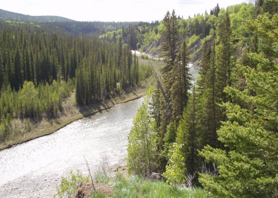
Photo credit: H.Unger
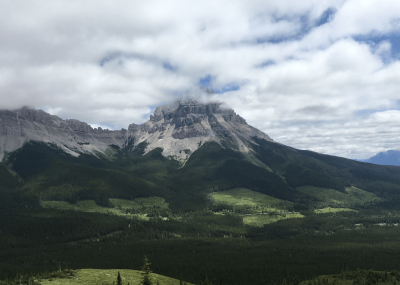
Photo credit: G.Wark
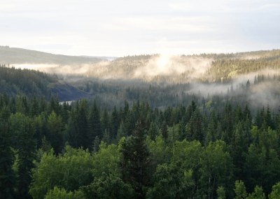
Photo credit: H.Unger
AWA believes that the Foothills Natural Region requires increased protection complemented by science-based management to prevent and restore the impact of damaging land uses on these public lands. This should be done in addition to supporting the recovery of at risk native species including endangered Woodland caribou and Athabasca rainbow trout.
 With the rolling forested hills and slopes providing vital habitat for many wildlife species, and the cool clear rivers harboring imperiled native trout, the Foothills are a critical piece of Alberta’s wilderness. Unfortunately, this landscape has been subjected to a significant amount of human development. As a result, the Foothills are scored by an extensive network of roads, trails, power lines, seismic lines, cutblocks and pipeline access routes, the majority of which see an extensive amount of use by motorized recreationists.
The wildlife species of the Foothills, including woodland caribou, grizzly bears, westslope cutthroat trout, bull trout, and endangered Athabasca rainbow trout, have suffered major population declines because decades of unmanaged cumulative effects and excessive linear disturbance on the landscape.
The Foothills Natural Region is 66,436 km2 in size, encompassing 10 percent of the province. It is located east of the Rocky Mountains Natural region and begins just above Highway 1 in the Ghost, stretching north to the Kakwa and east to Lesser Slave Lake.
The Foothills Natural Region is composed of two subregions: the Upper Foothills and Lower Foothills Natural Subregions.
The forested slopes of Alberta’s Rocky Mountain along with the Foothills Natural Region are known collectively as the Eastern Slopes, which play a very important role in storing, cleaning, and slowly releasing water in upper watersheds. Healthy watersheds are important for their abilities to buffer the effects of climate change, , moderate flow to reduce floods, supply water in times of drought, recharge groundwater resources, provide critical fisheries habitat, and supply essential ecosystem services such as clean air, water, and soil (Kennedy and Wilson 2009).
AWA’s Areas of Concern within the Foothills Natural Region include:
As of July 2018, only 944km2 (or 1.4%) of the Foothills Natural Region is protected. The remainder of this region contains unprotected public lands within the Green Area, which are largely unregulated for multiple uses.
Provincial Protected Areas within the Foothills are managed under eight distinct designations covered by three different legislative acts: the Provincial Parks Act; the Wilderness Areas, Ecological Reserves, Natural Areas and Heritage Rangelands Act; and the Willmore Wilderness Park Act.
The Provincial Protected Areas vary in the amount of human activity and disturbance which they facilitate on the landscape. Wilderness Areas and Ecological Reserves have the strictest limits to ensure the protection of the natural integrity of the wilderness, while other protection designations such as Wildland Provincial Park and Provincial Recreation Areas prioritize recreation opportunities, and in some cases, industrial development.
Most public lands within Alberta are managed for their natural resources, recreational opportunities and ecological services. The administration and management of public lands is overseen by two regulatory bodies: the Alberta Energy Regulator and Alberta Environment and Parks.
Albertans have long advocated for the protection of our watersheds and wildlife on public lands within the Foothills Natural Region. There are several Policies and Acts of Legislation that reflect this priority:
In 1977, the Government of Alberta created A Policy for Resource Management of the Eastern Slopes, later revised in 1984. It declared that “the highest priority in the overall management of the Eastern Slopes is placed on watershed management”, creating a series of zones to manage the impacts of recreation, tourism, industrial development and resource extraction on public lands. The most protective of these was the Prime Protection Zone, “to preserve environmentally sensitive terrain and valuable aesthetic resources”, as well as the Critical Wildlife Zone, which was intended “to protect wildlife populations by protecting habitat that is essential to those populations”. Within these zones, industrial development and Off-Highway Vehicle (OHV) use are prohibited. Multiple Use Zones were established “to provide for the management and development of the full range of available resources, while meeting long term objectives for watershed management and environmental protection”. Within this zone industrial development and OHV use are permitted.
In 2008, the Government of Alberta promised to develop seven Land-use Framework regional plans that outline the integrated management of Alberta’s land and resources. The Foothills Natural Region is found in the Upper Peace, Upper Athabasca, North Saskatchewan and South Saskatchewan Regions. The Land-Use Framework recognizes that biodiversity is important for the management for healthy and resilient forests and emphasizes the watershed value of forests: “Historically, watershed and recreation were deemed the priority uses of the Eastern Slopes. These priorities should be confirmed, and sooner rather than later.”
While the Land-use Framework outlines important conservation objectives and an ecosystem based ethic for the management of for Alberta’s Foothills Natural Region, this framework lacks any legislative support to ensure these principals for responsible management are adhered to. In order to realize the full potential of regional plans, corroboration with other regulatory mechanisms is required.
The Public Lands Act governs public lands, particularly as it pertains to watershed protection [S. 54 (1)] and the unauthorized usage of public lands [S. 47 (1)]. Section 54(1)(d) states that “no person shall cause, permit or suffer the doing of any act on public land that may injuriously affect watershed capacity”. Other important regulatory mechanisms include the Forests Act [S. 10] and the Alberta Grizzly Bear Recovery Plan (2008).
AWA believes that sustainable management and the conservation of the natural integrity of the Foothills Natural Region should include the following:
The Foothills Natural Region is 66,436 km2 in size, encompassing 10 percent of the provincial landbase. This natural region begins at the base of the Rocky Mountains Natural region and extends eastward until it abuts with the Boreal Forest and a small portion of the Parkland Natural Region. Major highways that transect this landscape include Highway 1, 1A, 11, and 16.
The Foothills Natural Region extends eastward into the watersheds of the Smoky, Athabasca, Pembina, North Saskatchewan and Red Deer Rivers. The forested slopes of Alberta’s Rocky Mountain and Foothills Natural Regions, known collectively as the Eastern Slopes, play a very important role in storing, cleansing, and slowly releasing water in upper watersheds. Almost 90% of the river flow of the North and South Saskatchewan Rivers comes from the Eastern Slopes, (Schindler 2001, North Saskatchewan Watershed Alliance 2012).
Healthy watersheds are integral to maintaining healthy fisheries within Alberta in addition to the ecological services they provide for humanity such as clean air, water and soil (Kennedy and Wilson 2009). The foothills also serve to moderate water flow reducing the risk of flooding, continually recharge groundwater sources, and supply water downstream for times of drought. As the global temperature rises, good aquatic health of our foothill watersheds will be important in buffering the effects of climate change.
The Foothills Natural Region largely consists of a series of subparallel, northwest trending ridges composed of folded and faulted sedimentary strata. The composition of the bedrock is variable from Cretaceous strata composed of sandstone, shale, and coal, to older Triassic and Paleozoic formations composed of limestone, dolomite, gypsum, and quartzite (Alberta Research Council 1972).
(Information sourced from Government of Alberta 2013)
The Northern and Central Foothills’ bedrock is a combination of multiple formations from the Saunders Group:
The Northern and Central Foothills’ bedrock also has sections of the Alberta and Smoky Group formations that contain shales, argillaceous siltstones, and sandstones from the Upper Cretaceous period.
The Foothills Natural Region has many areas of environmental significance on a provincial, national and international scale. To learn more about each environmentally significant area, visit AWA’s areas of concern within the Foothills Natural Region.
(Information sourced from the Alberta Parks, 2015)
The Foothills Natural Region is distinguished as the steep to gently undulating forested slopes that reside adjacent to the Rocky Mountain Natural Region and blend into the Boreal Forest and a small section of the Parkland Natural Region. As such, the Foothills Natural Region is a transitional ecosystem supporting a diverse array of wildlife species common to the Rockies and the Boreal Forest.
The Foothills Natural Region is composed of two subregions: the Upper Foothills and Lower Foothills Natural Subregions.
Upper Foothills:
Climatically, this natural subregion is defined by damp and short summers and cold winters. Thick stands of coniferous trees dominate this area on steep slopes and strongly rolling hills. There is not a large amount of standing water, with wetlands mostly occur within major valleys. Forestry and coal mining are prevalent on the landscape, with intensive oil and gas exploration and development having occurred over several decades.
Lower Foothills:
Similar to the Upper Foothills, the Lower Foothills Natural Subregion has an extensive network of linear disturbances from resource exploration and development, in addition to industrial scale clearcut logging. This Subregion has a tremendous amount of plant and animal biodiversity with approximately 20 percent of the landscape being covered in wetlands.
Vegetation
Vegetation information source: Alberta Parks 2015
Upper Foothills:
The topography of this Subregion ranges from steeply sloping to rolling hills which are covered with predominately coniferous forest stands. Lodgepole pine stands are common on southern slopes, while northern sloped tree stands generally have black and white spruce. Depending on moisture content of a forest stand, understory shrubs can vary widely from Labrador tea, bog cranberry, green alder, tall bilberry, Canada buffaloberry, juniper, bearberry or hairy wild rye.
Lower Foothills: Accompanied by a gentler terrain, this Subregion is characterized by diverse forest stands composed of aspen, lodgepole pine, white spruce and balsam poplar. Drier areas are dominated by black spruce and lodgepole pine stands where bearberry, bog cranberry, hairy wild rye, low-bush cranberry, green alder, prickly rose, wild sarsaparilla, dewberry and marsh reedgrass are common in the understory. Bearberry, blueberry or Canada buffaloberry, bracted honeysuckle, willows, and wild currants are most common in the understory of moister mixedwood stands containing aspen, white spruce and lodgepole pine. Old growth stands with heavy ground lichen growth are commonly populated by black spruce and tamarack and can be located in bogs or fens. Calypso orchids and uncommon ferns partially compose the unique and high plant diversity within this area.
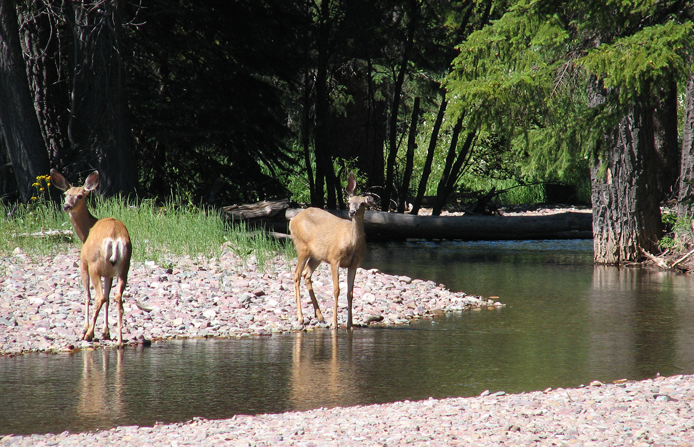
The Foothills Natural Region provides important habitat for many wildlife species. Landscapes are populated by many mammals and ungulates such as elk, moose, mule deer, white tailed deer, caribou, black bear, grizzly bears, wolves, lynx and beaver. The watersheds are equally diverse with many fish species including bull trout, Athabasca rainbow trout, Northern pike, mountain whitefish and Arctic grayling.
Caribou
The Foothills are critical habitat for populations of Woodland caribou. The Little Smoky and the A La Peche herds both have ranges throughout AWA’s Little Smoky Area of Concern, in addition to the Narraway and Redrock-Prairie Creek herds living in AWA’s Kakwa Area of Concern. While these herds differ based on migratory seasonal behaviour, woodland caribou have a specific requirement of old growth stands for habitat, and utilize different areas of the foothills depending on their life stage.
Little Smoky Herd: (also see our Caribou pages)
A La Peche Herd:
Redrock-Prairie Creek caribou herd:
Narraway caribou herd:
Wolves
Every winter since 2005/6, the Alberta government has culled most of the region’s wolves as a drastic measure to stabilize caribou populations, while industrial surface disturbances continue and is the root cause of declining Little Smoky-A La Peche caribou. Cutblocks, poorly reclaimed seismic lines and well pads stimulate deer, moose and wolf populations, and creates easy access to caribou by wolves. Industrial surface disturbances rob caribou of their ability to avoid overlap with the predators and other ungulates.
Grizzly Bears
The Marten Mountain wilderness has been identified and classified as a support zone for threatened grizzly bear populations within Alberta. The Government of Alberta has established this zone with the intent to “support the population of grizzly bears in the Recovery Zone by creating a priority area for the management of bear attractants and other sources of human-wildlife conflict adjacent to the Recovery Zone thereby improving the survival rate of grizzly bears, in particular females and females with cubs, that are moving between the Recovery Zone and the Support Zone” (Alberta Government 2016).
Alberta’s Foothills Natural Region extends across the traditional and current territories of Treaty 6, 7 and 8. The Stoney Nakoda First Nation (îyârhe Nakodabi) , comprising the Bearspaw, Chiniki and Wesley bands, and the
Public lands and provincially designated areas with the foothills offer some of the best outdoor recreation opportunities for Alberta; from hiking, camping, rafting, wildlife viewing, fishing and hunting, this diverse landscape offers many front and backcountry experiences. More information on the specific activities within various Provincial Parks can be found here.
The cumulative effects of increased human access, habitat fragmentation, and clearcutting are detrimental to forest health, species at risk, and water quality. Forest logging roads are often poorly built, with limited regard for hydrology, erosion and sedimentation, due to their limited use and temporary nature. “Left-over” logging roads and other routes may still be used by recreational users and energy tenure holders.
Off-highway vehicle (OHV) recreational use can increase the linear disturbance footprint created by access roads as branching trails are often created off of the main road. Poor maintenance and continued use of the access roads and subsequent trails can greatly increase the amount of sedimentation that drains into the watershed. This effect is compounded by changes in hydrology and the reduced number of trees that are responsible for water storage and related slow-release.
Native Alberta fish species, such as threatened bull trout and Athabasca rainbow trout, rely on cold clear water to thrive. Linear disturbances contribute to increases in sedimentation, which can suffocate eggs during spawning. More exposed earth also contributes to increases in water temperatures which may cause fish die-off or increased stress by inducing changes to how they feed, grow, breathe and reproduce. These adverse effects also affect humans as they can increase the cost of water purification and ultimately limit the security of Alberta’s water supply.
Due to these deleterious effects, AWA believes that industrial-scale clearcut logging should be eliminated from (a) Wild Spaces delineated on AWA’s Wild Alberta map, (b) Woodland caribou range (c) Prime Protection and Critical Wildlife Zones of the Eastern Slopes north of the Bow River watershed, and (e) areas identified as environmentally significant.
Sustainable forestry needs ecosystem based models that allow natural control mechanisms to function. This will include the restoration of natural insects and diseases as well as the restoration of wildfire on the landscape.
AWA supports the Eastern Slopes Policy and strongly recommends a moratorium be imposed on motorized recreation and trail development in the Prime Protection and Critical Wildlife Zones, as well as critical habitat for species at risk.
All land uses, including industrial development, forest management plans, road building, and motorized recreational activities must be changed to comply with provincial and federal recovery plans for species at risk. The Government of Alberta’s 2008 Grizzly Bear Recovery Plan notes that “human use of access (specifically, motorized vehicle routes) is one of the primary threats to grizzly bear persistence”. While linear disturbance thresholds have been set in theory, there is no indication that management plans are being updated to implement these thresholds in practice. Similarly, critical habitat and spawning areas for endangered fish species has been identified but largely ignored when siting access roads and limiting motorized recreation. Caribou are also affected by industrial development: competing species, such as deer and moose, are stimulated and predators can hunt along linear disturbances with increased efficiency. Woodland caribou populations require as much as 65 percent undisturbed habitat to have a better-than-even chance of being self-sustaining. Additionally, protection of caribou and other species at risk will benefit many other species in the ecological community.
AWA’s primary concerns regarding protected areas are to ensure that they remain in perpetuity and are managed in a way that they actually are protecting the ecosystem values that they were established to protect in the first place. Concerns range from insufficient funding, management, lack of enforcement, to over-development of facilities, detrimental levels and types of recreation, and commercialization. Areas that permit activities that are harmful and damaging to the landscape and wildlife do not offer the genuine protection that is needed within the Foothills Natural Region.
June 22, 2024
Text by Devon Earl Photos by Devon Earl and Carolyn Fisher The group headed out…
May 10, 2024
On April 10, 2024, AWA received a Notice of Hearing on the applications for a…
March 19, 2024
Dear valued AWA members, As you may have heard, plans are underway to rehabilitate Banff’s…
February 22, 2024
On February 22, 2024, AWA was cc’d on correspondence from Northback Holdings Corporation to the…
February 21, 2024
The controversial logging plan in the Upper Highwood of Kananaskis is on hold, for now….
January 8, 2024
By Kennedy Halvorson Click here for a pdf copy. In 1971, American singer-songwriter John Prine…
November 28, 2023
On November 9, 2023, AWA received a letter from the legal counsel of Northback Holdings…
November 28, 2023
On October 5th, the legal counsel for Summit Coal Inc. sent a letter addressing all…
September 21, 2023
Alberta Wilderness Association wrote Premier Smith and Minister Jean on September 21, 2023 to express…
August 16, 2023
Forest management in Alberta is not sustainable or inclusive. Click here to read AWA’s briefing…
June 19, 2023
Wild Lands Advocate article by: Devon Earl Click here for a pdf version of the article….
April 24, 2023
Wild Lands Advocate article by: Devon Earl, Kristen Andersen, Beth MacCallum, with support from Elisabeth…