A beautiful patchwork of forests, plains, sand dunes and wetlands, the Cache Creek-Wolverine wilderness borders the Peace River, and constitutes some of the highest vegetative biodiversity within Alberta.
- •
- •
- •
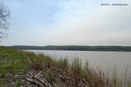
Prairie Point overlooking the Peace River ©N.Petterson

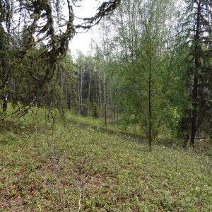
Machesis Lake Forest ©N. Petterson
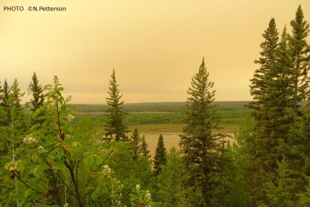
Inspiration Point near Peace River ©N. Petterson
AWA’s Cache Creek-Wolverine wilderness is a mosaic of diverse wildlife species that skirts the productive waterways of the Peace River. AWA believes the protection of this wilderness is vital to conserving Alberta’s northern wilderness.
- Introduction
- Features
- Concerns
- History
- Other Areas
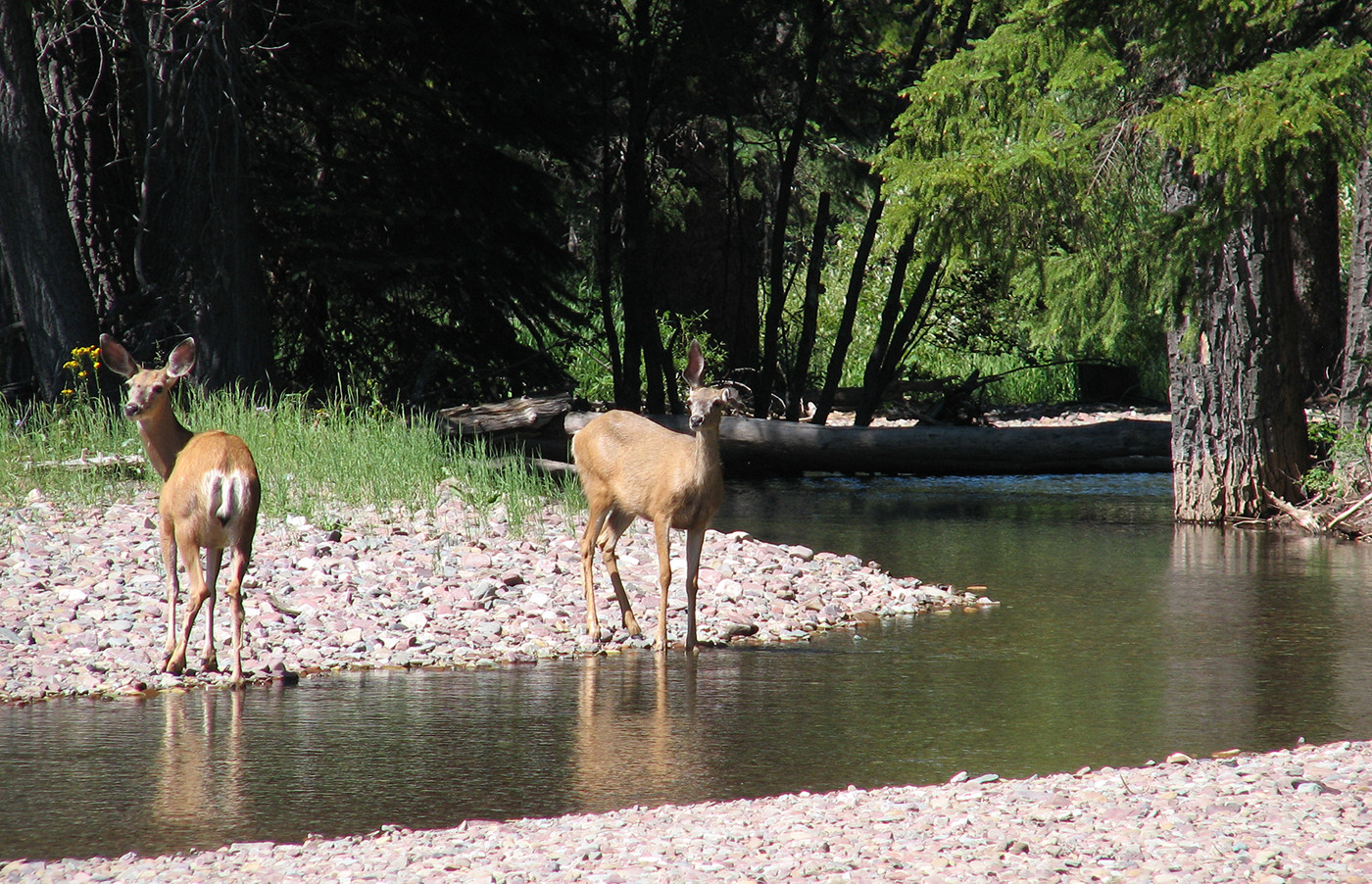
- Moose,
- Elk,
- Deer,
- Beaver
- Black bears,
- Grizzly bears,
- Wolverines,
- Arctic Grayling,
- Northern Pike,
- Rainbow trout,
- Snakes,
- Toads,
- Golden eagles, and
- Geese.
- Canoeing/Kayaking
- Fishing
- Front and Backcountry Camping
- Hiking
- Birding
 |
 |
Located east of Chinchaga, AWA’s Cache Creek-Wolverine Area of Concern is unique ensemble of vegetative communities in northwest Alberta that supports a diverse array of animal species in the midst of many agricultural communities. The Cache Creek-Wolverine wilderness is 11,291 km2 of public lands within the Boreal Forest Natural Region of Alberta that also includes the Notikewin Provincial Park. This wilderness is distinguished by its high biological diversity in plant communities, in addition to boasting a rich history and culture.
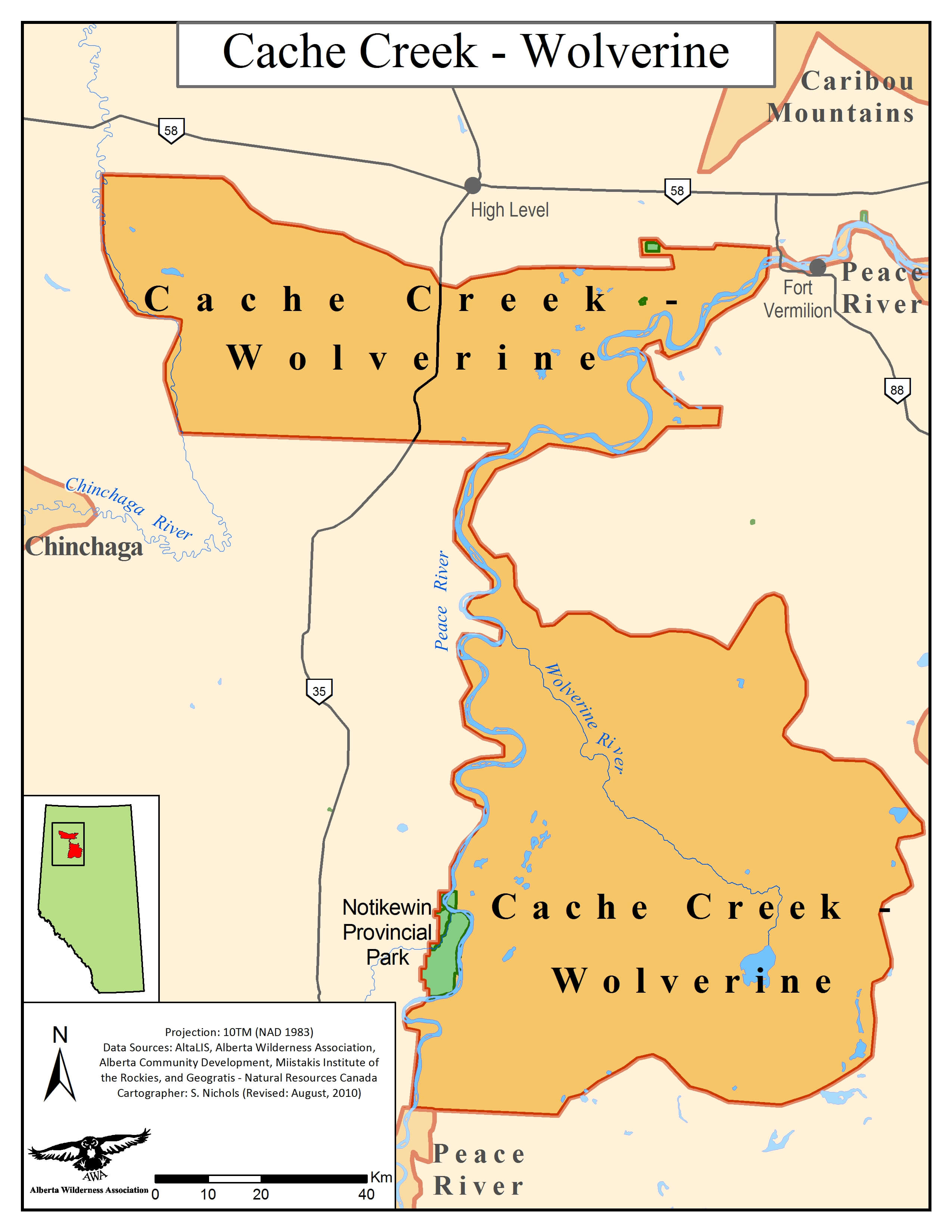
AWA’s Cache Creek-Wolverine Area of Concern is located south of the town of High Level and east of the town of Manning. These communities and others in the surrounding area have been supported by decades of agricultural and industrial developments within Cache Creek-Wolverine wilderness. The lowlands of this region that border the Peace River represents one of the fastest-expanding agricultural frontiers in Alberta, with only a small portion of native habitat that remains undisturbed. Minimal protection coupled with expanding industrial and agricultural developments compromises the sustainability of this invaluable northern wilderness.
Status
Currently, the majority of the Cache Creek-Wolverine is unprotected public lands with the exception of the Notikewin Provincial Park, which is located in the southwest region of AWA’s Cache Creek-Wolverine Area of Concern, and two smaller (less than 5 km2) blocks comprising a Provincial Recreational Area and Natural Area. These landscapes are currently being exploited for multiple land uses, with a particularly high concentration of agricultural developments situated within the Peace River valley.
Management
Cache Creek-Wolverine currently has no management framework to formally delegate and regulate land uses. The majority of this wilderness will be managed under the Lower Peace Land-use Framework once it is completed. Through the Land Use Framework, the Government of Alberta has committed to “addressing cumulative impacts on the environment and to managing social, economic and environmental realities and priorities in a holistic manner” (Alberta Parks 2018).
Public Lands
The majority of the Cache Creek-Wolverine wilderness is situated within the Green Zone, or forested portion of Alberta. This zone is managed for natural resources, in addition to recreation opportunities and ecological services. The western boundary closest to the Peace River along with a portion of the northwest region of Cache Creek-Wolverine wilderness falls within the White Zone of Alberta. The public land in the White zone is considered settled, containing the majority of Alberta’s population centers and agricultural areas. Similar to the Green Zone, the White Zone is also managed for natural resources, wildlife and recreation. However, a significant portion of these lands have been granted government dispositions for various land uses, with a particular emphasis being focused on agricultural developments within Cache Creek-Wolverine wilderness.
Management and administration of public lands within Alberta is overseen by two regulatory bodies, the Alberta Energy Regulator and Alberta Environment and Parks. Public land dispositions are regulated under two pieces of legislation within the province of Alberta: the Public Lands Act and Public Lands Administration Regulation. Other relevant provincial legislation includes, but is not limited to, Recreational Access Regulations and the Environmental Protection and Enhancement Act (Alberta 2014).
Protected Areas
The 97 km2 Notikewin Provincial Park is the sole large protected area within Cache Creek-Wolverine, and is managed under the Provincial Parks Act, with intentions to: “preserve natural heritage of provincial significance or higher, while supporting outdoor recreation, heritage tourism, and natural heritage appreciation activities that depend upon and are compatible with environmental protection” (Alberta Parks 2001).
Two smaller protected areas within the region include the Machesis Lake Provincial Recreation Area and Child Lake Meadows Natural Area. This Natural Area contains all major vegetation types of northern salt meadow, which are uncommon in the Boreal Forest Natural Region.
Vision
AWA believes that protection of the Cache Creek-Wolverine wilderness is important in terms of conserving an ecologically rich landscape within Alberta, and for its tremendous cultural and historical significance. Science-based management is required to set surface disturbance limits that will help prioritize the conservation of this pristine wilderness from further degradation and conversion both within its boundaries and on surrounding landscapes.
Area
AWA’s Cache Creek-Wolverine area of concern is 11,291km2 within the Boreal Forest Natural Region of Alberta, and is located south of the town of High Level, or directly east of the town of Manning. This wilderness can be accessed from Highway 35, and Highway 692 which eventually leads to the Notikewin Provincial Park located in the southwest region of Cache Creek-Wolverine.
Watershed
The majority of Cache Creek-Wolverine falls within the Peace/Slave River Basin, with the most northwestern portion bordering on the Hay River. The Peace River traverses the region, flowing northward and covering approximately 250 km. The Peace River is one of the most diverse and productive rivers within Alberta, contributing a significant amount of habitat for resident wildlife, in addition to being an important movement corridor. Notable watercourses within AWA’s Cache Creek-Wolverine Area of Concern include Cache Creek, Wolverine River, Notikewin River and Buffalo River. There are also numerous lakes and ponds with bordering sandhills in the Hungry Bend Sand Hills area.
Geology
Cache Creek-Wolverine is within the Interior Plains physiographic region in Alberta, which separates the Rocky Mountains from the Canadian Shield. Most of this area is underlain by thick bedrock consisting of sandstones, shales, and conglomerates from the Cretaceous to Early Tertiary period. Undulating plains varying in elevation coupled with a number of major valley systems are evidence of an intensive glaciation having occurred during the Pleistocene Epoch. The predominate soil types found in Cache Creek-Wolverine are gray luvisolic and organic soils. Gray luvisolic soils are generally found in areas with glacial till that are relatively well drained, while comparatively, organic soils are located in lower lying areas that are less drained, and are associated with peatlands.
Environmentally Significant Areas
Watersheds
The Cache Creek-Wolverine wilderness has many important watercourses that are environmentally significant areas. The Peace River is both provincially and nationally significant as it is one of the most productive and biologically rich rivers within Alberta. The Peace River also supplies water to the Peace-Athabasca Delta, which is one of the largest freshwater deltas in the world. The Peace River travels north through Cache Creek-Wolverine territory until confluence with Slave River. The Peace River also provides important habitat for wildlife species, and is a significant migration corridor for wildlife. Bison Lake, Buffalo River, Notikewin River Wolverine River and Cache Creek are also important waterbodies within Cache Creek-Wolverine due to their provincial significance. These waterbodies offer important staging habitats for a variety of waterfowl, diverse vegetation for wildlife, and spawning areas for fish species such as Arctic Grayling.
Sand Dunes
Cache Creek-Wolverine contains multiple areas with sand dunes that have unique formations and plant composition. The Hungry Bend Sand Hills, and the La Crete Sand Hills are provincially significant because of their unique morphology and vegetation cover. These dunes are mixed with wetlands, and are excellent examples of rare lacadena dune formations. Sloping fens and iron springs can also be found at the Wolverine Sand Dunes.
Notikewin Provincial Park
Sourced from Alberta Parks
This provincial park is situated at the confluence of the Peace and Notikewin River, and is situated within the Dry Mixedwood Natural Subregion of Alberta.
This park is approximately 97 km2, in size, and consists primarily of old growth forests that have a considerable amount of biodiversity. The older stands within the Dry Mixedwood Subregion are becoming increasingly rarer due to preferential logging, and are therefore garner its provincial significance and protection.

Natural Region
AWA’s Cache Creek- Wolverine Area of Concern is located within the Boreal Forest Natural Region of Alberta, with the core of this area being composed of the Dry Mixedwood Natural Subregion. A small eastern segment of this wilderness consists of the Central Mixedwood, while the western extent of Cache Creek-Wolverine is comprised of the Upper and Lower Boreal Highlands Natural Subregions.

Vegetation
Dry Mixedwood: Dry Mixedwood is the second largest of Alberta’s Subregions, representing a transition zone between the Central Parkland and the Central Mixedwood Subregions of Alberta. The undulating plains of this subregion are dominated by wetlands found in lower lying areas and forests. This area is characterized by a mix of deciduous and coniferous tree species. Aspen is very common in this region, with balsam poplar being found alongside aspen in more moist sites. White spruce and balsam fir become more dominant with succession. Drier and sandier uplands host Jack pine forest which can have considerable ground coverage from lichen species. Common shrubs found include rose, low-bush cranberry, Canada buffaloberry, and redosier dogwood. Southern facing slopes are generally drier and are populated by grass species such as porcupine grass, sedges and June grass.
Central Mixedwood: This subregion is mostly comprised of a mix of deciduous tree stands containing aspen and aspen/white spruce forests, and white spruce and jack pine in higher elevations. Canadian buffaloberry, low brush cranberry, and prickly rose are common in the understory. A mix of wild sarsaparilla, hairy wild rye, and tall lungwort are featured in herb communities as well as feathermosses.
Lower Boreal Highlands: Coniferous stands are common within this subregion. Forests are dominated by jack pine, lodgepole pine or hybrids of the two. Forested slopes contain aspen, balsam popular, black and white spruce. Common understory shrub species include prickly rose, green alder, and low-brush cranberry. Tall lungwort, fireweed, bunchberry, and marsh reedgrass are common to the herb layer.
Upper Boreal Highlands: Coniferous forests of lodgepole pine, and lodgepole-jackpine hybrids dominate most stands within this area which can be accompanied by treed or shrubby bogs and fens. The understory of this subregion generally contains bog cranberry, dewberry, fireweed and green alder. The main types of wetlands found in this subregion are treed or shrubby bogs and fens.
Sand Dunes
Cache Creek-Wolverine wilderness has sand dunes which are interspersed with bogs, fens, marshes, and small open lakes. These dunes generally accompanied by open pine tree communities with plants and roots stabilizing the surface. Sand dunes contribute a significant amount of biodiversity to the wilderness of Cache Creek-Wolverine, but are also sensitive landscapes that once disturbed, are incredibly difficult to regenerate.
Prickly rose (Rosa acicularis) PHOTO © AWA FILES
Sand ridge in Machesis Lake Provincial Recreation Area © PHOTO AWA FILES
Birch forest in Machesis Lake Provincial Receation Area © PHOTO AWA FILES
Wildlife
Cache Creek-Wolverine offers habitat for wildlife species that include:
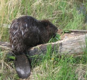
Beaver (Castor) PHOTO © AWA FILES
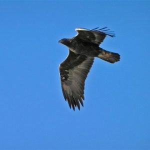
Golden eagle (Aquila chrysaetos) PHOTO © AWA FILES
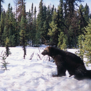
Wolverine ( Gulo gulo) PHOTO © AWA FILES
Cultural
Named after the large loop in the Peace River central to the area, the Hungry Bend Sand Hills is not only a biological diverse area, but also has a rich First Nations history. The Beaver First Nation, one of two Danezaa bands within Alberta, lived within the Hungry Bend Sand Hills area with many encampments, graves and homesites still remaining on the landscape today. This area also has many fur trade sites, in addition to trails from early explorers.
Activities
Cache Creek-Wolverine hosts a variety of recreational opportunities including:
Agriculture
The Cache Creek-Wolverine wilderness has been subjected to a significant amount of agricultural development, particularly near the Peace River corridor. This area has one of the fastest expanding agricultural frontiers, with nearly half of the native habitat having been converted into cultivated landscapes (Turner 1991). In comparison to oil and gas or industrial clearcut logging, the forests, riparian and wetland regions of Cache Creek-Wolverine are quickly disappearing due to the surging agricultural industry. This extensive development eliminates important habitat for wildlife, in addition to depriving the local landscape of important ecological services provided by those vegetative communities. AWA believes that more efforts must be made in order to evaluate how agricultural developments along with other land use activities affect on the ecological integrity of the Cache Creek- Wolverine wilderness. Literature has already shown that agricultural developments not alter landscape composition and functioning, but can also significantly impact the species richness in an area. Species from plankton, insect and amphibian communities have demonstrated declines within aquatic ecosystems bordering agricultural developments (Ecological Applications 2005). AWA believes that by means of protecting and implementing science-based management, the biodiversity and ecological integrity of the Cache Creek-Wolverine wilderness can be conserved for the next generation of Albertans.
2019
In May, AWA makes a field trip to the Cache Creek-Wolverine area to meet with members and colleagues. One of the stops on the trip is to the hamlet of Fort Vermilion which at the time hosts many evacuees from High Level and the Dene Tha’ First Nation due to nearby wildfires. AWA’s visit to Fort Vermilion focusses on connecting with the Hungry Bend Sandhills Society, a local grassroots organization that has long advocated for increased protection and improved land-use management for the sensitive local wilderness.
2017
AWA participates in a public consultation process by the Alberta Government regarding the North Central Native Trout Recovery Program. The province is proposing angling closures of watershed with high risk trout populations.
AWA believes the provincial government has historically not done enough to protect native trout. Serious intervention is needed to restore populations after years of neglect, and the proposed restoration actions need to be paired with strong land use management.