May 22, 2024
News Release: Alberta and Ontario lag on threatened boreal caribou recovery, federal report illustrates
TORONTO | TRADITIONAL TERRITORY OF THE MISSISSAUGAS OF THE CREDIT, ANISHNABEG, CHIPPEWA, HAUDENSOAUNEE AND WENDAT…


Sharing its northern border with Wood Buffalo National Park, Birch-Wabasca is a collection of rich ecological communities with many unique geomorphological features that make this a distinct landscape in northern Alberta.
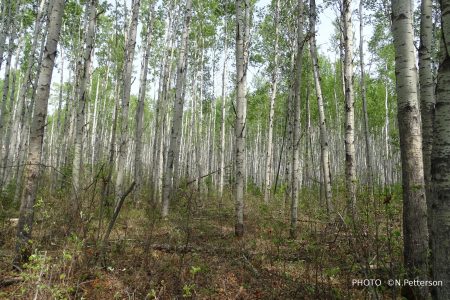
Aspen in Machesis Lake Forest ©N. Petterson

Machesis Lake Forest ©N. Petterson

Peeled Birch Bark – Moose Call ©N. Petterson
With increased science-based management, AWA believes that the Birch-Wabasca wilderness can be conserved for generations to come.
 |
 |
AWA’s Birch-Wabasca Area of Concern is an extensive boreal landscape, south of Wood Buffalo National Park, characterized by its unique ensemble of ecological communities that render this wilderness incredibly diverse in plant, animal and insect species. Northwest of Fort McMurray, Birch-Wabasca wilderness is one of the most diverse intact hill systems in northern Alberta with numerous wetlands and shallow lakes interspersing various continuous mixedwood tree stands.
 AWA’s Birch-Wabasca Area of Concern: JPG | PDF MAP: © AWA
AWA’s Birch-Wabasca Area of Concern contains Kitaskino Nuwenëné Wildland Provincial Park (1,619 km2), Birch Mountains Wildland Provincial Park (1,460 km2) and Birch River Wildland Provincial Park (3,328 km2). Outside of those designated areas, the lands are under a multiple land-use designation. Within the Moose Lake 10KM zone, the 2021 Moose Lake Access Management Agreement limits total buffered industrial disturbance features to support ecological integrity and exercise of Indigenous constitutional rights and traditional land uses.
AWA’s Birch-Wabasca Area of Concern falls within two regional land-use plans: the eastern segment is located within the Lower Athabasca Regional Plan (LARP), which was completed August 22, 2012, and the western segment falls within the Lower Peace Region, which has not been completed.
Public Lands
The majority of AWA’s Birch-Wabasca Area of Concern is situated within the Green Area of Alberta, otherwise known as the forested portion. Public lands within the Green Area of Alberta are managed for recreation, natural resources, and ecological goods and services. This area has minimal public settlements and permits exploration and development of natural resources, including oil and gas extraction and industrial clearcut logging. Agricultural activities are largely excluded from the Green Area, with the exception of grazing leases generally located around the periphery of the zone. Management and administration of public lands within Alberta is largely overseen by provincial regulatory bodies such as the Alberta Energy Regulator and the departments of Alberta Environment and Parks, Alberta Energy, and Alberta Agriculture and Forestry. Public land dispositions are regulated under multiple pieces of legislation that include, but are not limited to, the Public Lands Act, Public Lands Administration Regulation, Recreational Access Regulations, and the Environmental Protection and Enhancement Act (Alberta 2014).
Protected Areas
Within AWA’s Birch-Wabasca Area of Concern there are three wildland provincial parks, two of which border Wood Buffalo National Park, Canada’s largest National Park. These four parks together form the largest contiguous boreal forest protected area in the world. Under the Provincial Parks Act, Wildland Provincial Parks are managed with the intent to “to preserve and protect natural heritage and provide opportunities for compatible backcountry recreation” (Government of Alberta 2017). These Wildland Provincial Parks have limited access and are valuable areas for the exercise of Indigenous rights and traditional land uses including hunting, trapping and fishing.
Birch Mountains Wildland Provincial Park (WPP) was designated in Dec. 2000 as part of the Special Places Program. In May 2018 it was expanded east by about 16 km2 to protect additional forest and lakeshore areas and now covers approximately 1,460 km2. Birch River Wildland Provincial Park was designated in May 2018. Under the 2012 Lower Athabasca regional plan, it was proposed as a public land use zone, but in 2018 it was designated as a Wildland Provincial Park. The WPP designation resulted from collaboration between Nature Conservancy Canada, the Tallcree First Nation, the governments of Alberta and Canada, and Syncrude Canada, whose financing of a timber quota purchase provided it with oil sands mine offset credits. The Wildland Park encompasses 3,328 km2, extending from the southern border of Wood Buffalo National Park to Birch Mountains WPP.
Kitaskino Nuwenëné Wildland Provincial Park was created March 2019. It was made possible by a collaborative process between Indigenous communities, the Alberta government, and several oil sand companies who voluntarily relinquished leases covering a portion of the WPP. Alberta Parks has committed to cooperatively manage the WPP with Indigenous communities.
In order to conserve the ecological integrity of Birch-Wabasca, AWA believes that the Wildland Provincial Park designation should be expanded to encompass the entire Area of Concern. AWA believes that an expanded Wildland designation would: protect the observed biodiversity and ecological functioning of this sensitive northern landscape; help buffer the globally significant wildlife populations of Wood Buffalo National Park from encroaching developments and land use activities; and be an invaluable boreal reference area, as it is a large intact region that is highly reflective of Alberta’s northern native flora and fauna.
Directly south of Wood Buffalo National Park, AWA’s Birch-Wabasca Area of Concern is a northern boreal landscape that is 13,523 km2in size. The area is a patchwork of high and lowlands dissected by numerous wetlands and lakes, dense forest stands, permafrost and thermokarst scarring, in addition to striking geological features such as glacial flutings. Given the remoteness of the area, access into this wilderness is generally restricted to airplanes or snowmobiles. The nearest roads are Highway 63 to Fort Mackay to the east, or Highway 88 to the west travelling northward toward Fort Vermillion.
AWA’s Birch-Wabasca Area of Concern: JPG | PDF MAP: © AWA
The highlands and lowlands of Birch-Wabasca are distinguished from surrounding landscapes by various forms of wetlands, creeks, streams, rivers and shallow lakes that spread across this wilderness. The largest and most notable rivers and creeks include:
Wetlands
Fens and bogs are the most common wetland type in Birch-Wabasca, with swamps occurring along the edges of bogs and along some streams. Marshes are relatively rare in this wilderness, although some do occur at inland deltas, and along lakeshores.
Fens in Alberta’s Boreal Forest Natural Region are described as peatlands that have deep organic deposits (peat) that can range to a depth of 40 cm or less. Fens are greatly influenced by the slow lateral moving water that is generally more nutrient rich because of its contact with groundwater or nutrient surfaces. This increased concentration of nutrients allows fens to be more productive and support a higher number of wildlife species. Fens can have a variety of vegetation covers: they can be treed, shrubby or completely open. Fens in Alberta’s boreal forest provide many ecological services such as preventing downstream flooding and regulating water flow, but they also serve as the main channel of transport for water and nutrients to many different landscapes (Ducks Unlimited Canada 2017).
Similar to fens, bogs are peatlands that have deep organic deposits. Bogs are often situated in poorly drained sites somewhat higher than the surrounding terrain; unlike fens they receive water and nutrients mainly from precipitation. These topographical features make bogs far less productive than fens. Bogs can be treed, shrubby or open with the vegetation cover being reflective of the level of water and nutrients readily available. Common plant species found in bogs are stunted black spruce, bog cranberry, sphagnum moss and Labrador tea. The deep organic deposits of bogs store an incredible amount of carbon which helps mitigate climate change issues, and they serve also to store water and release it depending on the climatic conditions (Ducks Unlimited Canada 2017).
Common wetlands found in Birch-Wabasca include:
AWA’s Birch-Wabasca Area of Concern displays many striking geological formations such as eskers, drumlins, fluted moraines, slump and seepage areas, permafrost features and broken terrain with soil creep (AWA files 1985). The Birch Mountains are indicative of erosional remnants from the upper cretaceous period with glacial till deposits covering the top layers. Many surface materials are mostly fine grained till, however, areas of coarse till are possible. Some regions of Birch-Wabasca contain thick organic layers between layers of till; overlaid layers generally include coarse macrofossil fragments such as wood, bark and moss and finer fractions, charcoal and seeds. Middle Wisconsin sites in northern Alberta are rare, this organic layer between till units suggests two glacial events in north-central Alberta-regionally significant middle Wisconsin nonglacial interval (Paulen et al 2005).
Wetlands:
The extensive cover and assortment of wetlands across the landscape of Birch-Wabasca is part of what makes this region provincially significant. These wetlands provide a multitude of ecological services such as water retention, release, cleansing and carbon and nutrient storage and distribution. These wetlands also provide the necessary habitat for many boreal forest species in addition to threatened boreal woodland caribou herds.
Birch River Wildland Provincial Park:
Established in May 2018, the Birch River WPP is approximately 3,328 km2 in size and extends south from Wood Buffalo National Park connecting with the western segment Birch Mountains WPP. The Wildland designation shifted the landscape away from a multiple-use framework with forestry and energy exploration and development and concentrated on the biodiversity and ecological value of the area. Birch River WPP is a provincially significant area due to the connectivity of habitat and the movement of wildlife between Wood Buffalo National Park and Birch Mountain WPP. This vast landscape represents the largest contiguous conserved boreal forest area in the world, and has been recognized as being essential to the conservation of at risk species with over 68 species such as boreal woodland caribou and wood bison depending on this landscape for habitat. Birch River WPP is also important to many First Nations communities in the surrounding area; this landscape allows communities to continue to exercise their Treaty rights, and maintain the natural values of the landscape and wildlife that are important to their heritage and culture.
Birch Mountains Wildland Provincial Park:
The Birch Mountains WPP is characterized as relatively flat highlands that can average a height of 800m in comparison to the surrounding lowlands of the Athabasca River valley. The elevation of this landscape influences the hydrology and vegetation cover, fostering many treed, shrubby and open bogs that are essential habitat for many wildlife species in addition to many old growth forests (Johnson and Allen 2007). This Wildland park is also connected to the Birch River Wildland Provincial Park, contributing to the necessary connectivity of habitat and wildlife populations within the region, rendering it provincially significant.
Kitaskino Nuwenëné Wildland Provincial Park:
Kitaskino Nuwenëné Wildland Provincial Park was established in March 2019 with the intent to protect more of Alberta’s boreal wilderness and to support the traditional rights and practices of local First Nations. Totalling 1618 km2, Kitaskino Nuwenëné is located along the southern border of Wood Buffalo National Park serving as buffer for the national park, in addition to connecting both the Birch River and Richardson Wildland Provincial Parks. This protection and connectivity of the local landscape facilitates the movement and survival of wildlife populations such as wood bison and woodland caribou.

AWA’s Birch-Wabasca Area of Concern environmentally significant areas: JPG | PDF MAP: © AWA
AWA’s Birch-Wabasca Area of Concern resides within the Boreal Forest Natural Region of Alberta, but is divided into four distinct natural subregions which are:
Central Mixedwood:
This subregion encompasses the western, eastern and southern extremities of AWA’s Birch-Wabasca Area of Concern. It has a continental climate, which is defined by cold winters and warm summers. The undulating plains, extensive wetlands, and hummocky uplands of this subregion are dominated by stands of pure aspen, white spruce-aspen or pure white spruce stands which are generally located in areas of till and lacustrine. Jack pine stands occur in areas with more coarse material, with black spruce being found in bogs and fens. Gray Luvisolic soils are dominant in this landscape in addition to Gleysolic soils. Canadian buffaloberry, low brush cranberry, and prickly rose are common to the understory. A mix of wild sarsaparilla, hairy wild rye, and tall lungwort are featured in herb communities in addition to feathermosses.
Upper Boreal Highlands:
The Upper Boreal Highlands Natural Subregion is higher in elevation, with a change in vegetation indicating the transition from Lower Boreal Highlands Natural Subregion. This natural subregion occurs on the slopes and plateaus of the Birch Mountains with coniferous forests of lodgepole pine, black spruce or lodgepole-jack pine hybrid stands covering the majority of this landscape. Bogs are more commonly found with some areas containing fens. The understory species common to these areas are cloudberry, Labrador tea, sphagnum moss, and bog berry.
Lower Boreal Highlands:
The Lower Boreal Highlands Natural Subregion occupies a significant portion of the landbase in AWA’s Birch-Wabasca Area of Concern. This subregion is defined by slopes with diverse mixedwood forests with common species such as white birch, aspen, and white spruce. Jack pine or jack pine-lodgepole stands are common in more dry areas. Many areas contain fens or bogs with species such as sphagnum moss, dwarf bog-rosemary,water sedges, bog cranberry and willow being common to the understory.
Athabasca Plains:
This subregion is relatively small, occupying only the small eastern fringe of AWA’s Birch-Wabasca Area of Concern. This subregion includes level to undulating sandy fluvial and eolian plains with some prominent dune fields in the northern and eastern areas of this region. Water levels vary across this subregion with some drier areas being covered in jack pine tree stands with understories of lichen, bearberry, common blueberry, bog cranberry, willows, river alder, horsetails and Canada buffaloberry. Occasionally white spruce can also be found in these sites, however, mature specimens are rare because of frequent fire return intervals and heavily drained soils. Sand dunes have special vegetative communities which stabilize the surfaces of the dunes, but areas of bare sand do exist.Moist rich sites are relatively uncommon for this region, but they can be found along the rivers and around small lakes. Aspen, balsam poplar, white spruce, black spruce and white birch occur in these areas. Wetland areas in this Subregion can be treed, shrubby or graminoid (open) fens. Vegetative cover common in wetland areas of this Subregion include black spruce, tamarack, common Labrador tea, peat mosses and feathermosses.

Birch-Wabasca Natural Subregions: JPG |PDF MAP: © AWA
The topograghy and climate of Birch-Wabasca have created a unique ensemble of ecological communities in relatively close proximity, supporting a high level of biodiversity. Birch-Wabasca has many unique plant species such as the northern quillwort (Isoetes echinospora), believed to be located in a sheltered bay of Pelican Island in Namur Lake. It is also believed that the landscapes of Birch-Wabasca support multiple species of Botrychium (moonwort) which include:


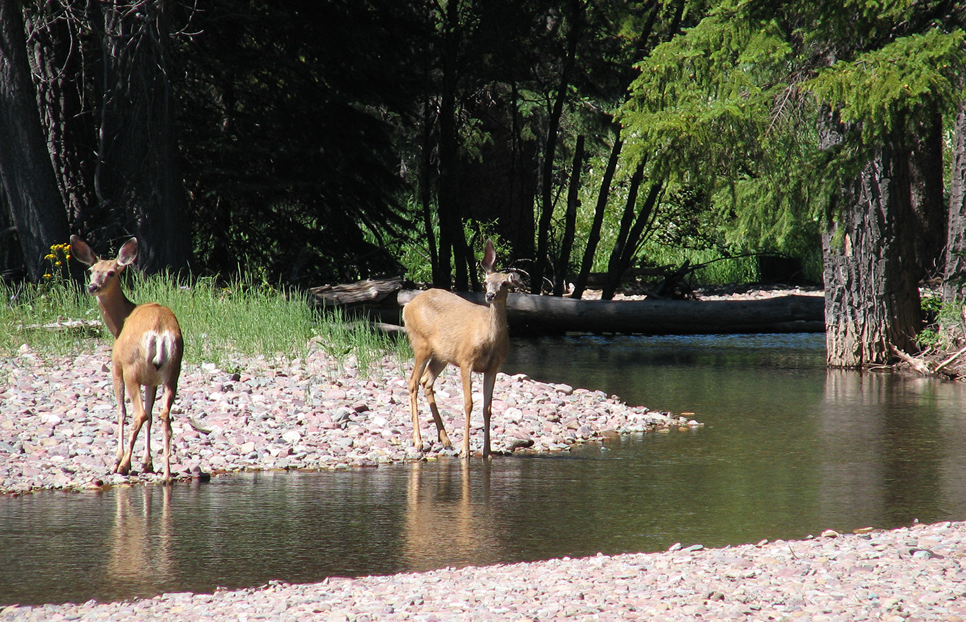
Birch-Wabasca is home to many wildlife species such as wolves, coyotes, moose, and white tailed deer, in addition to at-risk species such as wood bison and boreal woodland caribou.
Birds
This landscape and its extensive wetland cover provides habitat for many migratory and resident bird species such as the white pelican, bald eagle, common loon, common terns, cormorants, black-bellied plovers, ruddy turnstones, peregrine falcons, warblers, and Franklin and Bonaparte gulls.
Fish
AWA’s Birch-Wabasca Area of Concern is renowned for excellent and diverse fisheries. Some of the species common to the watercourses and bodies of Birch-Wabasca include Arctic Grayling, Goldeye, Lake Whitefish, Mountain Whitefish, Northern Pike and Walleye.
Insects
The insect, or invertebrate, species in Birch-Wabasca are as diverse as the animals and plants in this region. Surveys of this region have found a diverse array of species within orders such as the Odonata and Araneae.
Some uncommon species spiders found in Birch-Wabasca include:
Common families of damselfilies found in Birch-Wabasca include:
Wood Bison
In 1922, Wood Buffalo National Park was established to protect what remained of wood bison populations within northern Alberta, with Plains bison being introduced to the park a few years later with the intent to bolster population size. The introduction of Plains bison into the Park resulted in a hybridization between Plains and Wood bison, and the spread of brucellosis and bovine tuberculosis, which is believed to have originated from contact between Plains bison and livestock.
Contrary to local First Nation’s knowledge, wildlife managers believed for many years that the Ronald Lake wood bison herd was a derivative of the hybridized herds from Wood Buffalo National Park, rather than being an established free-roaming population prior to the introduction of Plains bison into the park.
In 2018, research and genetic analysis confirmed that the Ronald Lake herd was indeed a distinct free-roaming population established prior to the park, in addition to being disease free. This confirmed status enabled the herd’s protection under Alberta’s Wildlife Act as a “Subject Animal”, protecting the herd from non-indigenous hunting, but still allowing for First Nations harvesting rights.
Given its disease-free status and its cultural and historical significance to local Indigenous communities, the Ronald Lake herd requires significant conservation efforts. With population estimates ranging anywhere from 80 to 225 individuals, the Ronald Lake herd has yet to receive a management plan, despite looming concerns around potential land-use impacts from mineral exploration and development.
AWA continues to engage with government officials and indigenous stewards to advocate for a science-based management plan that will incorporate Traditional Knowledge, and ensure thriving populations of wood bison to support Indigenous treaty rights and food security.
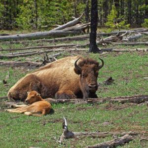
Wood Bison ( Bison bison athabascae) PHOTO © AWA FILES
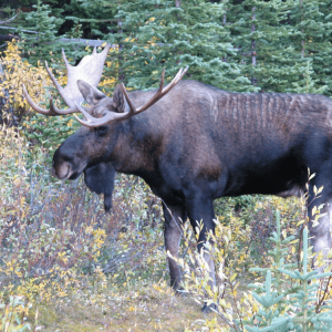
Moose (Alces alces) PHOTO © AWA FILES
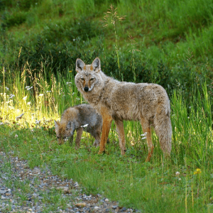
Coyote (Canis latrans) PHOTO © AWA FILES
Birch-Wabasca is the traditional territory of many First Nations and Métis communities. The Anishinabe Tallcree First Nation has seven reserves covering a total of 9,387 Ha. Mikisew Cree First Nation traditional lands range over most of the Athabasca Oil Sands deposits, with the center of their traditional lands being the Athabasca Delta. Fort McKay First Nation’s Gardiner and Namur Lake reserves, known locally as the Moose Lake reserves, are adjacent to the east boundary of Birch Mountains Wildland. There are numerous burial and settlement sites for both First Nations that have been identified around Eaglesnest Lake, Sandy Lake, Big Island Lake, and Gardner Lake.
The landscape of Birch-Wabasca can support many low-impact recreational activities that are compatible with conservation objectives such as backpacking, canoeing, equestrian riding, skiing, camping, hiking, and fishing.
Cumulative effects and Restoration
Over the decades, AWA’s Birch-Wabasca Area of Concern has undergone a significant amount of industrial development from oil and gas, forestry and even diamond mines. All of this exploration and development has rendered a significant portion of the Birch-Wabasca landscape fragmented and discontinuous. These alternations on the landscape have considerable consequences on the survivability of local wildlife, in particular at risk species such as wood bison and boreal woodland caribou.
AWA believes that this landscape deserves increased protection and a science-based management strategy to limit surface disturbances in this sensitive boreal forest landscape. Larger protected areas are required in order to properly conserve the ecological integrity and functioning of native habitat and maintain wildlife connectivity. For example, AWA supports the expansion of the Kitaskino Nuwenëné WPP. As well, the Birch Mountains WPP and Birch River WPP should have considerable buffer zone management areas to minimize the impacts of industrial encroachment. The 2021 Moose Lake Access Management Plan is a good step in this direction.
AWA also believes that greater efforts need to be focused on rehabilitating industrial disturbance sites such as seismic lines and cutlines, as these features have a considerable impact on wildlife ranges such as those of boreal woodland caribou. Currently, parts of AWA’s Birch-Wabasca Area of Concern are occupied by the Red Earth boreal woodland caribou herd. Given that 68 percent of the Red Earth caribou range was disturbed by seismic lines as of 2017, AWA believes that restoration of legacy footrprints are required to continue to enable at risk species like boreal woodland caribou to continue to be a part of Birch-Wabasca wilderness.
In late January 2022, the Government of Alberta officially approved the large expansion of Kitaskino Nuwenëné Wildland Provincial Park (KN WPP). This achievement was a collaborative effort on behalf of Mikisew Cree First Nation (MCFN), the governments of Canada and Alberta, and three oil sands companies. KN WPP is situated south of Wood Buffalo National Park and the expansion area encompasses 1520 square kilometers – doubling its original area. AWA is supportive of the intent to prioritize conservation and the exercise of Indigenous treaty rights and traditional land uses. We encourage the Government of Alberta to proceed with establishing a cooperative management process for KN WPP with local Indigenous communities that includes co-governance, along with funding and planning support.
In August 2021 the federal government, Athabasca Chipewyan First Nation (ACFN) and Mikisew Cree First Nation (MCFN) released for public comment a Conservation Agreement they had negotiated for boreal woodland caribou. Such agreements are enabled under section 11 of Canada’s Species at Risk Act (SARA). AWA strongly supports this Agreement, which we believe has the potential to greatly benefit four important northeast Alberta caribou populations and ranges: The East Side Athabasca River (ESAR), West Side Athabasca River (WSAR), Red Earth and Richardson. The Agreement affirms and advances the essential role of the ACFN and MCFN in the recovery and protection of boreal caribou and their habitats.
In February, the Government of Alberta announces a proposed significant expansion of the Kitaskino Nuwenëné Wildland Provincial Park, adding 143,800 ha of land and nearly doubling the park’s size. Stated goals for the park expansion are to:
Days earlier, the Alberta government announces final approval of the Moose Lake Access Management Plan. This precedent-setting lang-use plan, developed with the Fort McKay First Nation, applies to a 10 kilometre wide Zone around the Gardiner and Namur Lake reserves of Fort McKay First Nation (the Moose Lake reserves), covering 100,000 hectares. Half of the Zone is on ‘mixed use’ public lands outside designated protected areas. The Plan recognizes that ‘edge effects’ to wildlife habitat extend 50-200 metres beyond industrial disturbance points and increases maximum limits of ‘buffered’ industrial disturbance in the Zone to 15%; it further allocates the allowed disturbance limit amongst the forestry, oil and gas and sand/gravel sectors. It commits to significant community-based monitoring, enhanced reclamation practices, and restoration of legacy seismic lines.
AWA applauds both announcements as important advances to inform management of critical habitat of species at risk – such as woodland caribou, native fish and grasslands species – and further the exercise of Indigenous rights and traditional land uses everywhere in Alberta.
In February, Teck Resources Ltd. withdraws their proposed Frontier open pit oil sands mine, a decision welcomed by AWA.
In July, a joint federal-provincial review panel recommends that Teck Resources Ltd.’s Frontier open pit oil sands mine proceed; final approval decisions still remain from the federal government and Teck itself. AWA is greatly concerned about the threats posed by this mine, to be situated in the Birch-Wabasca region. This proposed mine threatens the destruction of important boreal forests and wetlands, degradation of Lower Athabasca River corridor habitat, threats to wood bison, caribou and other wildlife, and increased risks to the downstream Peace Athabasca Delta ecosystem in Wood Buffalo National Park.
On March 11, the Government of Alberta establishes the Kitaskino Nuwenëné Wildland Provincial Park. This park covers an area of 161,880 ha and is to be managed with the intent of supporting Treaty rights and Indigenous land uses, while achieving biodiversity and conservation goals.
In May, the Government of Alberta announces the establishment of the 3,300 km2 Birch River Wildland Provincial Park, as well as a modest (16 km2) expansion of Birch Mountains Wildland Provincial Park.
In May 15, NCC purchases A9 timber quota from the Tall Cree First Nations.
Mikisew Cree First Nation wins a legal case affirming their rights and title interests to areas of Wood Buffalo National Park.
Alberta-Pacific Forest Industries Ltd. proposes the Leige Valley region as a protected area of 1400 km2 under the province’s Special Places program
Mikisew Cree First Nation signs a Treaty Land Entitlement with Canada that creates several Reserves in and around Fort Chipewyan and north of Lake Athabasca.
May 22, 2024
TORONTO | TRADITIONAL TERRITORY OF THE MISSISSAUGAS OF THE CREDIT, ANISHNABEG, CHIPPEWA, HAUDENSOAUNEE AND WENDAT…
February 26, 2024
FOR IMMEDIATE RELEASE Edmonton, AB/Calgary, AB – Canadian Parks and Wilderness Society, Northern Alberta Chapter (CPAWS…
July 10, 2023
On June 30, 2023, the Joint World Heritage Centre and the International Union for the…
October 14, 2022
October 14, 2022 Dear valued AWA members, I am reaching out to advise you about…
August 25, 2022
Alberta Wilderness Association (AWA) provided this presentation (link below) on August 25, 2022, to the…
August 17, 2022
Alberta Wilderness Association (AWA) has co-signed a joint letter submitted by CPAWS Northern Alberta on…
June 21, 2022
Wild Lands Advocate article by: Carolyn Campbell, Conservation Director Click here for a pdf version…
April 7, 2022
Wild Lands Advocate Wilderness Watch update by: Carolyn Campbell, AWA Conservation Director Click here for a…
November 1, 2021
Wild Lands Advocate article by: Carolyn Campbell, AWA Conservation Director Click here for a pdf…
July 5, 2021
Please click the link below to view AWA’s comment letter addressing the draft Athabasca River…
February 12, 2021
This week the Alberta government announced important advancements for northeast Alberta wildlife conservation and the…
October 29, 2020
The Alberta Wilderness Association, Athabasca Chipewyan First Nation (ACFN), Mikisew Cree First Nation (MCFN), David…