Scarred Landscape: Years of OHV Use Changed the Bighorn Backcountry
January 15, 2024
- •
- •
- •
By Devon Earl
No amount of trail maintenance will make Bighorn Backcountry’s off-highway vehicle (OHV) trail sustainable.
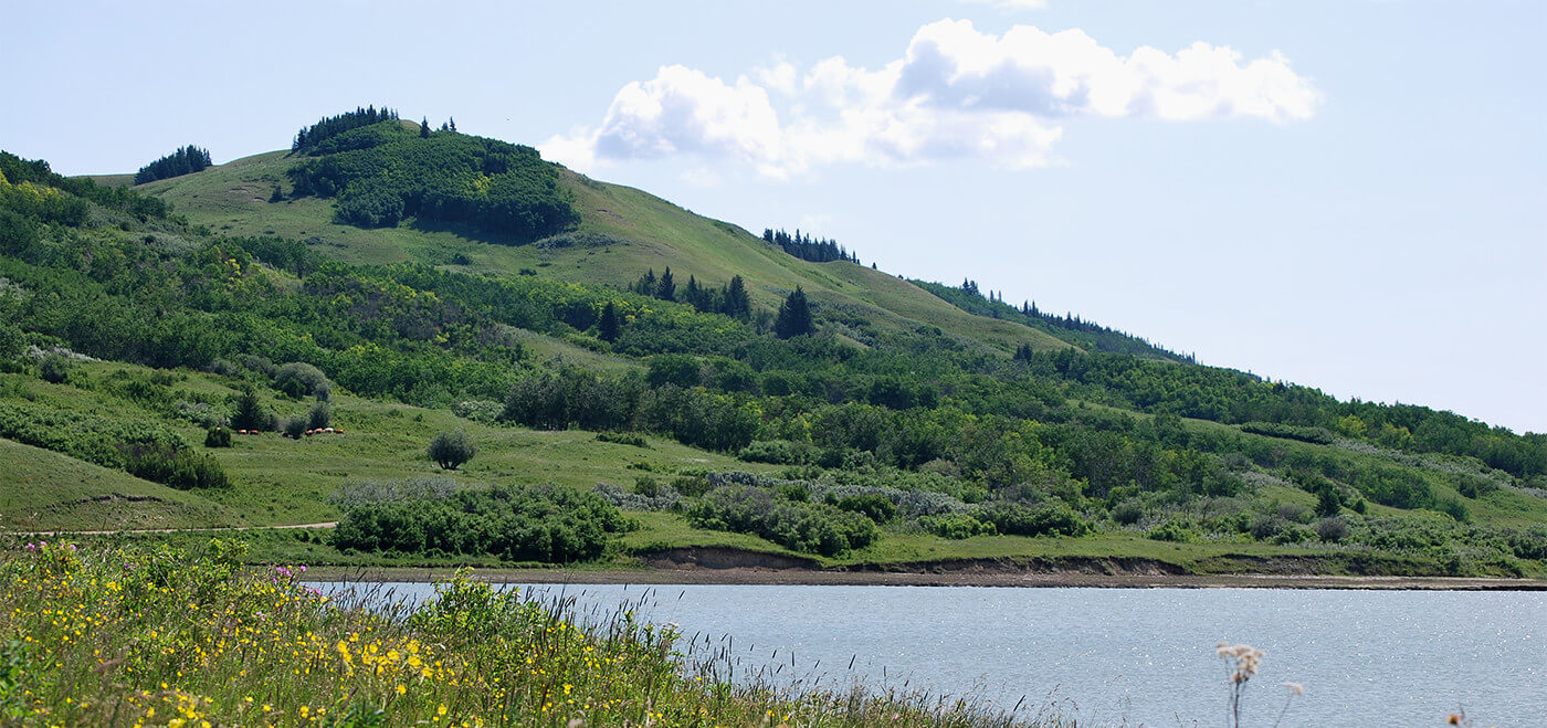
The Bighorn Backcountry is an important wilderness area in the Rocky Mountains and foothills, bridging the gap between Banff and Jasper National Parks. AWA has sought protected area designation for this area for nearly 50 years. From 2004 to 2017, AWA staff and volunteers conducted annual trail monitoring on the Hummingbird trail network to quantify trail damage and record OHV traffic.
The results of this long-term monitoring study are detailed in AWA’s Bighorn Backcountry report, which was released in July 2023. The study shows how — despite attempts at trail maintenance over the years — much of the Hummingbird trail network is unsustainable because it is sited on wet soils and steep slopes that are particularly prone to severe erosion with OHV use.
Read More: AWA’s Bighorn Backcountry report
From the Ground
This summer, I took a trip to the Bighorn with AWA’s executive director Debborah Donnelly and long-time volunteer Heinz Unger to check up on the condition of the Hummingbird Creek trail. We set out early on a Friday morning to maximize our time on the trail. As we began our hike, I was immediately stunned by the natural beauty of the Bighorn wilderness. The trail looks over a wide-open valley surrounded by forests with a mountainous backdrop.
Meandering through the rocky valley bottom, Hummingbird Creek reveals floodplains adorned with shrubs and small trees that offer unobstructed views extending far into the distance before transitioning into mature conifer forests. We brought our water shoes, as the trail passes several times through the creek.
It doesn’t take long before it becomes obvious that the trail bears the brunt of heavy OHV traffic. Early in
our journey, the trail branches off from its historic course and instead takes a path higher up the valley. Despite the dry weather, we encountered frequent stretches of flooded trail with stagnant water and mud. It’s clear why the old trail was abandoned — constant flooding and OHV use leads to erosion, which not only negatively affects water quality, but eventually renders the trail impassable. It will be a long time before the scar from the previous trail, still blatantly visible, is reclaimed by the landscape.
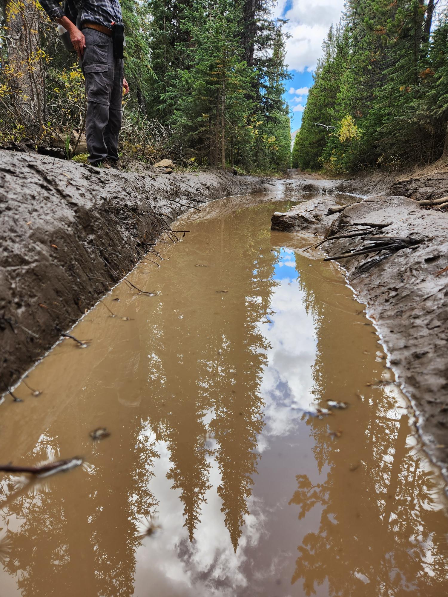
Travelling the “new” trail, we see it heading for a similar fate. As water gets caught in the trail, the wet mud gets ripped apart by the tires of OHVs, further excavating the trail deeper into the ground and making it more difficult for the muddy water to drain into the creek. To mitigate this, someone has dug channels along the trail’s edge to allow a path for the water to drain into the valley. Unfortunately, these channels quickly get clogged with mud, and the trail continues to embed itself into the soil. Several sections of the trail are impossible to travel on foot, requiring us to take occasionally lengthy detours into the forest to avoid slipping and falling into the muddy water. Eventually, the trail may become impassable by OHVs, perhaps prompting the construction of a third trail: another scar on the landscape. More sediment into the creek.
Sediment — dirt, sand, rocks, and other debris caught in water — has big impacts on water quality, which in the Bighorn Backcountry is particularly important. The area forms part of the headwaters for the North Saskatchewan River and drinking water for Rocky Mountain House, Drayton Valley, Thorsby, Devon, Edmonton, and Lloydminster before flowing into Saskatchewan. According to the Alberta government’s fact sheet about surface water quality management for the North Saskatchewan River, high sedimentation is one of the major water quality concerns that must be addressed.
In addition to providing clean drinking water, healthy headwaters sustain aquatic life and mitigate how much water flows in the river. Too much sediment in streams can harm and kill fish, in part by clogging their gills. Headwater landscapes play a major role in controlling the flow of water, mitigating drought and preventing floods by storing then releasing water. This is one reason why it is crucial to maintain intact ecosystems in the Eastern Slopes of the Rocky Mountains, and why the Hummingbird trail network isn’t sustainable.
Missing Plans
OHVs can have a significant impact on the environment, and that’s why OHV trails should only be in areas with low susceptibility to erosion, and kept below thresholds that could harm the surrounding ecosystem.
The Hummingbird Trail network, with its soft, wet soils, is ill-suited for this type of use. The missing piece of the puzzle is strategic land-use planning, which would enable us to assess which land uses are appropriate for specific areas, and in what volumes. Alberta has a law that enables the government to plan how lands are used now, and, in the future.
Read more: AWA report reveals severe damage to trails
Known as the Alberta Land Stewardship Act, passed in 2009, it is also meant to consider the cumulative effects of all activities on the landscape. The province was split into seven regions based on major watersheds, with each slated for a comprehensive regional plan. Those plans were to be followed by more detailed and specific sub-regional plans, capable of establishing limits on human disturbances to protect wildlife habitat and water quality, among other things. But so far, in the last nearly 15 years, only two of seven regional plans have been completed, and there has been minimal headway on completing the remaining regional plans and the associated sub-regional plans.
To protect the Bighorn Backcountry, and all of Alberta’s sensitive wilderness areas, the Alberta government needs to roll up its sleeves and get to work on these plans. The Bighorn Backcountry falls within the North Saskatchewan region, which is expected to be next in line for a regional plan. But even though the public engagement phase for the North Saskatchewan Regional Plan wrapped up in spring 2018, there has been no word of a draft plan in the five years that have passed since. So, in the meantime, decisions about where to allow high-impact activities like OHV use need to follow the precautionary principle.
While we await the seemingly interminable process of land-use planning, wilderness areas such as the Bighorn Backcountry are in danger. AWA’s extensive trail monitoring project from 2004 to 2017 vividly shows the unsustainability of current use of the area. This summer’s trip to the Hummingbird Creek trail emphasized the urgency of thoughtful cumulative effects management and science-based decision making, a key missing link in the conservation of Alberta’s wild spaces. The fate of the landscapes that we depend upon hinges on making responsible land management decisions now.