July 19, 2020
Dinosaur Provincial Park: Taking No Comfort
Wild Lands Advocate article by: Allison McPhail Click here for a pdf version of the…


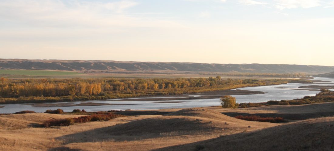
The Red Deer River is a major river in southern Alberta.
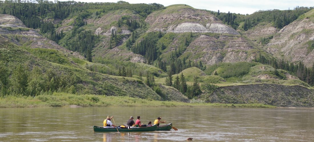
Paddling down the Red Deer PHOTO © C. OLSON
Dry Island Provincial Park PHOTO © C. OLSON
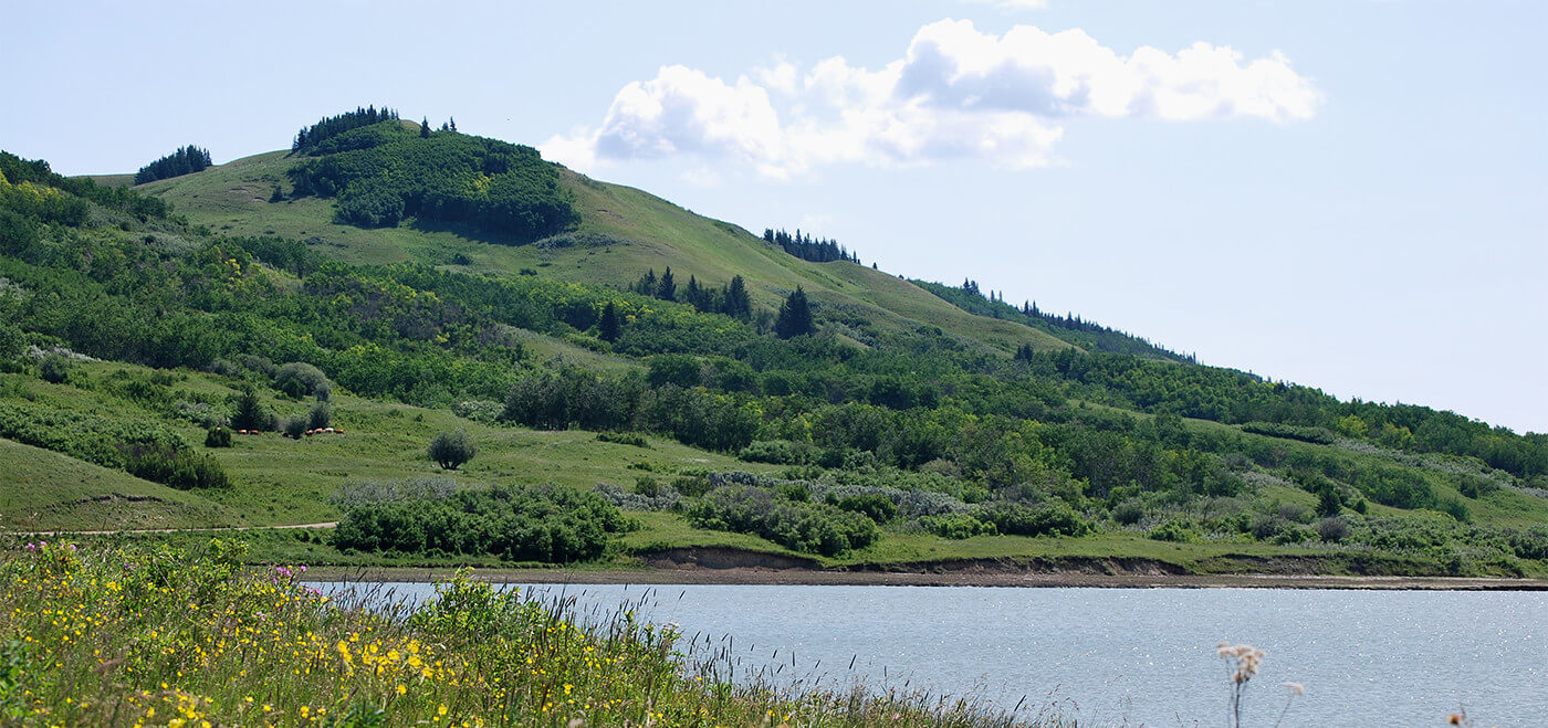
Red Deer River Valley. PHOTO © C. OLSON
Due to its importance for water and wildlife, AWA believes that the Red Deer River’s river valleys should be conserved. In addition, given the present and future challenges with water availability, AWA believes it is vital to conserve as much of the natural flow of the Red Deer River as possible.
Red Deer River Area of Concern is 1,213 km2 in size, beginning where the river turns south at Content Bridge near the hamlet of Nevis, marking the start of the strikingly sculpted badlands terrain in the Parkland and Grassland Natural Regions. The banks and riparian areas flanking the river have a high abundance of vegetation and provides habitat that is crucial to the life stages of many birds, mammals, reptiles and amphibians in a relatively dry area of the province. Major settlements along the Red Deer River corridor include the city of Red Deer (located upstream of AWA’s Area of Concern) and the town of Drumheller.
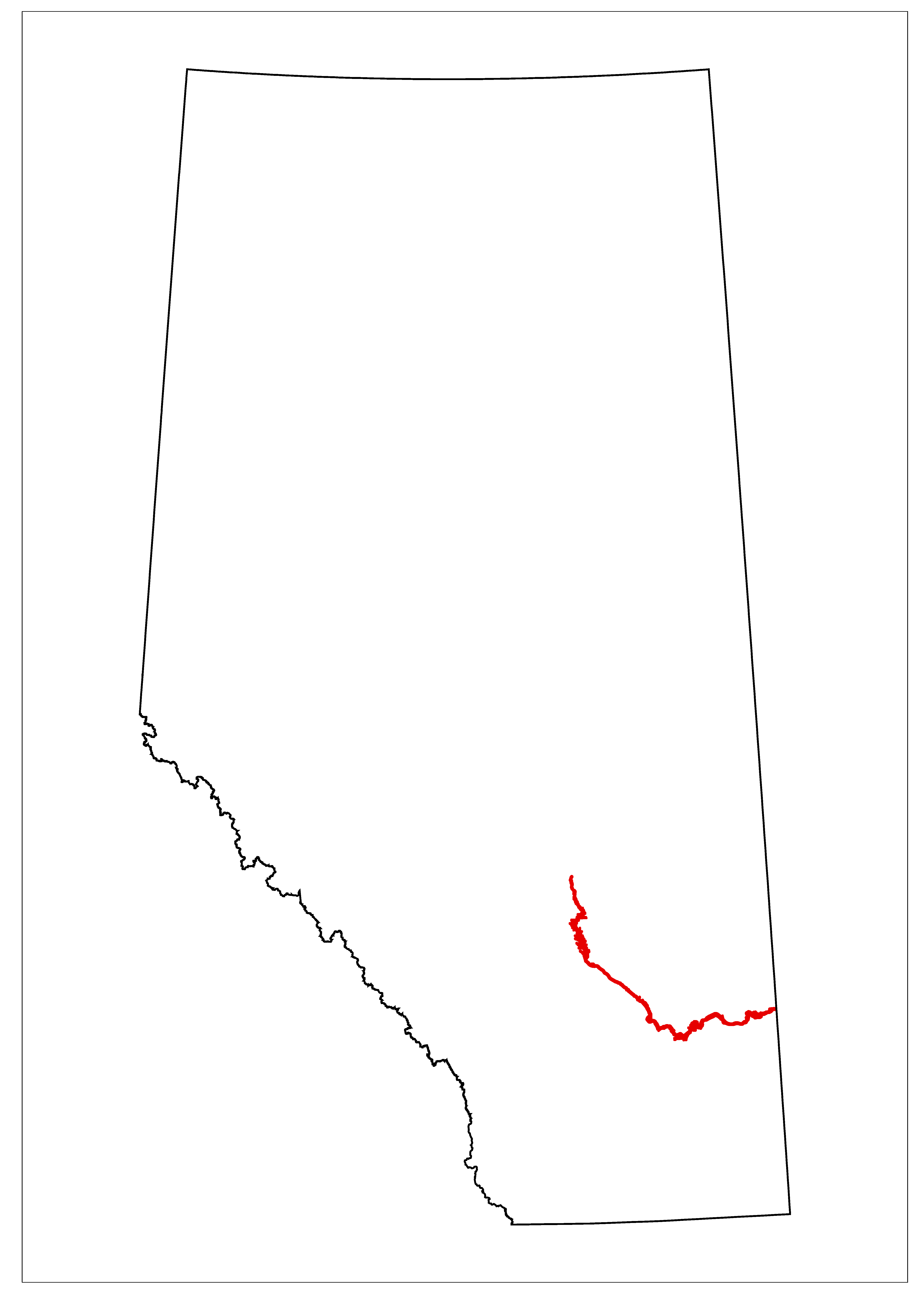
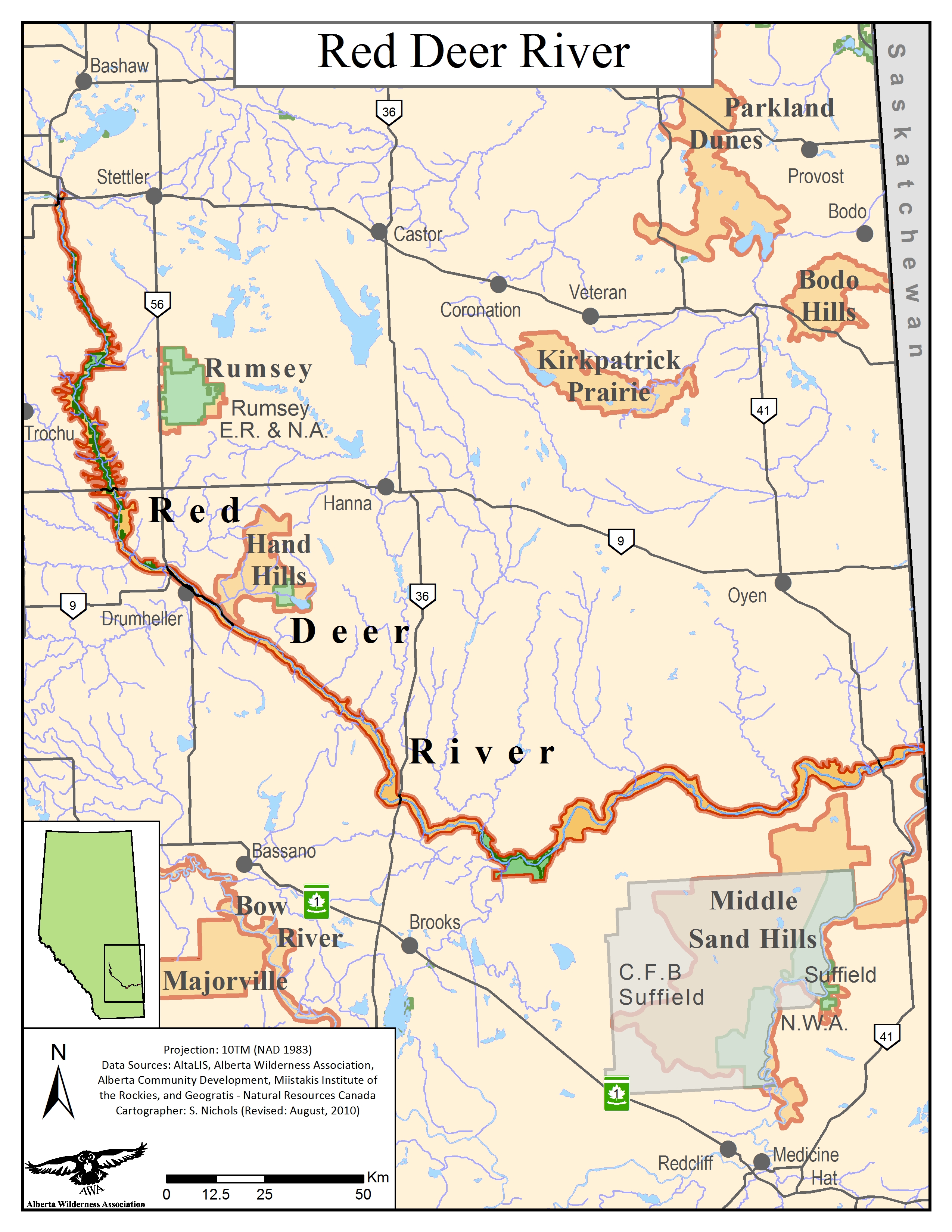 AWA’s Red Deer River Area of Concern JPG |PDF MAP: © AWA FILES
The Red Deer River headwaters start in the Rocky Mountains of Banff National Park near Lake Louise. The river is fed primarily by snow melt, only minimally by glacial melt, and has numerous inflowing tributaries. It is truly an Alberta born river – as soon as it crosses the Saskatchewan border it flows into the South Saskatchewan River, which becomes part of the Hudson Bay Watershed. There are 15 sub-watersheds of the Red Deer River drainage system.
Due to its importance for water and wildlife, AWA believes that the Red Deer River’s riparian areas should be protected. In addition, given the present and future challenges with water availability, AWA believes is vital to conserve as much of the natural flow of the Red Deer River as possible and that new allocations should be reserved for household consumption only.
AWA’s Red Deer River Area of Concern is located in the White Area, surrounded by industrial activity, agriculture, livestock and settlements. Gleniffer Lake, which is the reservoir of the Dickson Dam, is the only dam along the Red Deer River.
Protected areas within this Area of Concern include:
Tolman Heritage Rangelands Natural Area – 59.5 km2
Dry Island Buffalo Jump Provincial Park – 34.5 km2
Midland Provincial Park – 6.3 km2
Dinosaur Provincial Park (UNESCO World Heritage site since 1979) – 80.86 km2
Tolman Heritage Rangelands Natural Area – established during Special Places 2000 along with a number of other candidate areas, this area is currently managed and protected as a Natural Area. The intent was to re-designate the site under the Heritage Rangelands class once the legislation was in place but this has not happened to date.
Dinosaur Provincial Park – Managed under the Provincial Parks Act, the park contains a campground, visitor’s centre and rich interpretive opportunities. Much of the park is designated as a Natural Preserve in order to protect the fossils and natural history of the area.
Provincial Parks – Protecting both natural and cultural landscapes and features, Provincial Parks are distinguished from a Wildland Provincial Park by its greater range of outdoor recreation facilities, interpretive and educational programs, as well as generally more support facilities and infrastructure.
AWA’s Red Deer River Area of Concern is 1,213 km2 in size, beginning where the river turns south at Content Bridge near the hamlet of Nevis, marking the start of the strikingly sculpted badlands terrain in the Parkland and Grassland Natural Regions. The Red Deer River ends at its confluence with the South Saskatchewan River, just east of the Alberta/Saskatchewan border. Major settlements along the Red Deer River corridor include the city of Red Deer (located upstream of AWA’s Area of Concern) and the town of Drumheller.
AWA’s Red Deer River Area of Concern JPG |PDF MAP: © AWA FILES
The Red Deer River headwaters start in the Rocky Mountains of Banff National Park near Lake Louise. The river is fed primarily by snow melt, only minimally by glacial melt, and has numerous inflowing tributaries. It is truly an Alberta river – as soon as it crosses the Saskatchewan border it flows into the South Saskatchewan River, which becomes part of the Hudson Bay Watershed. The Red Deer River is a major tributary of the South Saskatchewan River, occupying 8% of Alberta (approximately 49,000 km2); average water flow of the entire river is approximately 70 m3/sec (RDRWA 2009).
There are fifteen sub watersheds of the Red Deer River, including its headwaters region in the Eastern Slopes of the Rocky Mountains, a settled agricultural and urban central region, and a drier, more sparsely settled lower region.
Water quality on the main stem of the River receives a ‘good’ rating in the headwaters region (on a scale comprising excellent, good, fair and poor). In the reaches from Dickson Dam reservoir to the town of Drumheller, water quality is rated ‘good’ but with considerable variability in nutrient and pesticide levels. The reach below Drumheller to the Saskatchewan border receives a ‘fair’ rating in overall water quality (RDRWA 2009).
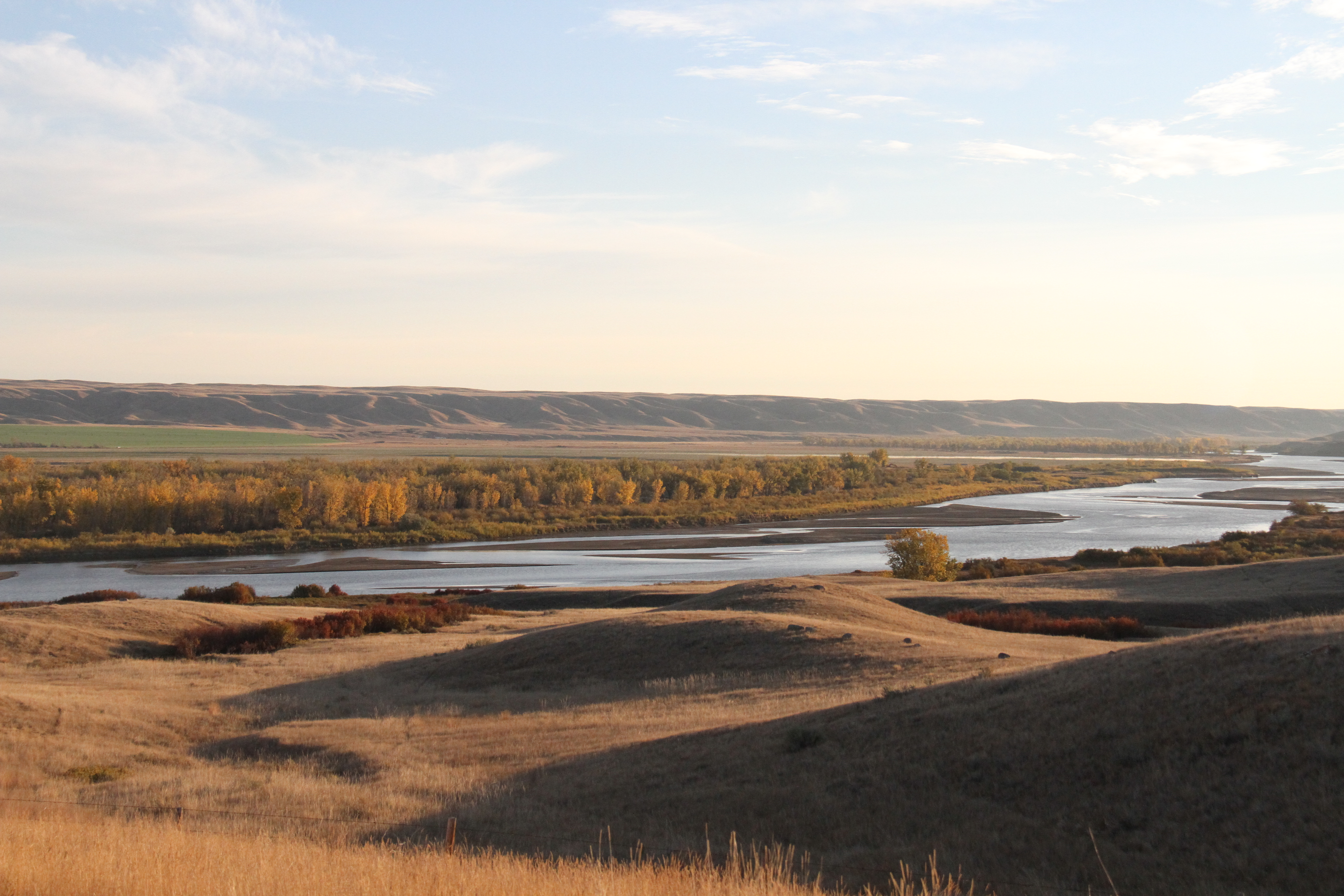
The fascinating geology of the badlands along the lower Red Deer River consists of sedimentary sandstones, siltstones and claystones deposited between 65 and 80 million years ago when much of the interior of North America was covered by a shallow sub-tropical sea. Major formations include the Paskapoo, Bearpaw, Horseshoe Canyon, Oldman, Scollard and Hand Hills Formations (NSWA 2009). The badlands began to form at the end of the last ice age roughly 10, 000 years ago with the melting of the ice sheets which covered most of Canada. Large volumes of melt water were dammed by remnant glaciers and when warming periods caused breaches in the ice walls, enormous volumes of water were liberated. The rushing melt waters flowed south and eastwards to form the lower Red Deer River valley. The melt waters cut easily through the sedimentary layers, slashing down 150 meters or more to form the deep canyons of the badlands. In so doing they exposed dinosaur-containing rocks representing the last few million years of the Cretaceous period.
The fascinating landforms of the badlands today are the result of extremely rapid erosion by rain and wind. The sedimentary layers of the badlands vary in hardness and thus vary in their susceptibility to erosion. The harder layers resist longer, and the uneven erosion gives rise to strange shapes and forms such as hoodoos, pinnacles, spires and terraces. The average rate of erosion is 0.5 cm per year, which is 1000 times greater than the rate in the Rocky Mountains.
Palaeontology
The lower Red Deer River and its major tributaries run through some of the most important palaeontological areas in the world for the Cretaceous and late Cretaceous period. These findings are highlighted by the Royal Tyrrell Museum of Palaeontology just northwest of the town of Drumheller, as well as at Dinosaur Provincial Park. Significant fossil finds still occur along the lower Red Deer River, including within Dry Island Buffalo Jump Provincial Park.
The Red Deer River Corridor is considered to be of National Significance.
Within this area of concern, the Tolman-Lousana Block is considered to be of Provincial Significance due to its
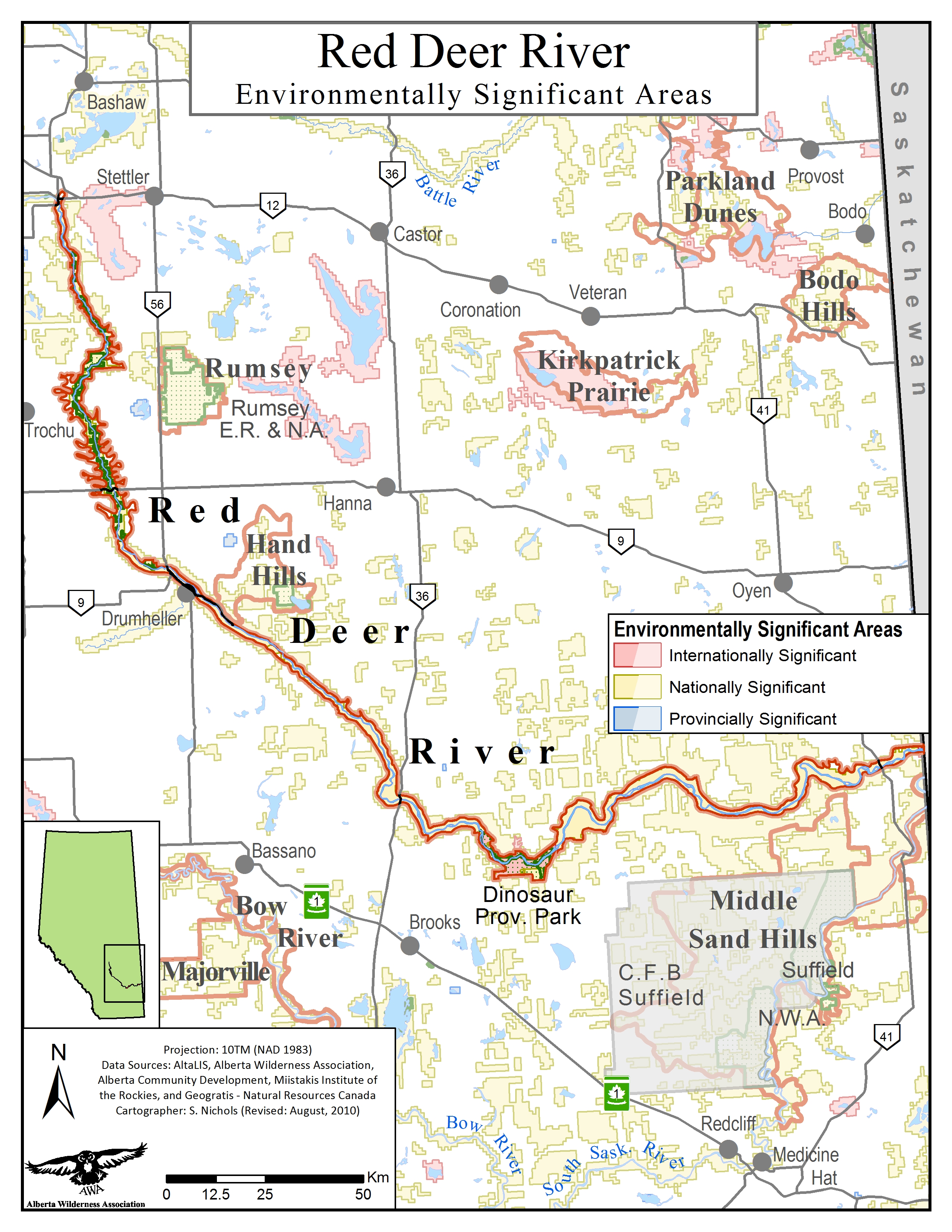
Environmentally Significant Areas within AWA’s Red Deer River Area of Concern JPG | PDF
MAP: © AWA FILES
The Red Deer River traverses five Natural Regions based on distinctive ecological attributes: Rocky Mountains, Foothills, Boreal, Parkland and Grassland. AWA’s Red Deer River Area of Concern begins in the Central Parkland (Parkland region), with the river winding down through Dry Mixed Grass, Mixed Grass, and the Northern Fescue Natural Subregions.
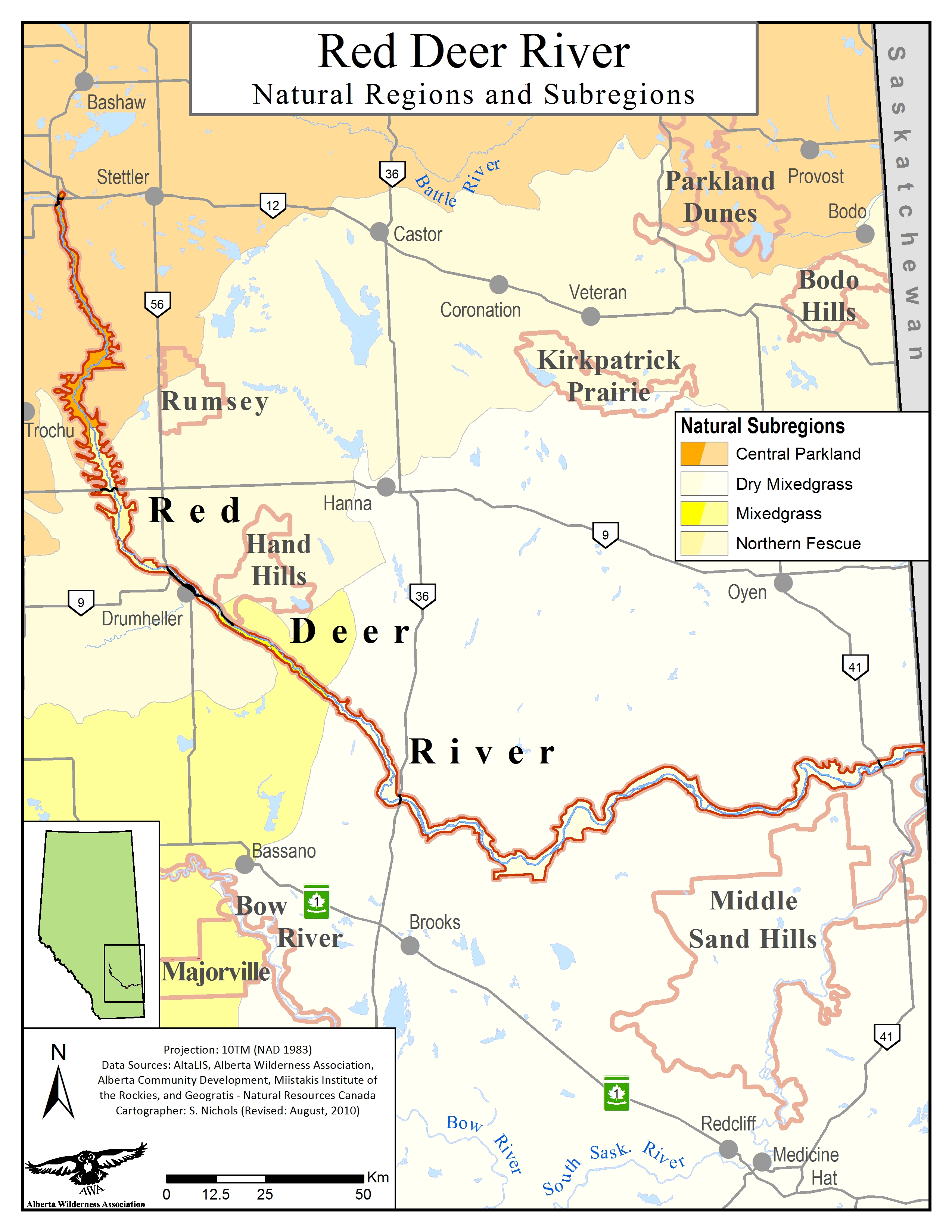
Natural Regions within AWA’s Red Deer River Area of Concern JPG |PDF MAP: © AWA FILES
The lower Red Deer River corridor contains a high number of identified plant species, of which some are threatened and unique for this latitude due to a hotter and drier micro-climate in the river valley. Much of the vegetation here is a reflection of the degree of protection from sun and wind and availability of water at specific sites. Xerophytic and salt tolerant vegetation inhabits dry and saline locations.
Central Parkland: Aspen, balsam poplar, snowberry, bunchberry, chokecherry, pin cherry, dogwood, bracted honeysuckle, plains rough fescue, wood liles, asters, wild sunflowers. Native vegetation relatively rare in this subregion due to the extensive conversion to agricultural land and as a result, invasive species are common (Alberta Parks 2015).
Northern Fescue: Plains rough fescue, silverberry, common wild rose, plains cottonwood, balsam poplar (Alberta Parks 2015).
Dry mixedgrass: Silver sagebrush, plains cottonwood, buffaloberry, willows, prickly pear cactus, sand grass, common wild rose, buckbrush, silverberry (Alberta Parks 2015).
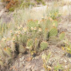
Prickly Pear Cactus. PHOTO © B. VERBEEK
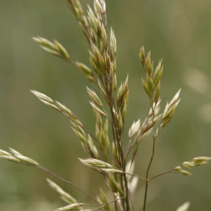
Rough fescue. PHOTO: © S. BRAY
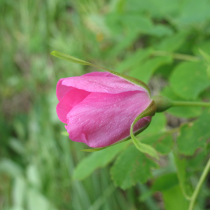
Wild rose (Rosa acicularis)
Birds: American white pelicans, while turkey vultures, golden eagle. In the spring and fall, migratory birds such as Canada geese, mallards, common goldeneye, trumpeter swans and pelicans follow the north-south line of the river. Endangered and threatened species such as piping plovers, ferruginous hawks, peregrine falcons and loggerhead shrikes can all be seen in the watershed.
Mammals: White tail deer, mule deer, moose and coyotes are abundant. Red fox, jackrabbits, bobcat, lynx and cougars have been spotted occasionally. There have been bear sightings every few years. The sage flats in the southern stretch of the river are important wintering habitat for pronghorn antelopes.
Fish: Burbot, lake sturgeon (provincially listed threatened, federally assessed as endangered), mountain whitefish, northern pike, walleye, sauger
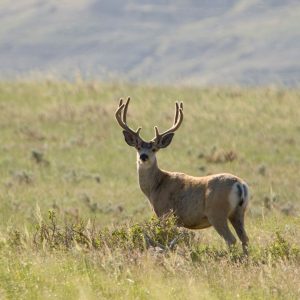
Mule deer (Odocoileus hemionus) PHOTO © A. Teucher
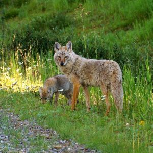
Coyotes. PHOTO © C. OLSON
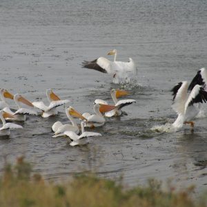
Pelicans. PHOTO © C. OLSON
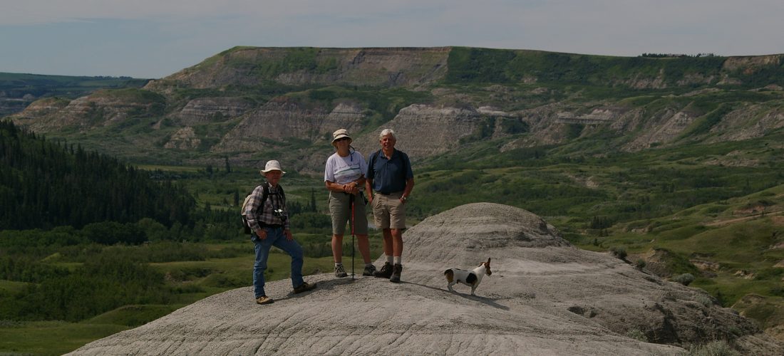
This is a recreational paradise. Roaming around in the badlands, whether taking in the views from the uplands or floating down the river, gives one the sense of being in a badlands wilderness. It is an exceptional region for biologists, ornithologists, botanists and entomologists, as well as for amateur birders and naturalists of all stages and ages.
The Royal Tyrrell Museum of Palaeontology, northwest of the town of Drumheller, is a world-renowned museum and research centre representing the palaeontology, geology and natural history of the local Red Deer River valley. The entire stretch of the lower Red Deer River is a significant scientific research area especially for palaeontology of the Cretaceous period.
Dry Island Buffalo Jump Provincial Park and Dinosaur Provincial Park are other excellent destinations to appreciate all the lower Red Deer River valley area has to offer.
The Red Deer River watershed is rife with industrial activity, agriculture, livestock and population growth, without any cumulative effects management. As a result, 56% of the watershed’s land cover has been disturbed from its natural state (RDRWA 2016).
Because the river and its tributaries flow mostly through agricultural lands, farming and ranching practices can affect water quality and the fragile badlands ecology. Nutrient runoff and increased sedimentation affecting water quality are prominent concerns.
Several studies conducted in the 1990s have indicated that agricultural practices are contributing to the degradation of surface water quality in Alberta and that the potential for impacts increases as agricultural intensity increases (Alberta Agriculture, Food and Rural Development 2000). These studies also showed the following results:
Water licenses in the South Saskatchewan River basin have been over allocated, largely for irrigation purposes. During dry seasons, insufficient water remains in sections of the Bow and Oldman river sub-basins to sustain healthy aquatic ecosystems; current summer flows in the South Saskatchewan are at 15 percent of what they were in the early 1900s (Schindler and Donahue 2006).
Water shortages are expected to escalate with climate changes: research indicates that Southern Alberta will experience significant decreases in annual streamflow and increases in water demands from both cities and irrigation districts (Islam and Gan 2011). By 2050, it is expected that the Red Deer River will see a 13% decrease in stream flows during the summer months (ICLEI Canada, 2011).
In 2007, an Alberta government study of the Red Deer River found that even if no new water licenses were allocated, increasing use of existing water licenses was expected to have negative impacts on the environment and suggested that in order to avoid serious impacts to the ecosystem, future water allocations should be very limited due to the high risk of water being unavailable ( Government of Alberta 2007).
AWA continues to urge the Government of Alberta not to proceed with the Special Areas Water Supply Project (SAWSP). This project is neither environmentally nor financially responsible. The proposal would build a costly water pipeline to divert water from the Red Deer River and pump it 100 km eastward to benefit a small number of residents in the Special Areas. The pipeline will further reduce optimal habitat of endangered grassland species such as burrowing owl.
In August, AWA reached out to Alberta Transportation and the Special Areas Board to inquire about the current status of the project. The Special Areas Board responded by saying that after reviewing the Engineering Confirmation study and the Environment Impact Assessment, the Special Areas Board moved not to advance further funding to the Special Areas Water Supply Project at this time.
The Special Areas Water Supply Project is once again proposed by the Alberta Government (see 2004).
Documents obtained by private citizens in a Freedom of Information and Protection of Privacy (FOIP) request reveal that Alberta’s internal sand and gravel mining policy was developed and approved in 2011 in a secretive process that ignored expert scientific advice and excluded the public. This gravel mining policy significantly erodes environmental protection by allowing gravel mining to occur in the 1:100 year floodplain of rivers. Alberta Wilderness Association (AWA) believes the Alberta government must conduct a science-based, transparent review of the current sand and gravel policy so that mining does not occur within the 1:100 year floodplain and minimizes water and wildlife impacts.
The Canadian and Alberta governments lay charges against Plains Midstream for its June 7, 2012 pipeline spill of 460,000 litres of high-sulfur-content crude oil into the headwaters of the Red Deer River.
Badlands Motorsports Resort puts forward a proposal to build an automotive course six kilometers long with 1200 track users and guests per day, a full service recreational resort requiring 200 staff, and residential community including vacation style condominiums housing 433 residents. Currently, the plateau is agricultural land and the river valley is undeveloped. To accommodate a new development, roads, parking lots, and buildings would be constructed, wetlands would have to be altered to allow storm water and waste water treatment, and noise levels would predictably increase. The Badlands Motorsports development is proposed to extend to the coulee formations on the Red Deer River right down to the riparian area.
A pipeline owned by Plains Midstream bursts along the Red Deer River, spilling 3,000 barrels of oil which then flowed into Gleniffer Reservoir.
The Special Areas water Supply Project is once again proposed by the Alberta Government (see 2004).
A pipeline owned by Pembina Pipeline Corp. breaks and spills 177 barrels of oil into the Red Deer River, upstream of Gleniffer Lake.
The Special Areas Water Supply Project receives widespread opposition in Alberta. At a cost of $200 million to the taxpayer, the project would divert water from the Red Deer River for irrigation purposes. This would represent an Inter-basin transfer from the Red Deer basin to the North Saskatchewan basin, currently not allowed under the 1999 Water Act.
Dinosaur Provincial Park is established with the goal to protect the fossil bone beds of the Cretaceous period, its striking landscape, and deep river valley with riparian forests and cottonwood trees.
Joseph Tyrrell discovers a dinosaur head while evaluating coal deposits, defining the future significance of the Red Deer River valley.
The lower part of the river is used as a source of coal mining, with coal seams exposed right along the river and coulees.
The Red Deer River corridor is of particular importance to Indigenous Peoples, including the Plains Cree. Archeological sites containing teepee rings, tools, and medicine wheels have been found along the river corridor. Bison were corralled and driven over the cliffs of Dry Island Buffalo Jump.
July 19, 2020
Wild Lands Advocate article by: Allison McPhail Click here for a pdf version of the…
July 19, 2020
Wild Lands Advocate article by: Joanna Skrajny, AWA Conservation Specialist Click here for a pdf…
June 25, 2020
AWA sent this letter to government of Alberta requesting that the Special Areas Water Supply…
September 1, 2018
Wild Lands Advocate article by: Andrea Johancsik Click here to download a pdf version of this…
June 1, 2016
June 2016 Wildlands Advocate article, by Andrea Johancsik. Andrea Johancsik takes us on a trip…
May 17, 2016
Alberta’s gravel mining policy significantly erodes environmental protection by allowing gravel mining to occur in…
December 1, 2015
Wild Lands Advocate update from December 2015 by Joanna Skrajny, Conservation Specialist This November, AWA was…
June 3, 2014
The Canadian and Alberta governments recently laid charges against Plains Midstream for its June 7,…
June 24, 2013
Letter from AWA to the Kneehill County planning department registering opposition to having the Badlands…
August 8, 2012
Wild Lands Advocate article, June 2012, by Tjarda Barratt. Barratt describes a personal pilgrimage to…
June 8, 2012
A pipeline leak north of Sundre, Alta. spilled between 1000 and 3000 barrels (160,000-475,000 litres)…
March 15, 2012
Wild Lands Advocate article, February 2012, by Carolyn Campbell, looking at this community-based water stewardship…