As one of the main tributaries supporting a multitude of life within northern Alberta, the Wabasca River is a highly productive watercourse that traverses the expansive Boreal Forest Natural Region.
- •
- •
- •
With increasing land-use pressures encroaching, AWA believes that local management strategies should prioritize conserving the ecological integrity of the Wabasca River by protecting more of the surrounding landscape from being converted or deteriorated, and incorporate Traditional Knowledge through co-management with local indigenous communities.
- Introduction
- Features
- Concerns
- Other Areas
With a total drainage area of 36,300 km2, the Wabasca River is a highly productive watercourse that brings life to northern extremity of Alberta’s Boreal Forest Natural Region. In addition to supporting many native fish populations such as Walleye and Arctic Grayling, the Wabasca River and its surrounding landscapes also provide habitat and migration corridors for many boreal woodland species. The surrounding landscapes of the Wabasca River vary greatly; from lowland stretches, to deepcut valleys, and swamps, the topography and types of vegetation associated with Wabasca River vary greatly.
Stemming from the Cree word ‘wapuskau’, meaning ‘white rapid’, the Wabasca River is a tributary to the Peace River as it meanders northward from Sandy Lake from which it originates. Given the density and extensiveness of Alberta’s Boreal Forest, portions of this landscape and the Wabasca River remain inaccessible limiting the number of human settlements nearby. Close communities would include the hamlets of Wabasca-Desmarais, Bigstone Cree Nation and the town of Fort Vermillion.

AWA’s Wabasca River Area of Concern. MAP: © AWA PNG | PDF
Status
Currently, there no segments of the Wabasca River or its surrounding landscapes that are under the jurisdiction of a protected area within Alberta. With the exception of some privately owned parcels of land, the majority of the surrounding landscape of Wabasca River are public lands that are subjected to multiple land-use entertaining commercial, agricultural and industrial developments.
Management
The entirety of the Wabasca River resides within the boundaries of the Lower Peace Regional Plan (LPRP), which has yet to be initiated. Beginning in 2008, the Government of Alberta committed to developing seven regional plans that would assist in “addressing cumulative impacts on the environment and to managing social, economic and environmental realities and priorities in a holistic manner” (Alberta Parks 2018).
Public Lands
Wabasca River is mostly located within Alberta’s Green Area for public lands, which are managed for recreation, ecosystem significance and services, in addition to natural resources. Public lands in the Green Area can have government granted dispositions for natural resource exploration and development for industries such as oil and gas, minerals and coal. Agricultural developments are largely excluded from the Green Area, with the exception of grazing leases on the periphery of the Foothills Natural Region.
Management and administration of public lands within Alberta is overseen by two regulatory bodies, the Alberta Energy Regulator and Alberta Environment and Parks. Public land dispositions are regulated under two pieces of legislation within the province of Alberta: the Public Lands Act and Public Lands Administration Regulation. Other relevant provincial legislation includes, but is not limited to Recreational Access Regulations, and the Environmental Protection and Enhancement Act (Alberta 2014).
Vision
AWA believes that the Wabasca River and its surrounding landscape deserves an ecosystem-based ethic that will protect the ecological integrity of both aquatic and terrestrial habitats, and implement important Traditional Knowledge and co-management strategies with local indigenous communities.
Area
With a total drainage area of 36,300 km2, the Wabasca River is a highly productive and diverse watercourse located in the heart of Alberta’s extensive Boreal Forest Natural Region. AWA’s Wabasca Area of Concern is a total of 1,686 km2, and serves as a migratory corridor for many ungulates and mammals. The Wabasca River also serves to connect various important regions together, in addition to providing high quality habitat for many fish populations. Given the remoteness of northern Alberta, much of Wabasca River’s wilderness is restricted to industrial roads, with the exception of Highway 35, which runs parallel to the west of AWA’s Cache Creek-Wolverine Area of Concern.
AWA’s Wabasca River Area of Concern. MAP: © AWA PNG | PDF
Watershed
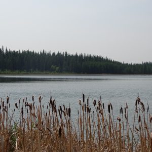
Originating from Sandy Lake, which is located northeast of Slave Lake, the Wabasca River flows northward into the North and South Wabasca Lake. The North Wabasca Lake is one of the largest lakes within Alberta, ranking 15th overall with a total area of 101 km2. The North Wabasca River drains an area of 3,819 km2, receiving inflows from multiple wetlands, the Willow River and the South Wabasca Lake. The North Wabasca Lake is somewhat nutrient-rich, displaying moderate levels of nitrogen and phosphorus, and a pH that is mildly basic allowing for optimal vegetation growth which supports a variety of invertebrate species, birds and fish populations.
The Wabasca River continues its northern trajectory through the Boreal Forest until it drains into the Peace River just west of the town of Fort Vermillion. The variation in topography influences the drainage of this landscape, and creates many different formations of wetlands such as ribbed fens, muskegs, and bogs, all of which serve as ecological hotspots within the Boreal Forest landscape. The Wabasca River basin and its associated wetlands are responsible for forming the basis for many complex and diverse boreal ecosystems in northern Alberta. The river and its associated landscape belongs to the Mackenzie River-Arctic Ocean drainage system, which is divided between the Peace River, via the Wabasca River, and the Athabasca River basins. Other notable waterbodies/courses within AWA’s Wabasca River Area of Concern includes Loon River, Muskwa River, Nipisi River, and Pastecho Lake.
Tributaries of Wabasca River include:
• Willow River,
• Muskwa River,
• Pastecho River,
• Trout River,
• Wood Buffalo River,
• Woodenhouse River,
• Liege River,
• Panny River,
• Loon River,
• Muddy River, and
• Bear River.
Geology
The meandering Wabasca River has an associated landscape that is characterized by rolling hills and undulating plains with bedrock outcrops being limited to the deepest valleys. A significant portion of northern Alberta was covered by the Wisconsin Ice sheet producing fluted surfaces and eskers, in addition to glaciolacustrine and glaciofluvial surfaces. Organic and Moraine deposits are common features from the Holocene and Pleistocene epoch. Organic deposits are defined as undifferentiated peat which is essentially woody or fibrous muck found within wetland areas. There are many organic veneers throughout the Wabasca River landscape, in addition to moraine slumps consisting of clays, silts, sands, cobbles and boulders. The Wabasca River and it surrounding landscape also have fen and bog peatlands which differ in nutrient and water content. Bog peatlands are commonly raised surfaces that have a water table that fluctuates greatly that are dominated by sphagnum mosses, heath shrubs and short stunted trees. Conversely, peatland fens receive their water from precipitation or slowly flowing streams or groundwater, and therefore, have a water table is commonly lower. Peatland fens are dominated by vegetation such as sedges, grasses, and reeds, with few to no trees. Fluvial deposits are also geological feature of AWA’s Wabasca River Area of Concern which are essentially sediments that were transported and deposited by flowing water; this includes sands, gravel, silt, clay and organics sediments, all of which can be found in channels, terraces, fans and deltas.
Natural Region
The Wasbasca River falls entirely within the Boreal Forest Natural Region of Alberta, or more specifically through the Central Mixedwood, Dry Mixedwood, and the Lower and Upper Boreal Highlands Natural Subregions of Alberta.

Natural Regions of AWA’s Wabasca River Area of Concern. MAP: © AWA PNG | PDF
Vegetation
The Wabasca River and its associated landscape varies in topography and geology, both of which dictates the drainage of the area, and therein the soil composition and the types of vegetation they subsequently support. As a result, AWA’s Wabasca Area of Concern has a diversity of vegetative communities that support many different wildlife ranges. The northward transition from Alberta’s grasslands and parkland into the southern extremity of the Boreal Forest Natural Region is marked by climatic changes such as an increase in annual precipitation, decrease in temperature, and declining evaporation rates.
Central Mixedwood
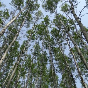
This subregion encompasses the western, eastern and southern extremities of AWA’s Birch-Wabasca Area of Concern. It has a continental climate, which is defined by cold winters and warm summers. The undulating plains, extensive wetlands, and hummocky uplands of this subregion are dominated by stands of pure aspen, white spruce-aspen or pure white spruce stands which are generally located in areas of till and lacustrine. Jack pine stands occur in areas with more coarse material, with black spruce being found in bogs and fens. Gray Luvisolic soils are dominant in this landscape in addition to Gleysolic soils. Canadian buffaloberry, low brush cranberry, and prickly rose are common to the understory. A mix of wild sarsaparilla, hairy wild rye, and tall lungwort are featured in herb communities in addition to feathermosses.
Dry Mixedwood
Dry Mixedwood is the second largest of Alberta’s Subregions, representing a transition zone between the Central Parkland and the Central Mixedwood Subregions of Alberta. The undulating plains of this subregion are dominated by wetlands found in lower lying areas and forests. This area is characterized by a mix of deciduous and coniferous tree species. Aspen is very common in this region, with balsam poplar being found alongside aspen in more moist sites. White spruce and balsam fir become more dominant with succession. Drier and sandier uplands host Jack pine forest which can have considerable ground coverage from lichen species. Common shrubs found include rose, low-bush cranberry, Canada buffaloberry, and redosier dogwood. Southern facing slopes are generally drier and are populated by grass species such as porcupine grass, sedges and June grass.
Upper Boreal Highlands
The Upper Boreal Highlands Natural Subregion is higher in elevation, with a change in vegetation indicating the transition from Lower Boreal Highlands Natural Subregion. This natural subregion occurs on the slopes and plateaus of the Birch Mountains with coniferous forests of lodgepole pine, black spruce or lodgepole-jack pine hybrid stands covering the majority of this landscape. Bogs are more commonly found with some areas containing fens. The understory species common to these areas are cloudberry, Labrador tea, sphagnum moss, and bog berry.
Lower Boreal Highlands
The Lower Boreal Highlands Natural Subregion occupies a significant portion of the landbase in AWA’s Birch-Wabasca Area of Concern. This subregion is defined by slopes with diverse mixedwood forests with common species such as white birch, aspen, and white spruce. Jack pine or jack pine-lodgepole stands are common in more dry areas. Many areas contain fens or bogs with species such as sphagnum moss, dwarf bog-rosemary,water sedges, bog cranberry and willow being common to the understory.
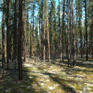
PHOTO: Old-growth forests in the boreal with plentiful lichen (© C. Wearmouth).
Machesis Lake PHOTO ©N.Petterson
Birch Forest PHOTO© N.Petterson
Wildlife
Wabasca River and its surrounding landscapes offer habitat for varying of wildlife species common to the Boreal Forest which includes:
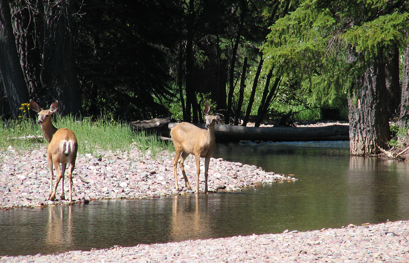
• Moose,
• Elk,
• Deer,
• Beaver
• Black bears,
• Grizzly bears,
• Wolverines,
• Arctic Grayling,
• Northern Pike,
• Burbot,
• Walleye,
• Toads,
• Golden eagles, and
• Geese.
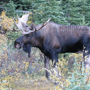
Moose (Alces alces) PHOTO © AWA FILES
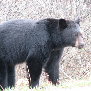
Black bear (Ursus americanus)
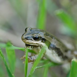
Boreal chorus frog. Photo © A. Teucher
Cultural
The Wabasca River region has been the traditional territory for First Nations such as the Tall Cree tribe and Bigstone Cree. The word ‘Wabasca’ originates from the Cree word ‘wapuskau’ meaning ‘white rapid’ which refers the Wabasca River flowing out of the North Wabasca Lake basin. The North Wabasca Lake provides a means for recreational activities, drinking water, and subsistence fishing for surrounding communities.
Surrounding communities include the Wabasca 166 (a,b,c and d), Tall Cree 173, and the hamlet of Wabasca-Desmarais located along the eastern shores of North and South Wabasca Lake.
Activites
The Wabasca River and its surrounding landscapes offer many different types of recreational activities which includes but is not restricted to:
• White-water rafting,
• Fishing,
• Wildlife watching,
• Hiking,
• Canoeing/Kayaking,
• Front and Backcountry Camping, and
• Birding.
Cumulative effects
The Wabasca River and the surrounding landscapes continue to experience land-use pressures and alterations by the means of industrial, commercial and agricultural activities. AWA is concerned that these landscape disturbances and alterations will have negative ecological impacts on the Wabasca River and its surrounding landscapes. the absence of formal protection, public lands within this region could cause a decreases in habitat quantity and quality both for terrestrial and aquatic ecosystems, reduce local and regional biodiversity, and decrease the ecological integrity of the Boreal Forest Natural Region. AWA believes that science , the cumulative effects of these land uses have comprised the ecological integrity of surrounding native habitat. AWA believes that science-based management strategies in addition to incorporating Traditional Knowledge from local First Nations is imperative to conserving the Wabasca River and its surrounding landscapes.
Dams
Dams on watercourses have a variety of purposes such as industrial, agricultural and domestic uses. These hydrological alterations are known to cause site-specific alterations to river ecology as well as to riparian and downstream ecosystems. Hydroelectric reservoir dams create in-situ ecosystems that are incompatible for the survival of many species due to fluctuating water levels and temperatures. Dams also inhibit the flow of water within a river acting as a barrier to organic materials. The reservoirs of dams tend to accumulate a significant amount of organic material, dissolved and suspended, which has implications for in situ and downstream aquatic systems. Overtime, this organic matter can begin to decompose, consuming significant amounts of oxygen from the water, further contributing to the inhospitable conditions of the reservoir, and can limiting the productivity and sustainability if released into downstream habitats (Kingsford 2001).
These anthropologic barriers also hinder the movement of wildlife, disrupting the movement of many fish species which can have negative consequen
ces on their population dynamics. Dams have shown to impede genetic flow and the distribution of species such as bull trout (Molecular Ecology 2001) which can result in population fragmentation and lower genetic diversity, both of which could ultimately decrease the survivability of a population (Jager et al 2001).