AWA Wilderness & Wildlife Defenders: The Future of Livingstone-Porcupine
June 9, 2016
- •
- •
- •
I’m writing to let you know government planning is in progress for the Livingstone and Porcupine Hills. The outcome will inform land use in this important and biodiverse region. AWA is encouraged that a new plan is being developed in a landscape that so desperately needs it.
Now is your chance to tell your MLA and the Minister why this area is important to you and how much we need an integrated and scientifically sound plan. Placing strict limits on land use in Alberta’s headwaters landscape is critical.
-Andrea Johancsik, Conservation Specialist
This area has high ecological value, but is also heavily used by industry and recreational off-highway vehicles (OHVs). These new plans will set the tone for land use in the entire Eastern Slopes.
AWA’s recommendations for the plan include:
- Apply appropriate science based land use limits on roads, trails and other disturbances: This will ensure species at risk like threatened native trout and grizzly bear can survive and thrive, quiet low-impact recreation is possible, and the ecosystem and watershed security are given first priority.
- Prioritize restoration of damaged and destroyed lands and water: Wildlife, watersheds, and biodiversity are compromised in the Livingstone and Porcupine Hills. The land needs to rest and heal.
- Ensure implementation and enforcement of the plan: The vast majority of Albertans agree that wilderness is important, and previous lack of follow-through and implementation of plans have let this province down. We’ll be doing it right if we turn a science based plan into action. More on-the-ground enforcement will help ensure this plan succeeds.
Background:
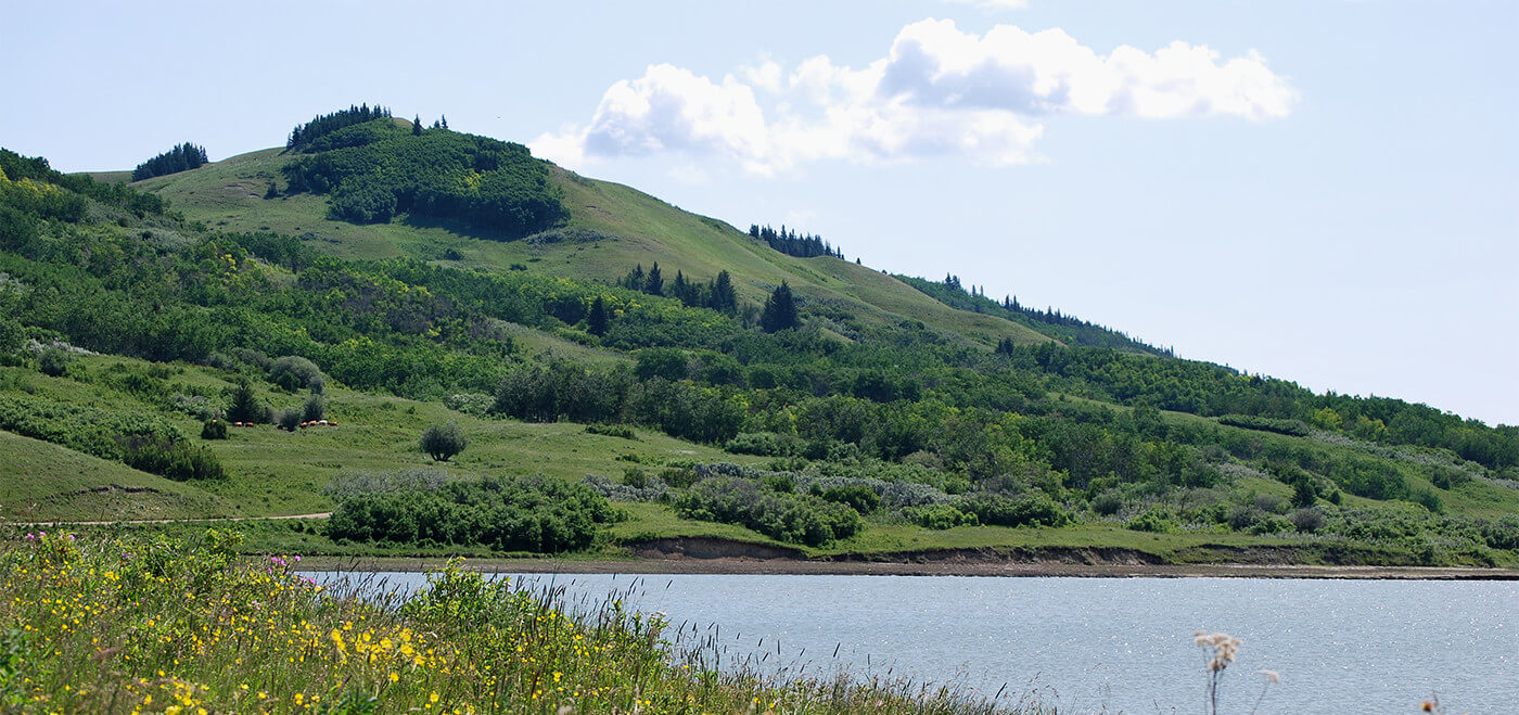
AWA’s Livingstone-Porcupine Area of Concern includes the Whaleback, Crowsnest Pass, and Upper Oldman River. It’s a key area for connectivity of grizzly bears and elk, contains fescue grasslands important for ranching and conserving species at risk, and was once abundant in large, native fish. It’s one of the most diverse areas in the province.
The South Saskatchewan Regional Plan (SSRP) directs the government to make land-use plans on a smaller scale within southern Alberta. This is the first subregional plan in the SSRP.
The Linear Footprint Management Plan will address what land uses are acceptable. Your feedback will help inform what those uses are and approporiate limits for this region.
Take Action
Show your support for the process and protecting the Livingstone and Porcupine Hills. Write, call or visit your elected representatives and, in your own words, let them know what values you want to see in the plan:
- Your MLA
- The Hon. Shannon Phillips, Minister of Alberta Environment and Parks
- Please copy us on your correspondence: ajohancsik@abwild.ca
Thank you for keeping Alberta wild!
-Andrea Johancsik
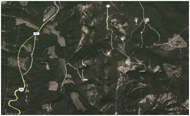
Linear footprint: any recreation trail, roadway, well site, fence lines, land clearing, power transmission line, natural gas or oil pipeline, industrial sites or cut blocks, seismic exploration, or utility line. With too much linear footprint, certain wildlife cannot persist in an area. Linear footprint is what gives this aerial photograph in the Livingstone a quilt-like appearance (Google Earth).