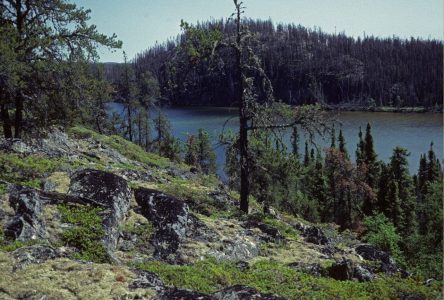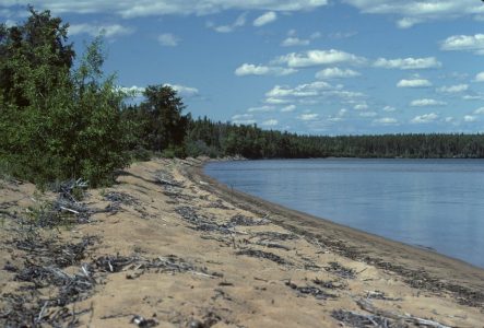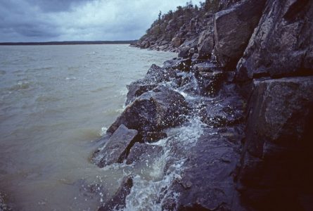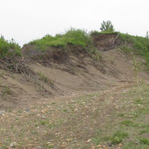
Bordering the southern edge of Athabasca Lake, Old Fort is a distinctive piece of Alberta’s Boreal Forest consisting of undulating graveled and sandy uplands and treed hummocky terrain.
- •
- •
- •
Given the uniqueness and fragility of the Old Fort wilderness, AWA believes that science-based management strategies and increased protection are the best avenues for conserving this landscape as a part of Alberta’s vast wilderness.
- Introduction
- Features
- Concerns
- Archive
- Other Areas

 Belonging to the Athabasca Plains, Old Fort is a remote wilderness that contributes to Alberta’s biological diversity.
AWA’s Old Fort Area of Concern is located within the Athabasca Plains Natural Subregion of Alberta’s Boreal Forest. This landscape is defined by jack pine forests in upland sites, gravel-cored hills, and sandy plains. Located on the southern border of Athabasca Lake and east of the hamlet Fort Chipewyan, the Old Fort’s wilderness also comprises open sand dunes that are stabilized by vegetative communities such as san heather.
Status
AWA’s Old Fort Area of Concern currently has no legislated protected areas, however, it is located in close proximity to the Athabasca Lake Public Land Area of Recreation/Tourism.
Management
Land-use Framework
Under the provincial government’s direction, the province of Alberta will be divided into seven land-use regions, each of which will have a land-use framework that provides a balance between social, economical and environmental priorities for the landscape. The regional frameworks are meant to be developed through the collaboration of multiple stakeholders that manage the cumulative effects of a growing population and economy within the region’s ecosystems and environment (Government Alberta 2014). Under this regional framework, AWA’s Old Fort Area of Concern falls entirely within the boundaries of the Lower Athabasca Regional Plan (LARP), which was completed August 22, 2012. LARP extends across 9,321,180 Ha from the southern edge of the M.D. of Bonnyville, all the way to Alberta’s northern border including Lac La Biche, Cold Lake, and Fort McMurray.
Public Lands
AWA’s Old Fort Area of Concern is situated within the Green Area of Alberta, otherwise known as the forested area of Alberta. Public lands within the Green Area of Alberta are managed for recreation, natural resources, and ecological goods and services, with a minimal number of public settlements. The Green Area of Alberta falls under a multiple land-use designation which allows for the exploration and development of natural resources such as timber products, petroleum exploration and development, as well as mineral and metal excavation. Agricultural activities are largely excluded from the Green Area, with the exception of grazing leases generally located in periphery of the zone. Management and administration of public lands within Alberta is largely overseen by provincial regulatory bodies such as the Alberta Energy Regulator and the departments of Alberta Environment and Parks, Alberta Energy, and Alberta Agriculture and Forestry. Public land dispositions are regulated under multiple pieces of legislation that include, but are not limited to, the Public Lands Act, Public Lands Administration Regulation, Recreational Access Regulations, and the Environmental Protection and Enhancement Act (Alberta 2014).
Vision
AWA believes that Old Fort and its surrounding landscapes deserve increased protection that would prioritize conserving the natural integrity of this distinctive landscape. AWA also believes that Old Fort requires management strategies that incorporate Traditional Knowledge from local First Nations that would aid in protecting important natural features and wildlife populations that sustain many local communities.
Area
AWA’s Old Fort Area of Concern is 733 km2 within the Boreal Forest Natural Region of Alberta, and is directly east of Fort Chipewyan. Bordering the Alberta-Saskatchewan provincial border, this remote wilderness can via Highway 63, by boat, or by chartered fly-ins.
 AWA’s Old Fort Area of Concern: JPG PDF MAP: © AWA
Watershed
The Old Fort wilderness resides within the Peace/Slave River Basin, and borders the southeastern edge of Lake Athabasca. Lake Athabasca covers an area of 7,770 km2, and has a fairly large drainage basin of 282,000km2 that extends southwest across the width of Alberta to the Columbia Icefield in the Rocky Mountains and east across most of northern Saskatchewan to Wollaston Lake. The southern portion of AWA’s Old Fort Area of Concern contours the Old Fort Bay of Lake Athabasca, with the Old Fort Bay River traversing the lower southern edge of AWA’s Old Fort Area of Concern. The headwaters of Old Fort River originate north of Minto Lake in Saskatchewan, and flow northwest towards Old Fort Bay entering Lake Athabasca at a confluence point through a large wetland. There are many small lakes throughout the Old Fort wilderness, one of which includes Lillabo Lake which spans across the Alberta-Saskatchewan provincial border.
Geology
As the Athabasca Plain Natural Subregion varies substantially in topography, so does the underlying bedrock. Helikian sandstone is common in the north and east, with Devonian sandstone, siltstone and dolomite in the southwest. Bedrock in the southeast consists of shale, siltstone, and Cretaceous non-marine sandstone formations. Most surficial deposits are deep and coarse textured sediments, with glaciofluvial, deltaic, and eolian sands occurring on the plains. Hummocky terrain is generally composed of sandy and gravelly ice-contact materials. Dominant soils within the Old Fort wilderness include Acidic dysrtric Brunisols, which rapidly drain water , along with Gle ysols being common within depression areas. G leysols are the “wetland soils”, characterized by the grey-blue hue that results from the anoxic (low oxygen) conditions of waterlogged soil.
Environmentally Significant Areas
The northern portion of AWA’s Old Fort Area of Concern has areas of environmental significance located on the eastern edge of Lake Athabasca. These areas of provincial significance provide important habitat for many fur-bearing animals, dense flocks of waterfowl and an abundance of fish species. Additionally, these provincially significant areas provide important outflows for many shallow lakes throughout the region. The central and southern portion of the Old Fort wilderness is considered an area of national significance due to expansive areas of active and stabilized sand dunes. These sand dunes vary in form such as longitudinal and U-shaped dunes, which support unique flora and fauna communities with respect to the surrounding landscapes.
Old Fort contains areas which are of provincially and nationally significant. JPG PDF MAP: © AWA
Natural Region
AWA’s Old Fort Area of Concern is located within the Boreal Forest Natural Region of Alberta. On a finer scale, the Old Fort wilderness resides entirely with the Athabasca Plain Natural Subregion which totals 13,525km2 or 4 percent of the Boreal Forest of Alberta. Predominate vegetative features include jack pine forests, sandy plains, dunes, as well gravel-cored hills. The climate of the Athabasca Plain Natural Subregion is the warmest of any Boreal Forest Natural Subregion, with continental polar and arctic weather systems producing very cold winters.
Natural subregions of Old Fort JPG PDF MAP: © AWA
Vegetation
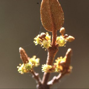
Athabasca Plain: Common forested communities within this Subregion are jack pine tree stands with understory species such as bog cranberry, Canada buffaloberry, common blueberry, bearberry and lichen. White spruce stands can also be found in some regions, however, they are less common because of frequent fire regimes. Areas with more moisture support understory communities of green alder, rose, low bush cranberry and feathermosses with white birch, aspen, Alaska birch, and jack pine as pure or mixed stands. Jack pine and black spruce are common in poor-nutrient areas along with common Labrador tea, feathermosses and bog cranberry. Moist nutrient sites are not common within this Subregion and are found mainly along rivers, or in narrow bands near small lakes that support balsam poplar, white or black spruce, white birch, or aspen trees. The understory of nutrient rich moist sites can contain river alder, low bush cranberry, willows and horsetails.
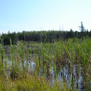
Wetlands: An estimated 25 percent of the Athabasca Plain Natural Subregion is covered with wetlands with an uneven distribution of wetlands across the landscape. The highest density of wetlands is found in the eastern segment of this wilderness. Wetlands within the Athabasca Plain can be a complex of treed, open (graminoid), or shrubby fens with common plant species such as black spruce, common Labrador tea, leatherleaf, peat mosses and feathermosses. Where nutrient supplies are better, Tamarack with golden mosses and sedges are more pronounced. Shrubby fens generally have leatherleaf, dwarf birch and willow, while open fens are commonly populated with water sedge, and bluejoint.
Grasslands and Low shrublands:Sand dunes within the Athabasca Plain Natural Subregion have unique vegetative communities that serve to stabilize the dune surfaces. Species include Plains wormwood, sand heather and American dunegrass, however, some areas of bare or exposed sand do exist. With prevailing winds continuously shifting, the sand dunes extend eastward, and can bury or expose different vegetative communities. As succession occurs on bare or open sand dunes, the surface becomes dominated by sand heather, followed by hair cap moss and finally lichen.
Wildlife
Common wildlife species found within AWA’s Old Fort Area of Concern include, but are not limited to:
• Black bears,
• Red squirrels,
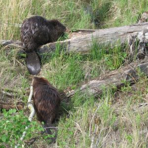
• Beavers,
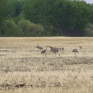
• Sandhill Cranes,
• Willow ptarmigan,
• Spruce grouse,
• Ruffed grouse,
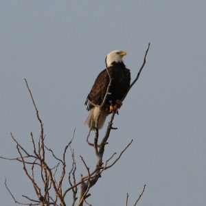
• Bald eagles,
• Boreal chickadee,
• Canada Jay,
• Black capped chickadee,
• Lake trout,
• Arctic grayling
• Lake whitefish,
• Goldeneye,
• Northern pike,
• Yellow birch, and
• Walleye.
Cultural
The Old Fort wilderness is the traditional territory of the Beaver, Chipewyan and Cree First Nations who have inhabited the area for over 2000 years. Around the mid-nineteenth century, the Beaver First Nation migrated to the west end of Athabasca Lake and settled in and around what is now Fort Vermilion, while the Chipewyan and Cree First Nations remained closer to Athabasca Lake. The Cree and Chipewyan First Nations became extensively involved with fur trading which began in 1778 when Peter Pond established a trading post on the Athabasca River at its junction with the Embarras River, a location known as Old Fort. The Cree and Chipewyan First Nations have several communities located around Lake Athabasca and throughout the Old Fort wilderness, and continue to rely on this landscape to fulfill traditional cultural practices and sustain their communities.
Activities
Given the remoteness of this wilderness, the level of recreation within Old Fort is relatively limited with access being restricted to boat or fly-ins. Hunting, fishing and trapping mainly provides sustenance and income for local residents.
Concerns
Relatively low tree volume and poor access make the Old Fort wilderness incompatible for supporting industrial clearcut logging, in addition to poor soil conditions limiting agricultural potential. However, the southern part of AWA’s Old Fort Area of Concern has the potential for oilsands exploration and development. Increased development of oilsands within the region could result in a deteriorated state of water quality which can have negative impacts on aquatic and terrestrial communities. Naphthenic acid is a mixture of several carboxylic acids that is produced with the oxidation of hydrocarbons. Naphthenic acid serves as an environmental contaminant from the process water from oilsands development, and has been demonstrated through scientific research to produce acute and subchronic toxicity for mammals and fish.
AWA believes that the ecological integrity of the Old Fort wilderness should remain intact with minimal industrial development in order to maintain healthy wildlife populations, that are integral to sustaining local communities, and in fulfilling traditional and cultural rights of local First Nations.
