Livingstone-Porcupine Final Plans Released
May 17, 2018
- •
- •
- •
The provincial government has released final plans and established Public Land Use Zones (PLUZ) in the Livingstone Porcupine region in order to manage the impacts of industrial development and motorized recreation in the area. Alberta Wilderness Association (AWA) believes these measures signal an important shift towards sustainable management of our public lands.
“Establishing designated trails and providing officers with the ability to enforce these plans at the beginning of the season are responsible measures that provide clear guidance for both motorized and non-motorized users,” said Joanna Skrajny, AWA Conservation Specialist. “It’s also important that the government has identified priority projects and allocated funds for the implementation of these plans.”
There are currently 4,053km of linear features in the Porcupine Hills/Livingstone with an average trail density of 2.28km/km2. There is no question these ecosystems are damaged and reducing the linear density is necessary. In addition, the newly designated trail network helps protect important watersheds such as the upper Oldman and Hidden Creek by avoiding OHV use in these areas. The restrictions will benefit westslope cutthroat trout and bull trout populations, native plants, ungulates, and provide opportunities for other forms of recreation.
“We remain concerned with several aspects of the final plan. For example, the number of stream crossings over westslope cutthroat trout and bull trout habitat pose a continuing threat to those populations,” Joanna added. “In addition, a healthy grizzly bear population demands limits on not just trails and roads, but also on pipelines and seismic lines which are not included in the disturbance calculations. Consequently, the government’s plan allows for at least twice as much linear disturbance as what grizzly recovery requires.”
AWA recognizes the final plan has included measures that address concerns raised in the consultation process.
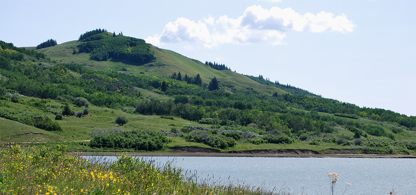
The Livingstone-Porcupine area includes the Whaleback, Porcupine Hills, Crowsnest Pass, and Upper Oldman River. It’s a key area for connectivity of grizzly bears and elk, contains fescue grasslands important for ranching and conserving species at risk, and was once abundant in large, native fish. It’s one of the most iconic and diverse landscapes in Alberta.
The South Saskatchewan Regional Plan (SSRP) directs the government to make land-use plans on a smaller scale within southern Alberta. This is the first subregional plan in the SSRP. The Linear Footprint Management Plan addresses what land uses are acceptable, where those land uses should be allowed and how much of an impact they will be allowed to have on the land. The Recreation Management Plan guides recreation uses within the limits set by the Linear Footprint Management Plan.
For more information contact:
Joanna Skrajny, Alberta Wilderness Association, 403.283.2025