«
Maps of Areas Covered by Sage-grouse Emergency Protection Order
December 4, 2013
- •
- •
- •
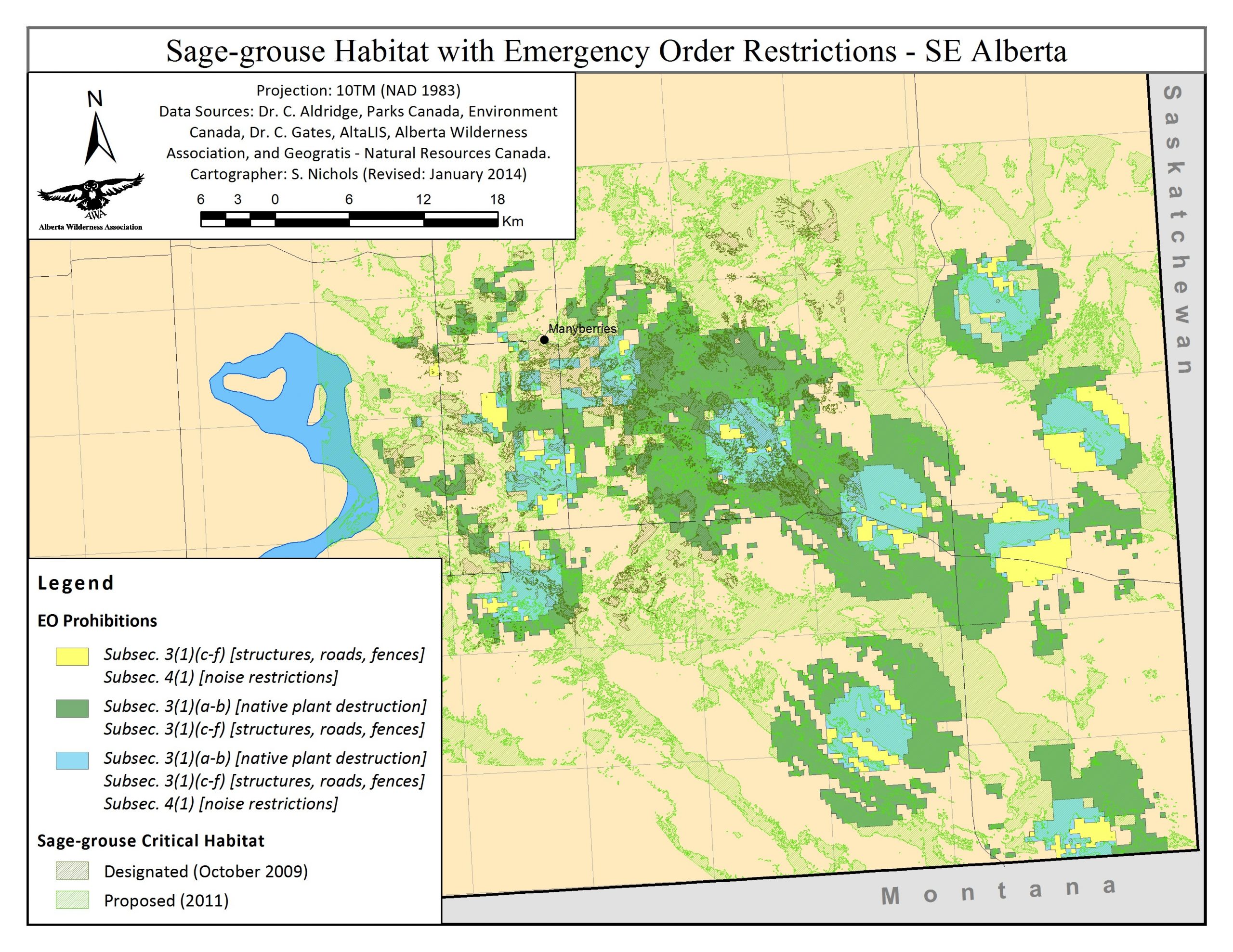
Maps of the areas covered by the Emergency Order for the Protection of the Greater Sage-grouse. As compared to identified SG Critical Habitat (both designated 2009 and proposed 2011) and brooding and nesting habitat (2007 source and sink areas near Manyberries AB).
Maps of the areas covered by the Emergency Order for the Protection of the Greater Sage-grouse [PDF, 129pp] (click on maps for larger versions):
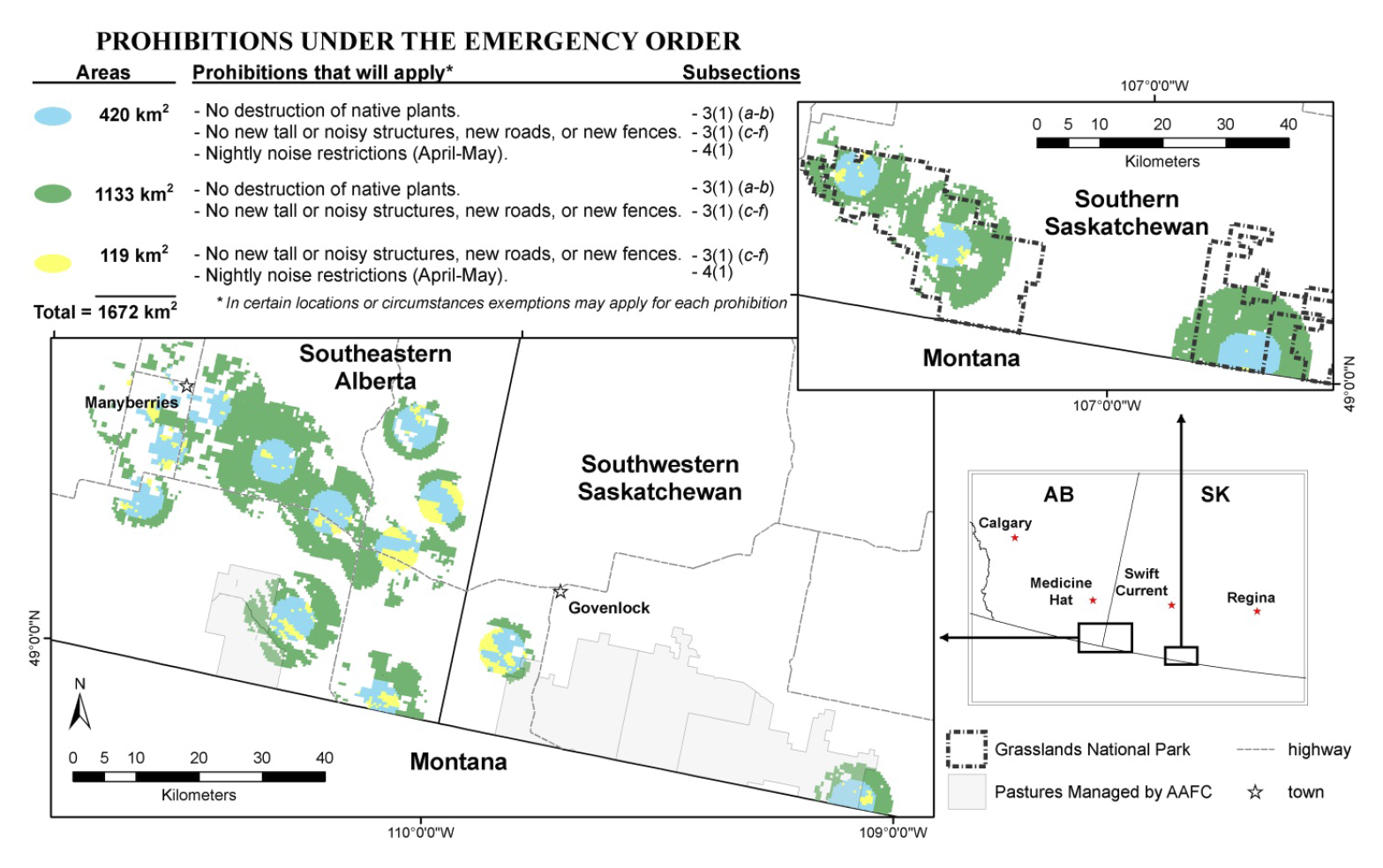
- Map of area covered by Emergency Order (colour):
- Map of Emergency Order area with identified critical habitat (designated 2009 and proposed 2011) in SE Alberta:

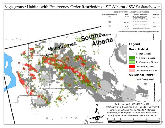
- Map of Emergency Order area with brooding habitat (source and sink areas)* near Manyberries AB:
- Map of Emergency Order area with nesting habitat (source and sink areas)* near Manyberries AB:
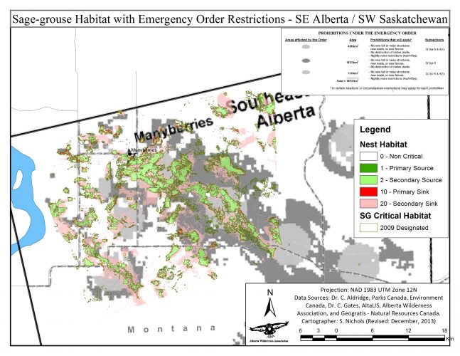


* Brooding and Nesting Habitat near Manyberries identified by Aldridge, C.L. and M.S. Boyce in the 2007 paper: Linking occurrence and fitness to persistence: a habitat-based approach for Greater Sage-Grouse from Ecological Applications 17:508-526
© 1965 - 2024, Alberta Wilderness Association. | Disclaimer | Privacy Policy | Federally Registered Charity Number 118781251RR0001
Website design by Build Studio