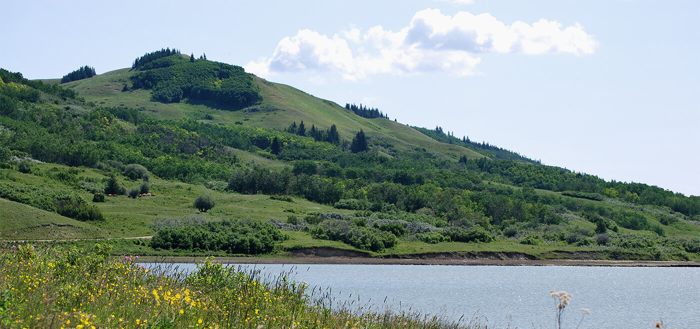
Undulating lowlands interspersed with wetlands and forests, Harper is an ecologically rich landscape that is home to free roaming bison and woodland caribou.
- •
- •
- •
AWA believes that an ecosystem-based ethic should guide management strategies for this sensitive boreal forest ecosystem. PHOTOS: © AWA FILES
- Introduction
- Features
- Concerns
- History
- Other Areas
 |
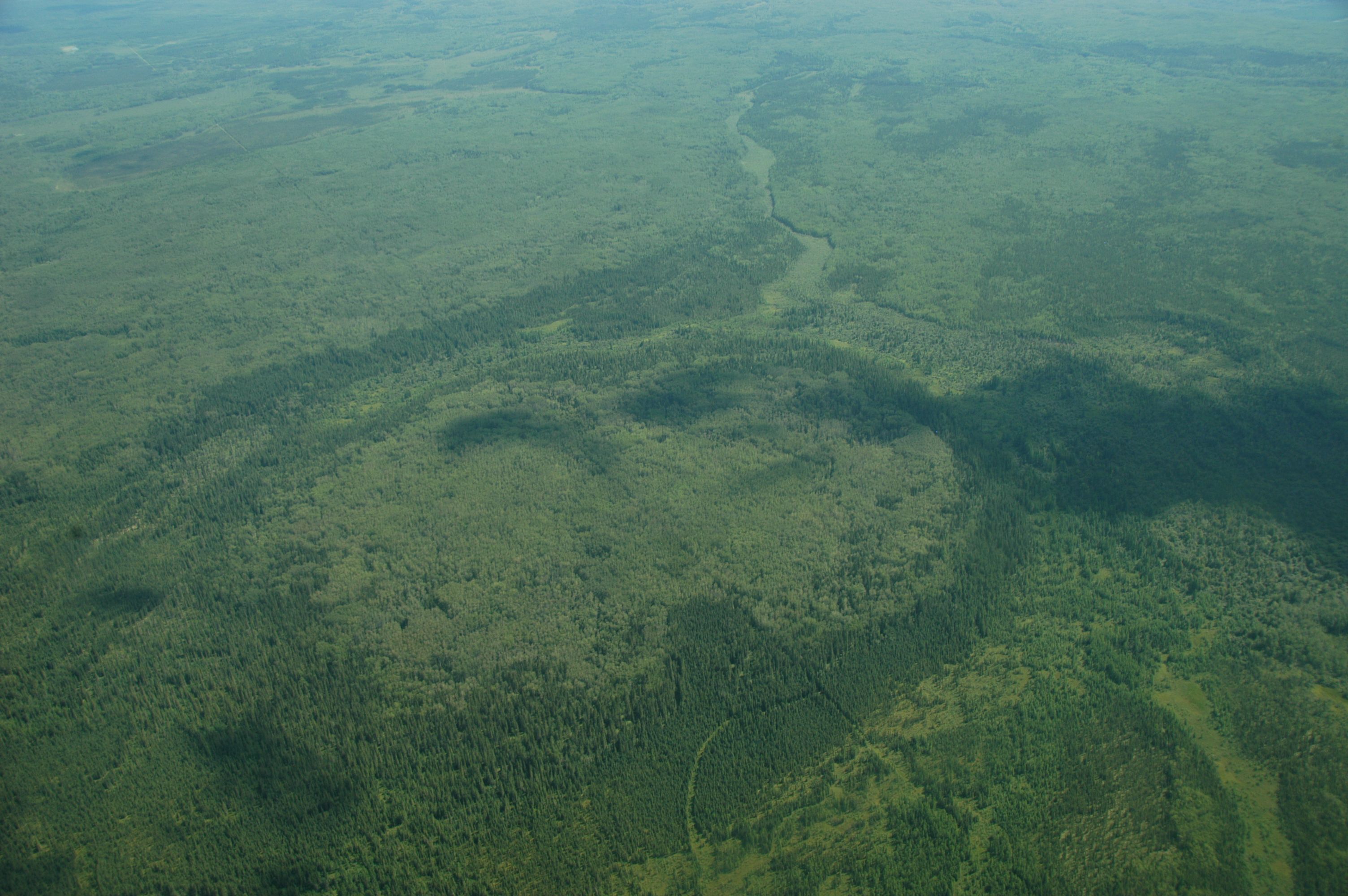
Harper’s boreal ecosystem is diverse and of great ecological importance.PHOTOS: © AWA FILES |
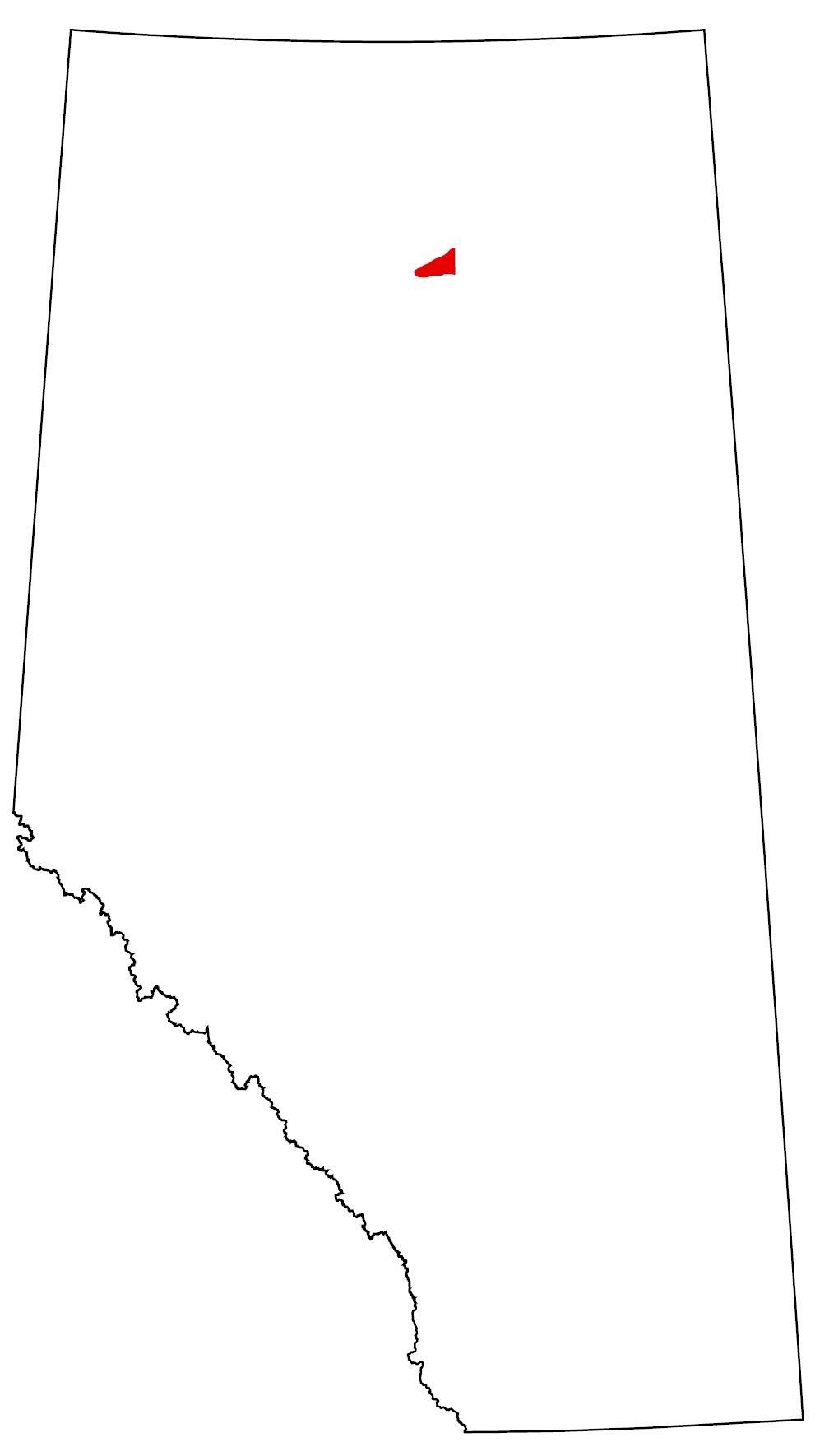
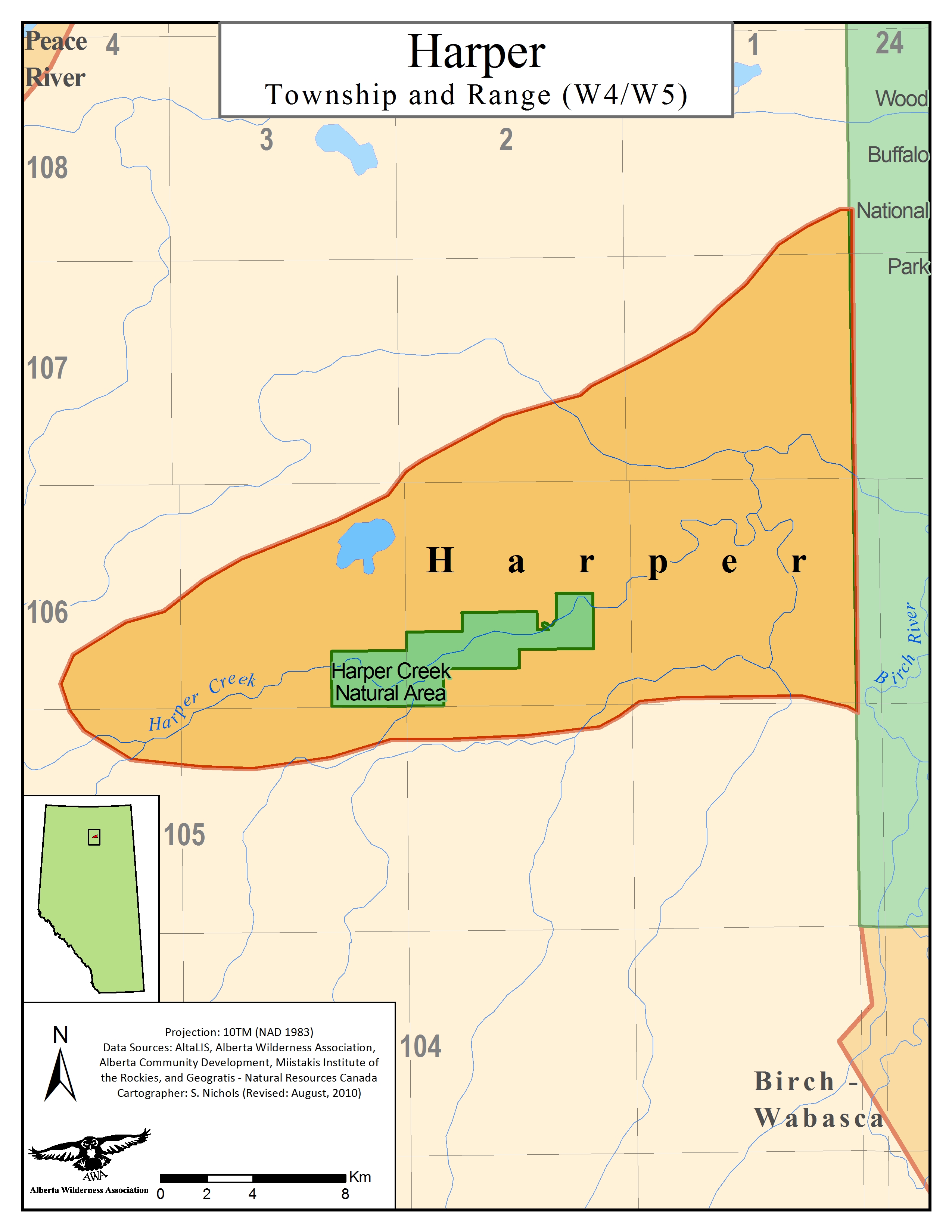
Sharing its eastern border with Wood Buffalo National Park, Harper is boreal forest landscape in far northwestern Alberta that is home to many wildlife species including wood bison and woodland caribou. Directly south of the Peace River and east of Fort Vermilion, AWA’s Harper Area of Concern is 428km2 of public lands that includes the Harper Creek Natural Area. Mixedwood forests, wetlands, limestone caves and oxbow lakes characterize these lowlands. Resource extraction, logging and agricultural developments continue to infringe on this sensitive landscape, ultimately changing its ecological integrity and functioning.
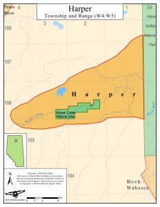
AWA’s Harper Area of Concern: JPG | PDF MAP: © AWA
Status
AWA’s Harper Area of Concern contains the Harper Creek Natural Area which is 26.2km2 in size, and was established in 1995 due to the Special Places Program 2000. Besides Harper Creek, most of this landscape is unprotected public lands that are currently used and developed under a multiple land-use designation.
Management
Under the provincial government’s Land Use Framework, Harper would be located within the Lower Peace Region. Once completed, the regional plan will commit to “managing our province’s land and natural resources to achieve Alberta’s long-term economic, environmental and social goals” (Government of Alberta, 2016).
Public lands
AWA’s Harper Area of Concern is entirely situated within the Green Zone of Alberta (forested portion), where public land is managed for recreation, natural resources, and ecological goods and services. This area has minimal public settlements and permits industrial exploration and development of natural resources, in addition to industrial clearcut logging. Agricultural activities are largely excluded from the Green Area, with the exception of grazing leases generally located around the periphery of the zone. Management and administration of public lands within Alberta is largely overseen by provincial regulatory bodies such as the Alberta Energy Regulator and the departments of Alberta Environment and Parks, Alberta Energy, and Alberta Agriculture and Forestry. Public land dispositions are regulated under multiple pieces of legislation that includes, but is not limited to, the Public Lands Act, Public Lands Administration Regulation, Recreational Access Regulations, and the Environmental Protection and Enhancement Act (Alberta 2014).
Protected Areas
Designated in 1995 under the Special Areas Program, Harper Creek Natural Area is managed under the legislation of the Wilderness Areas, Ecological Reserves, Natural Areas and Heritage Rangeland Act with the intent to “preserve and protect sites of local significance and provide opportunities for low-impact nature-based recreation and nature appreciation activities” (Government of Alberta 2017).
Bison Management
Wood bison are classified as Threatened under the Species At Risk Act, with some herds within Alberta being designated as endangered and are protected under Alberta’s Wildlife Act. The Wildlife Act states that, populations, such as the Hay- Zama herd, that are “free-roaming within Alberta’s Bison Protection Area are considered to be wildlife, and receive protection under the Wildlife Act. It is illegal to hunt, harm, or traffic in the bison within this area without a licence” (Government of Alberta 2018).
For free-roaming bison found in and around Wood Buffalo National Park, such as the Harper Creek, are considered to potentially carry tuberculosis and brucellosis, and therefore receive no protection outside of the boundaries of the park and the Bison Protection Area. In 2008, the provincial government began to control population growth and coordinate disease surveillance of the Hay-Zama herd, an uncontaminated herd in WMUs 536 and 539 within the Bison Protection Area, to prevent their contamination and the spreading of tuberculosis and brucellosis to livestock populations and other uncontaminated herds ( Government of Alberta, 2018).
The Harper Creek herd is a subpopulation of wood bison that is believed to be genetically differentiated from the Greater Wood Buffalo National Park (GWBNP) area founding population, which is estimated to represent approximately 72% of this species within our province. GWBNP is comprised of six spatially disjunct local herds that have some demographic or genetic connection among them (AEP and ACA 2017). The Harper Creek wood bison herd, also referred to as the Wabasca-Mikkwa herd, currently occupies a range of 2488km2 , an estimated that has been derived from a variety of sources such as aerial surveys, expert knowledge, direct observations, local indigenous knowledge, and natural signs (i.e. tracks, feeding craters, kill sites and fecal pats) (AEP and ACA 2017). Literature suggests that once individuals dispersed towards Vermillion by means of the Peace River Lowlands from GWBNP, the herd did not return to the Wood Buffalo National Park but rather became permanently located.
The estimated total number of mature bison in all Alberta subpopulations in 3866, with approximately 19% being represented amongst four free ranging herds that are considered not to be infected with bovine tuberculosis and brucellosis: Hay-Zama, Etthithun, Harper Creek and Ronald Lake. It is estimated that the Harper Creek subpopulation accounts for less than 1% of the provincial population with a total less than 50 individuals (AEP and ACA 2017).
Vision
In order to protect this boreal landscape and its resident species, AWA believes that the entire Harper Area of Concern should be designated as a Natural Area to prevent the further degradation of this landscape.
Area
Beginning west of Wood Buffalo National Park, Harper is a boreal forest landscape that is approximately 428km2 in size, and encompasses various mixed and pure tree stands, wetlands, and limestone outcrops, in addition to limestone caves. This wilderness can be accessed from Highway 88 east of Fort Vermilion.
AWA’s Harper Area of Concern: JPG | PDF MAP: © AWA
Watershed
The lower landforms of Harper contribute significantly to shaping the hydrology of the area. Residing within the Peace Slave River Basin, AWA’s Harper Area of Concern is a rolling topography characterized by numerous creeks, fens, bogs, and lakes, some of which are unnamed. Most notable waterbodies within this landscape include Moose Lake, Harper Creek, and the Birch and Peace River which flows north and east towards Lake Athabasca.
Geology
AWA’s Harper Area of Concern is located within the Ireton Formation of the Upper Devonian period from the Paleozoic era. According to Norris (1963) and Green et al. (1970), the Mikkwa Formation occurs in the Peace River area, which includes Harper, and overlies the Ireton Formation which subsequently underlies the Grosmont Formation. Limestone outcrops that occur at the conjunction of Harper and Lambert creeks are evidence of the Mikkwa formation (Cutler 1983).
The upper Ireton formation mostly consists of interbedded, fossiliferous, calcareous grey-green shales and argillaceous limestones. This unit is extensively dolomitized and contains areas of thick dolomitic carbonate of approximately 66 ft in depth. The upper Ireton formation also conveys numerous discontinuous surfaces which indicates early lithification (CSPG Lexicon of Canadian Stratigraphy, 1990).
The middle of the Ireton Formation is composed of slightly calcareous, fissile, grey-green shale, with occasional thin beds of calcirudite that contain abundant skeletal material and lithoclasts (CSPG Lexicon of Canadian Stratigraphy, 1990).
The lower Ireton is composed of large, dense, nodular and banded limestones that have calcareous shale partings, interbedded with grey-green, calcareous shales (CSPG Lexicon of Canadian Stratigraphy, 1990).
Environmentally Significant Areas
Wetlands
The boreal lowlands of Harper were carved out due to the erosional force of the Peace River, and as a result, caused a significant portion of the hydrology of the region to be in the form of standing water. These various forms of wetlands and the habitat they provide for wildlife in addition to ecological services such as water retention and cleansing is what renders regions of Harper’s landscape provincially significant.
Harper Creek Natural Area
Harper Creek Natural Area, established in 1995 as a part of the Special Areas Program, is 2,620 ha floodplain and uplands landscape adjacent to Harper creek. Located within the Boreal Forest Natural Region of Alberta, this landscape is characterized by a series of mixedwood forests, suplhur springs, shrubby meadows, meander scars and creek rapids. This area also has limestone caves, one of which is over 300 feet in long (Government of Alberta , 2017).
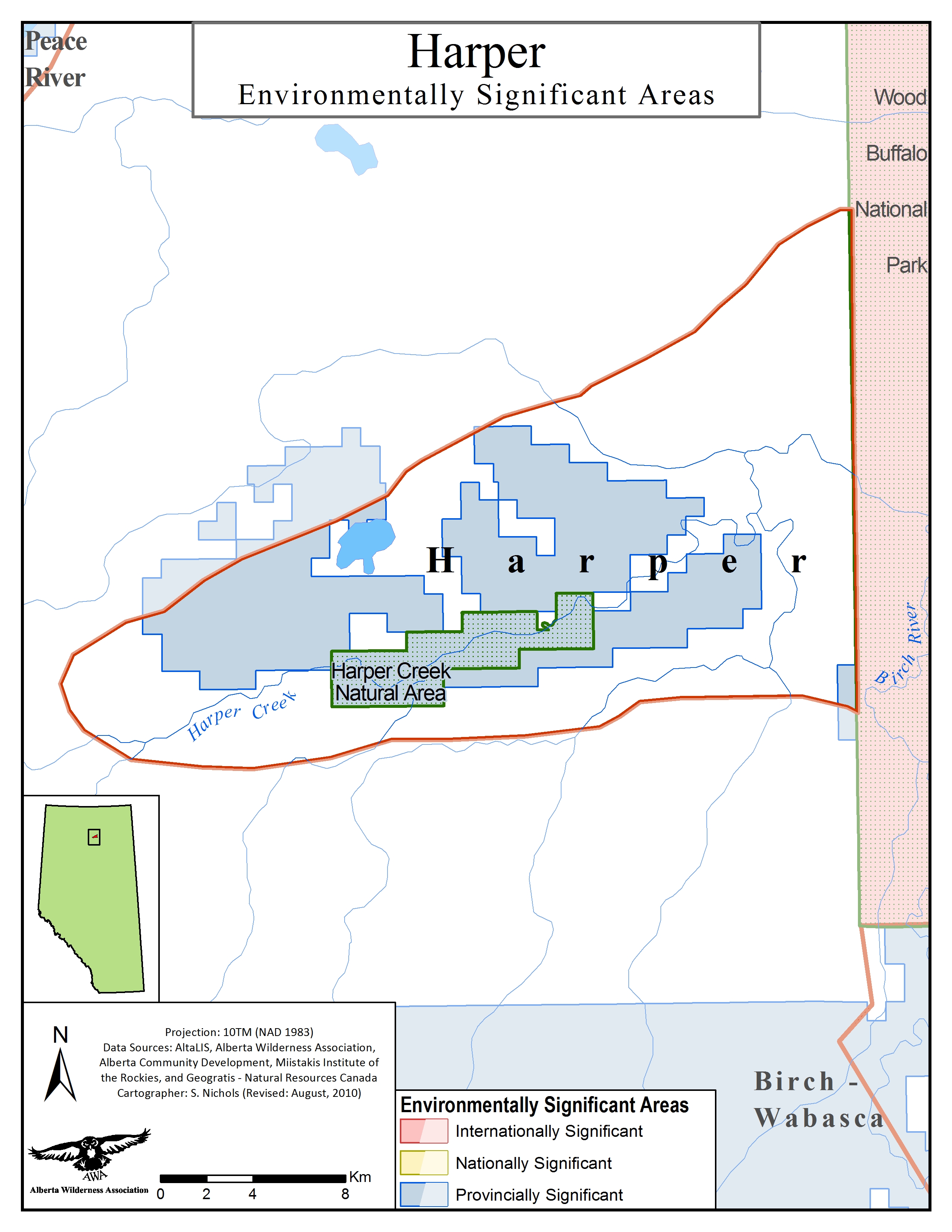
AWA’s Harper Area of Concern has provincially significant areas: JPG | PDF MAP: © AWA
Natural Region
AWA’s Harper Area of Concern is located within the Boreal Forest Natural Region of Alberta, or more specially, the Central Mixedwood Natural Subregion.
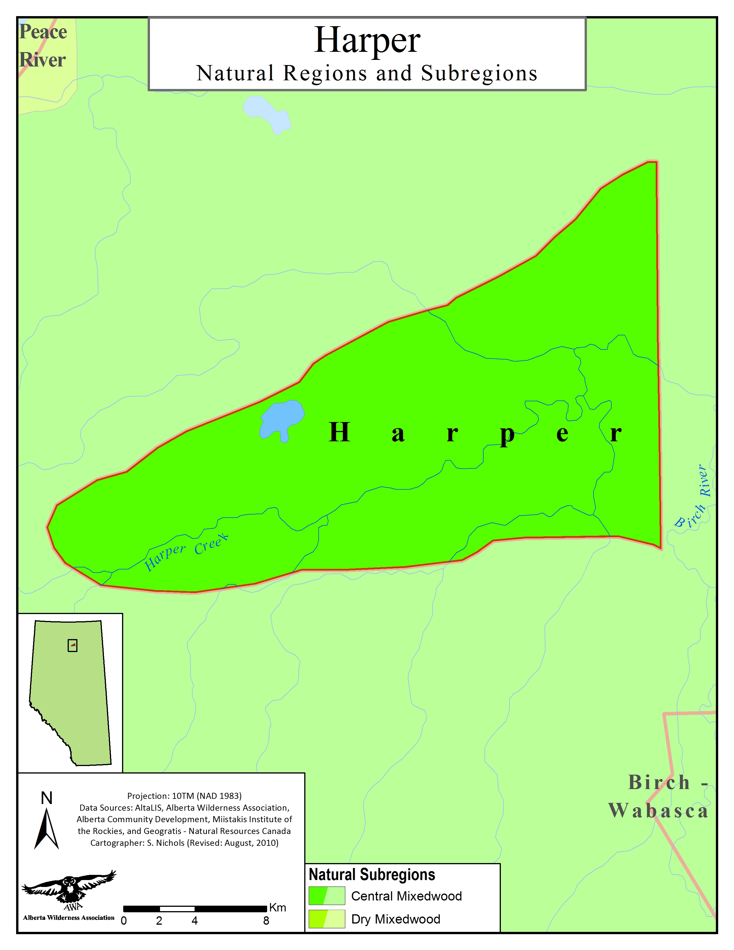 Harper Natural Subregions: JPG | PDF MAP: © AWA
Vegetation
The majority of Harper’s tree stands fall into the age class of immature, 20-79 years, and mature, 80-119 years of age. These stands are sporadically interspersed with old growth stands that range in age of 120 to 179 years. A significant portion of Harper’s landscape is influenced by the hydrology of the area, with many lowland areas retaining a significant amount of standing water that are populated with permanent vegetative features such as bulrush beds and cattails. Some areas have to withstand tremendous water level fluctuations; in areas that experience frequent flooding support a variety of grasses and sedges, while areas with minimal flooding support more willow and shrub species.
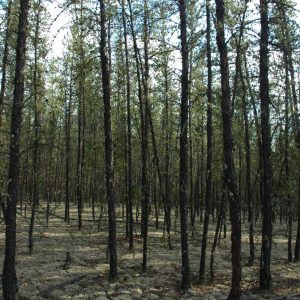
Northern Boreal Forest © AWA FILES
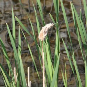
Cattail (Typha latifolia) © AWA FILES
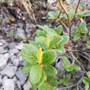
Snow willow (Salix vestita)© AWA FILES
Central Mixedwood: This region has a continental climate, which is defined by cold winters and warm summers. The undulating plains, extensive wetlands, and hummocky uplands of this subregion are dominated by stands of pure aspen, white spruce-aspen or pure white spruce stands which are generally located in areas of till and lacustrine. Jack pine stands occur in areas with more coarse material, with black spruce being found in bogs and fens. Gray Luvisolic soils are dominant in this landscape in addition to Gleysolic soils. Harper landscapes consists of parent materials for soils that are an amalgamation of glacial till, fluvial, and lacustrine material. Canadian buffaloberry, low brush cranberry, and prickly rose are common to the understory. A mix of wild sarsaparilla, hairy wild rye, and tall lungwort are featured in herb communities in addition to feathermosses.
Wildlife
In addition to common waterfowl species, Harper’s boreal forest landscapes provide habitat for many wildlife species such as lynx, coyotes, fishers, wolverines and otters. This region also supports at risk species such as wood bison and is part of the Red Earth boreal woodland caribou range. The woodland caribou have been observed using parts of the southeastern portion of Wood Buffalo National Park and the Harper Creek Natural Area.
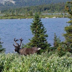
Woodland caribou (Rangifer tarandus caribou) Photo © Alberta Wilderness Association.
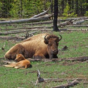
Wood Bison ( Bison bison athabascae) PHOTO © AWA FILES
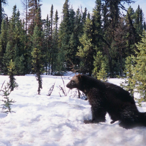
Wolverine ( Gulo gulo) PHOTO © AWA FILES
Cultural
AWA’s Harper Area of Concern is the traditional territory of the Thebathi, John D’Or Prairie and Tall Cree First Nations of Treaty Number 8 with numerous historical settlements and burial sites having been identified throughout the region.
Activties
Given the restricted access of the area, most recreation activities are restricted to foot access and are generally low-impact in nature. Hiking, backpacking and camping are possible with very few fixed facilities being available, in addition to hunting being permitted in the Harper Creek Natural Area.
Restoration
With a significant portion of the region’s economic activity being dependent on oil and gas, timber and mineral/gravel extraction, there is a considerable amount of legacy seismic lines from resource exploration fragmenting the landscapes of Harper. Given this region represents a portion of the Red Earth woodland caribou range, AWA believes significant efforts must be concentrated on restoring this landscape so that it can continue to be critical habitat for this species at risk. It is estimated that 68% of the Red Earth caribou range is disturbed by seismic lines, with only 14% of their range being protected by means of the Birch Mountains Wildland Provincial Park, Harper Creek Natural Area and Wood Buffalo National Park. In order to help a dwindling population size, AWA believes that restoration of legacy footrprints are required to enable boreal woodland caribou to continue to be a part of Harper’s wilderness.
November 1999
World Wildlife Fund Canada urges Premier of Alberta to protect 3 million hectares of Alberta’s wilderness by Canada Day 2000. Appeal came as nationwide challenge by WWF. The 3 million hectares for Alberta is comprised of a suite of outstanding natural areas as follows: Caribous, Harper Creek, Birch-Wabasca, Chinchaga, Castle Crown, Sheep-Ribbon and Bighorn. Ranging from the Rocky Mountains to northen foothills and boreal forests. They are home to some of Alberta’s most sensitive wildlife species such as grizzly bears, woodland caribou and Arctic grayling